
Peru is unmistakably beautiful. We started in Lima and traveled south along the coast before veering east and looping back up north. But if I were to return again, I’d probably take some time to explore the north and less trekked areas. You can find most of the same general information on expat blogs and discussion forums, so most of this blog will focus on my experience, observations, and tips in each city.
We landed in Lima in the evening and caught a taxi from the airport to Miraflores, a neighboring town, where we were staying the night. My sister and I shared a bunk bed. Of course being obnoxious, I shook the bed yelling “earthquake” as she tried falling asleep. Unbeknownst to us, that night we were going to experience an actual earthquake with a magnitude of 8.0. Luckily, the earthquake struck in a remote part of the Amazon jungle. But crazily enough, we were still able to feel it hundreds of miles away. Around 3am, I woke to the sound of banging windows and violent tremors, which subsided after a minute. What a way to start of this trip!
Paracas
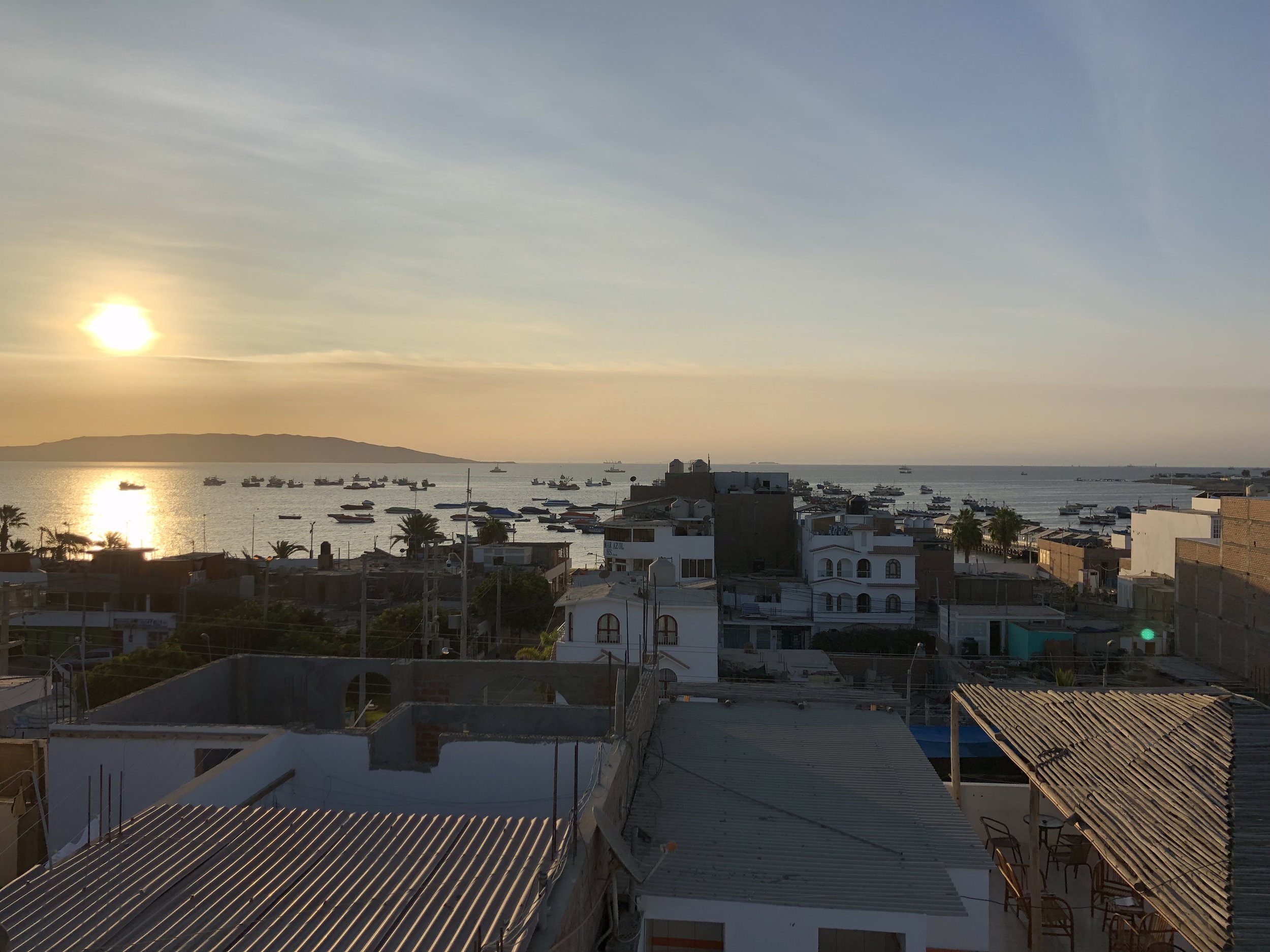
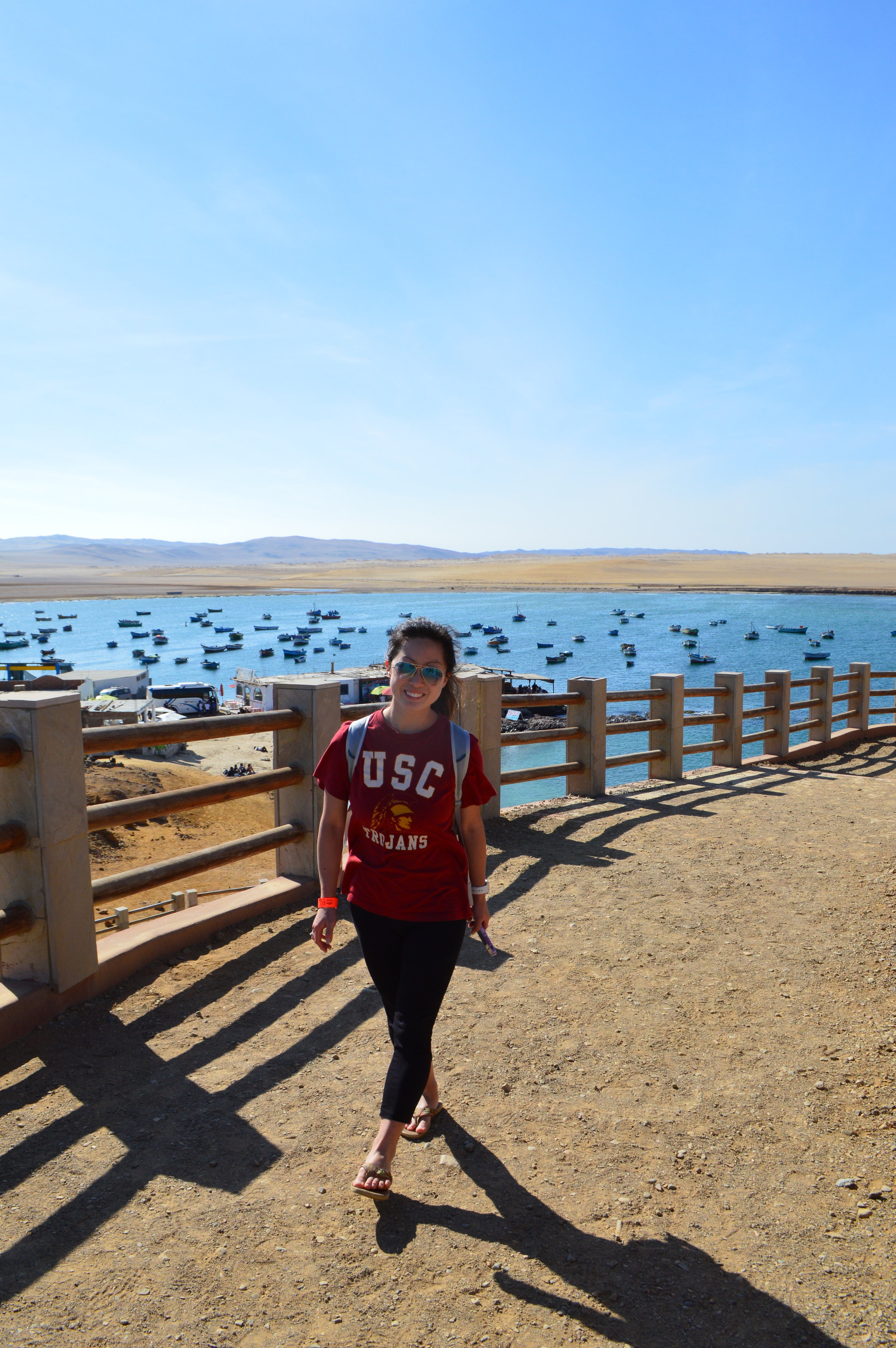
From Miraflores, we caught an early bus to Paracas. During the 4 hour journey, we watched the landscape transition from concrete jungle to desert stricken land.
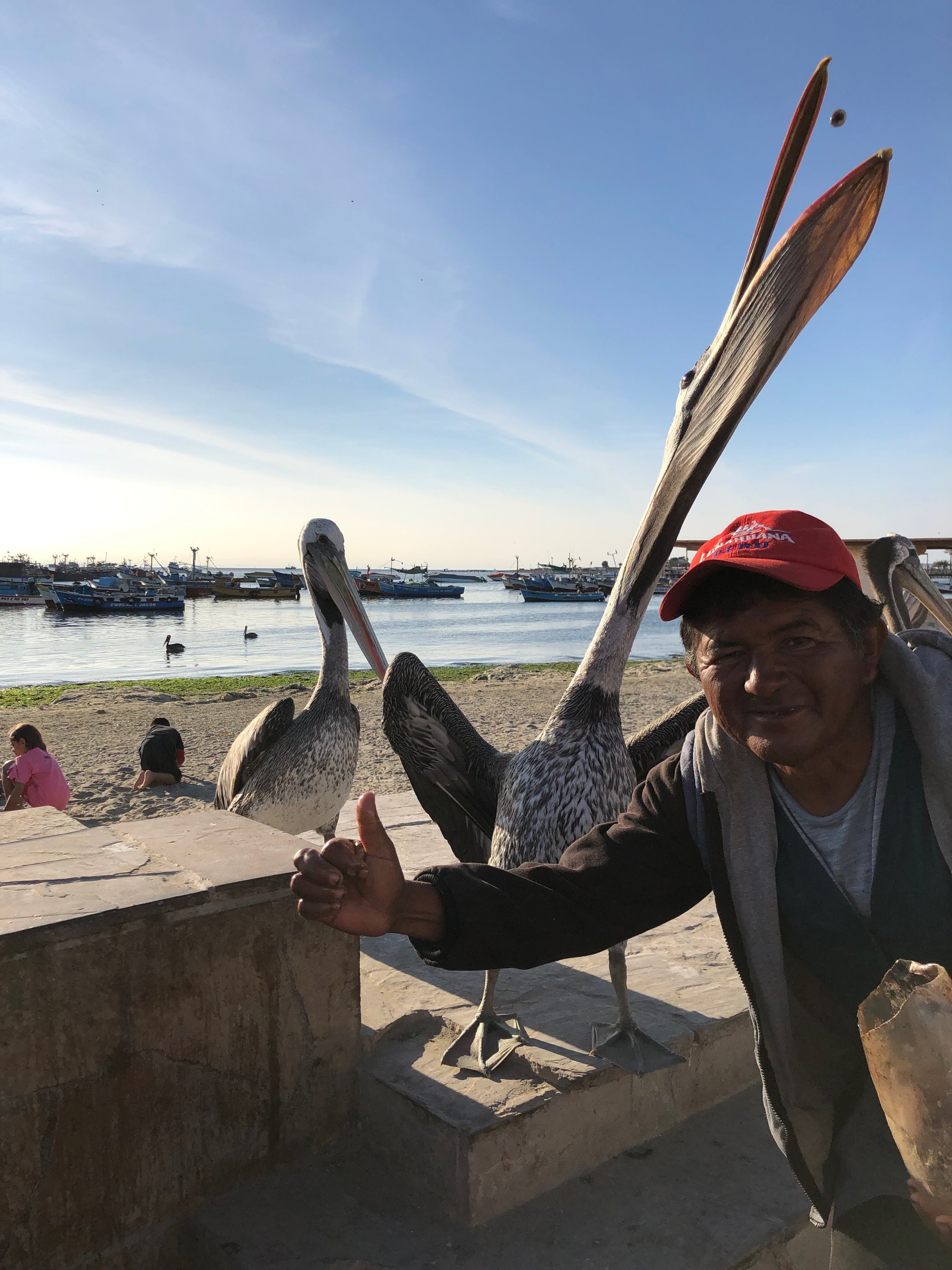
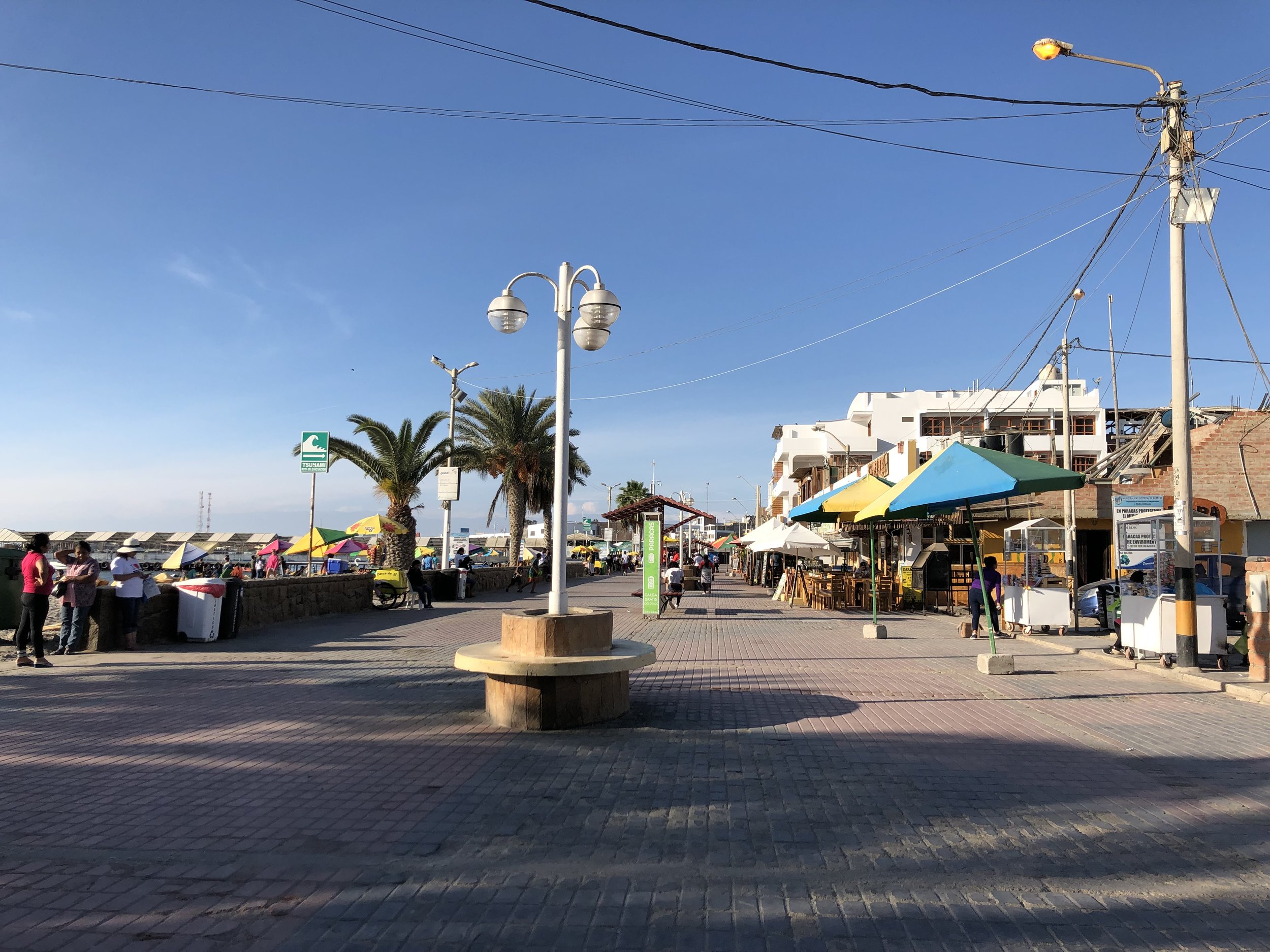
We stayed at Paracas Backpackers House, which was a pretty decent hostel. However, it was a bit odd that we had to pay for dispensing water at the hostel, which would normally be free of charge. The hostel was conveniently located a block and a half away from the boardwalk and marina, so we wandered around there as the sun was setting.
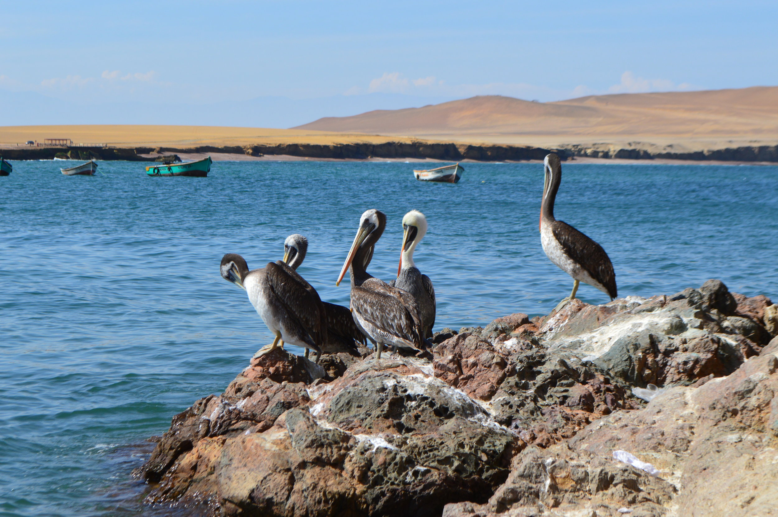
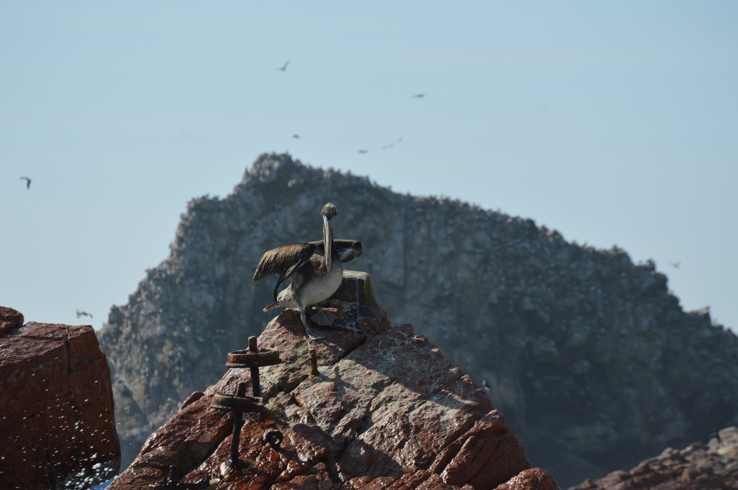
Restaurants and souvenir shops were plentiful along the boardwalk and there wasn’t a shortage of entertainment either. There was a man feeding a couple of large pelicans, which caught the attention of many tourists who stopped and took pictures. But beware! If you take pictures, you’re expected to pay a tip. We later found this to be true everywhere in Peru. There’s simply no free lunch.
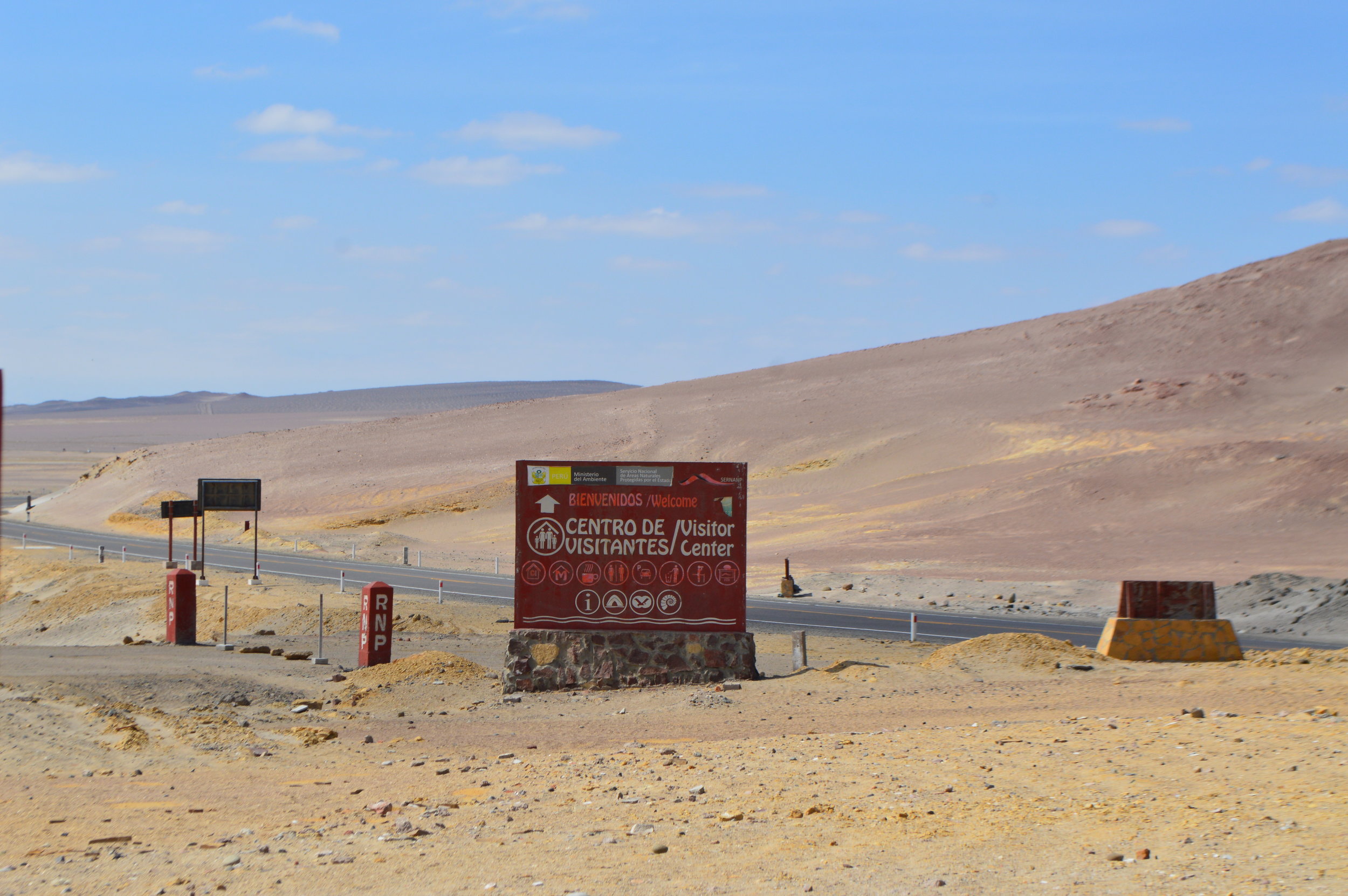
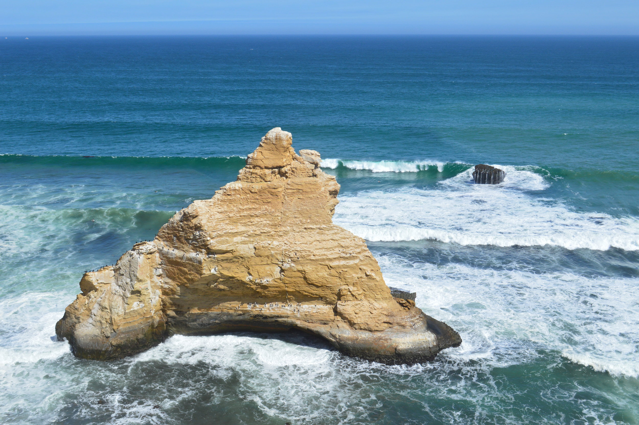
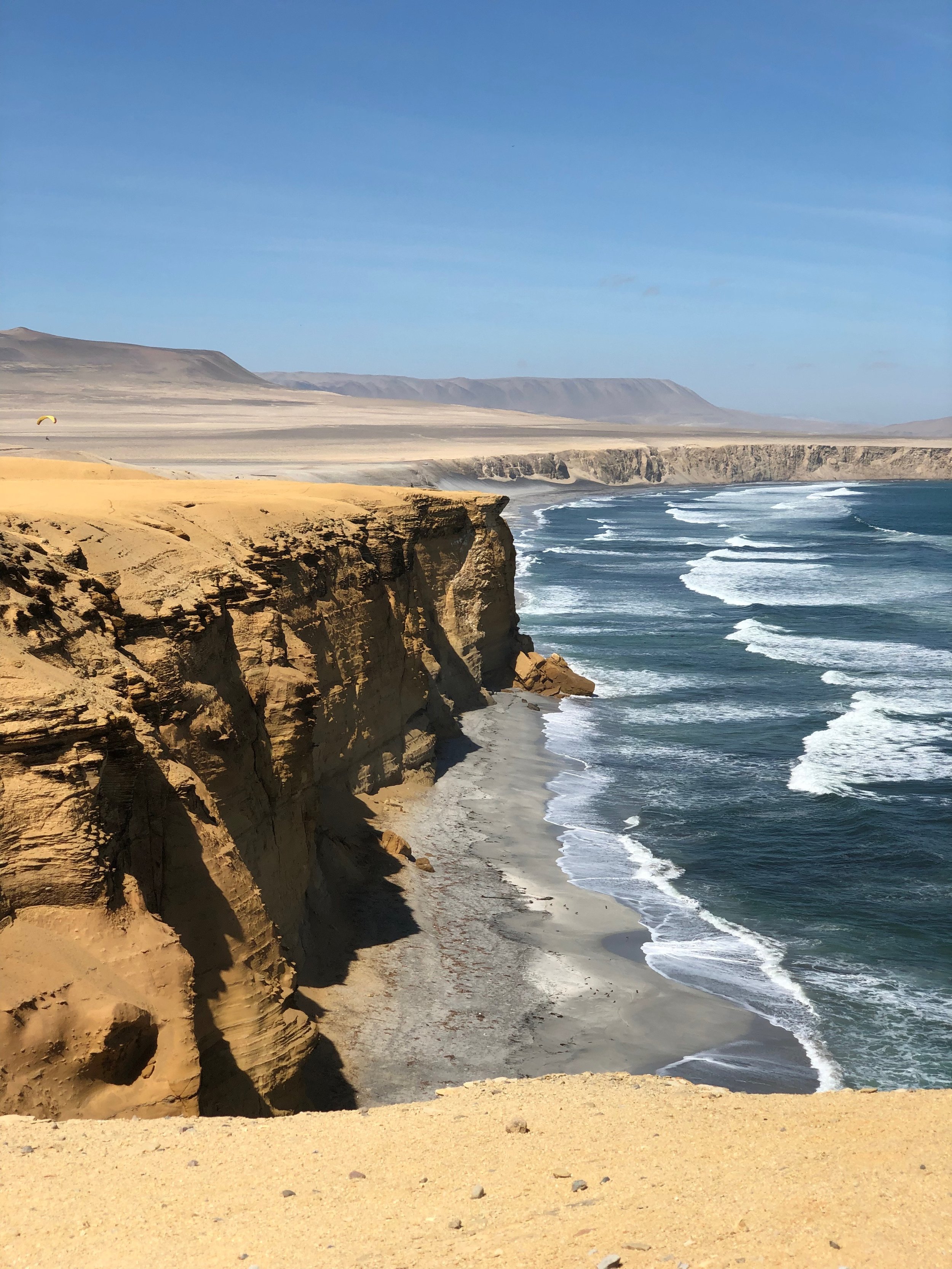
From our hostel, we caught a small tour bus for S/.20 (about $6) that took us a short 10 minute drive away to Paracas National Reserve. Our first stop was at the Paracas Museum where the guide gave us a short briefing of its history and landscape. Next, we stopped by Cathedral Rock, which sadly lost a chunk of its splendor during the earthquake in 2007.
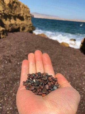
The stark contrast between barren desert and ocean makes for an interesting picture, but even more so, there is a face hidden within the cliffs along the shoreline if you look carefully. Oddly enough, it was harder to spot in person, and easier to make out in photos. After we took a couple pictures, we moved on to the next spot—Playa Roja. The red shores give this beach a unique beauty that leaves visitors in awe. The red color of the sand is caused by the waves breaking against the cliffs of a massif formed by a sort of igneous rock known as pink granodiorite, which contains solidified magma inside.
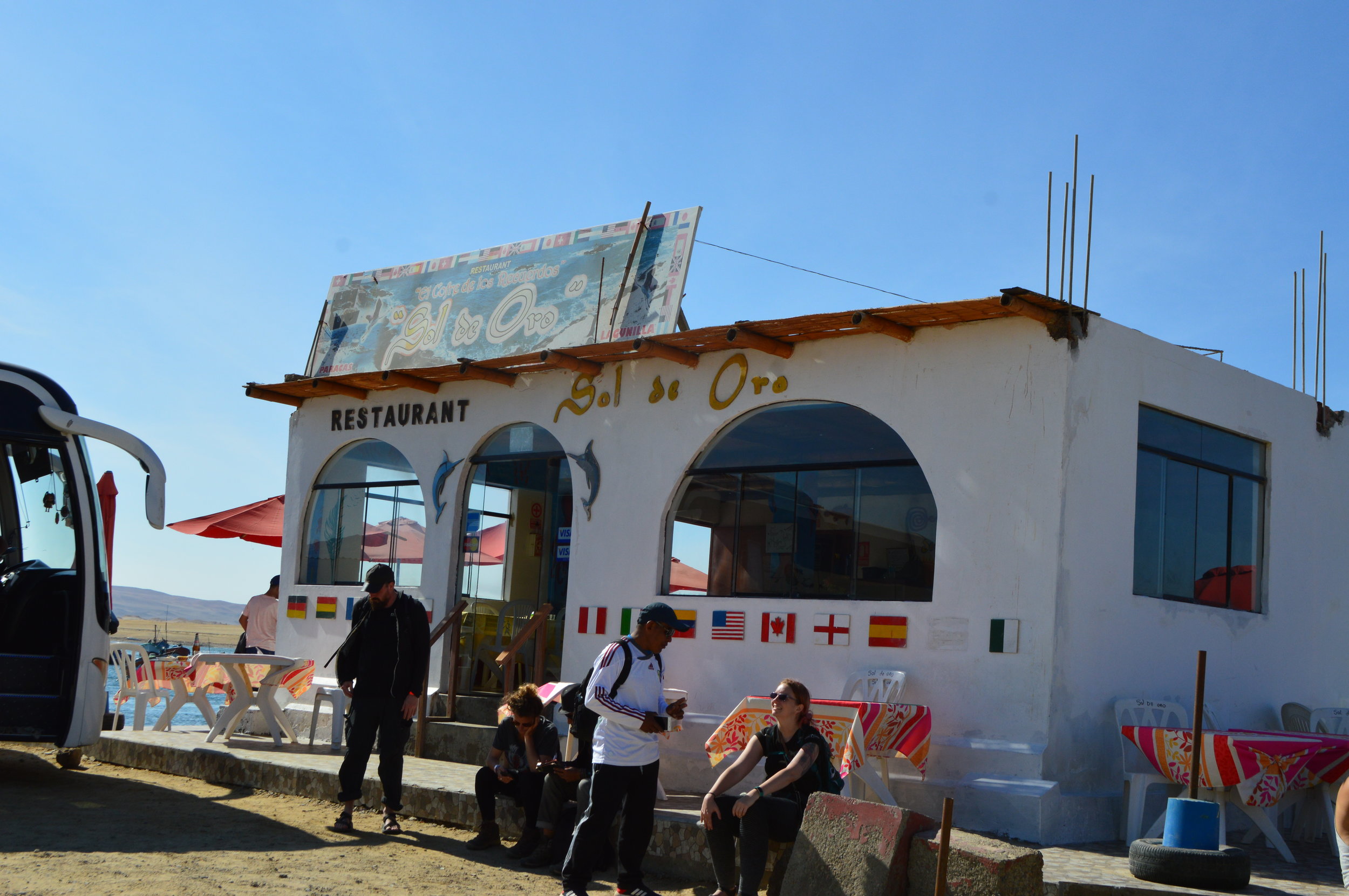
The tour bus dropped us off in Lagunillas, a small village on the peninsula, for lunch. The tour guide strongly recommended (in other words, pressured) everyone to go to the restaurant Sol de Oro because it offered free pisco sours and “good prices”. But the tour guide obviously gets a kick back! Don’t let them pressure you into going to that restaurant as there were several other restaurants within 50 feet of each other that offered the same. We ended up going to Sol de Oro since we found a table with a nice view, and ordered a seafood platter, which by the way, wasn’t on the menu. It was suggested after we mentioned to the waiter that we’d like to try a bit of everything. They brought out a platter with ceviche, mango salad, fried octopus, and fries. For S/.100, it was a pretty good deal and plenty enough to feed 4 people.
Islas Ballestas
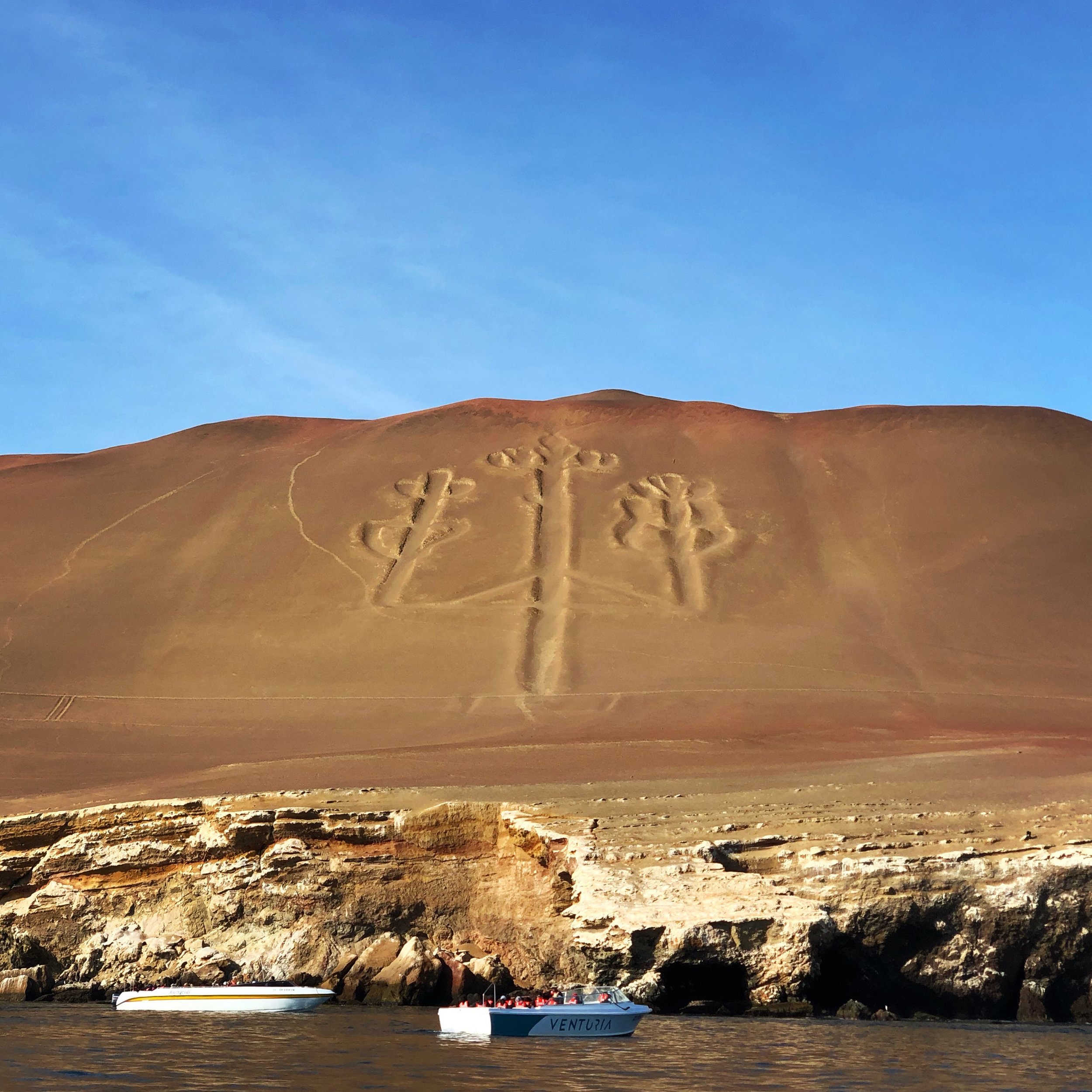
In the morning, we took the first tour to Las Ballestas. A short sail from Paracas, once past the unsightly industrial plant, there’s a quick stop to see ‘The Candelabra’. This prehistoric geoglyph (dated around 200 BCE) on the northern face of the Paracas Peninsula stretches about 600 feet from tip to tip and is large enough to be seen 12 miles from sea. Much like the famous Nazca lines, its existence remains a mystery.
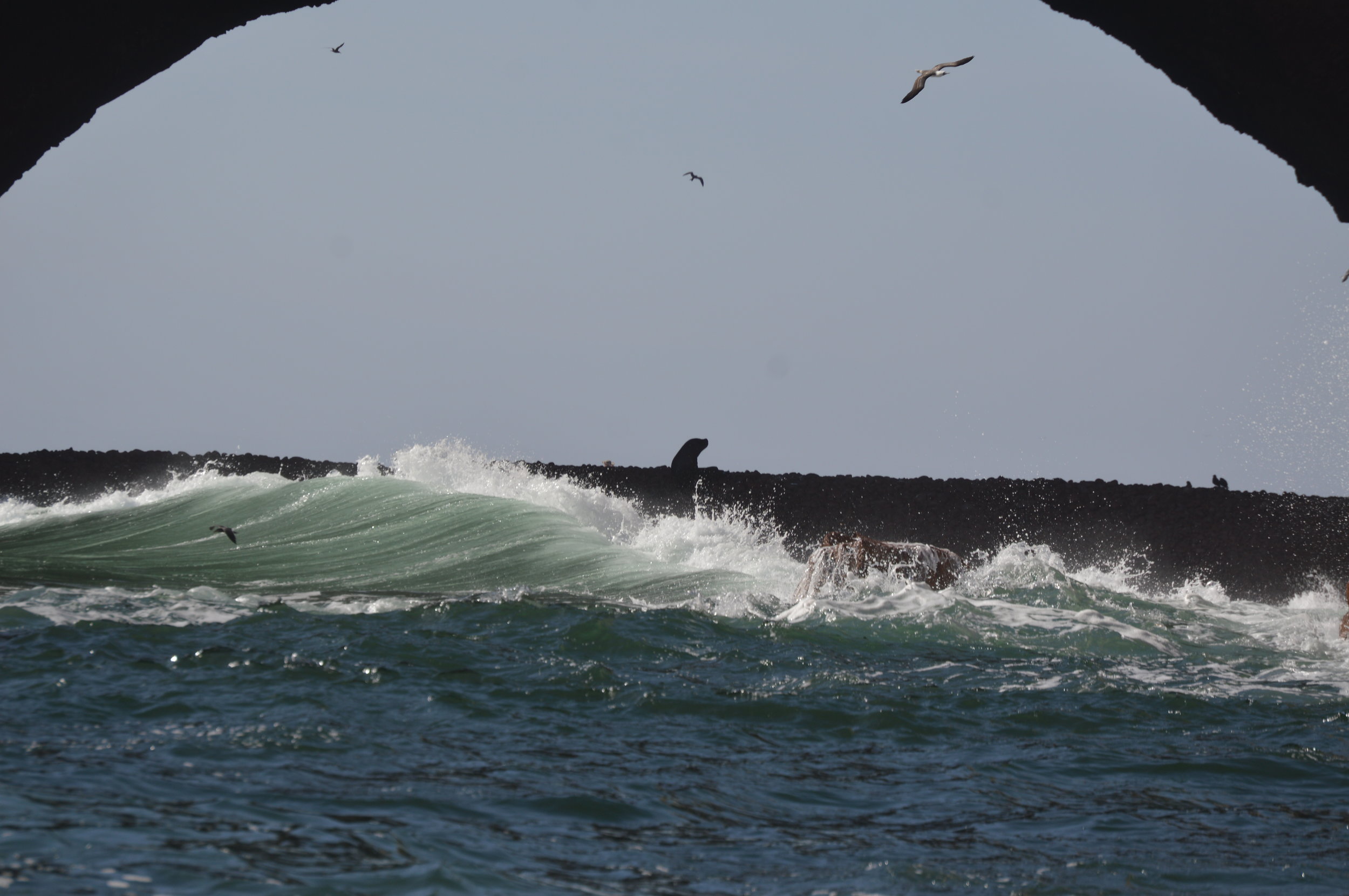
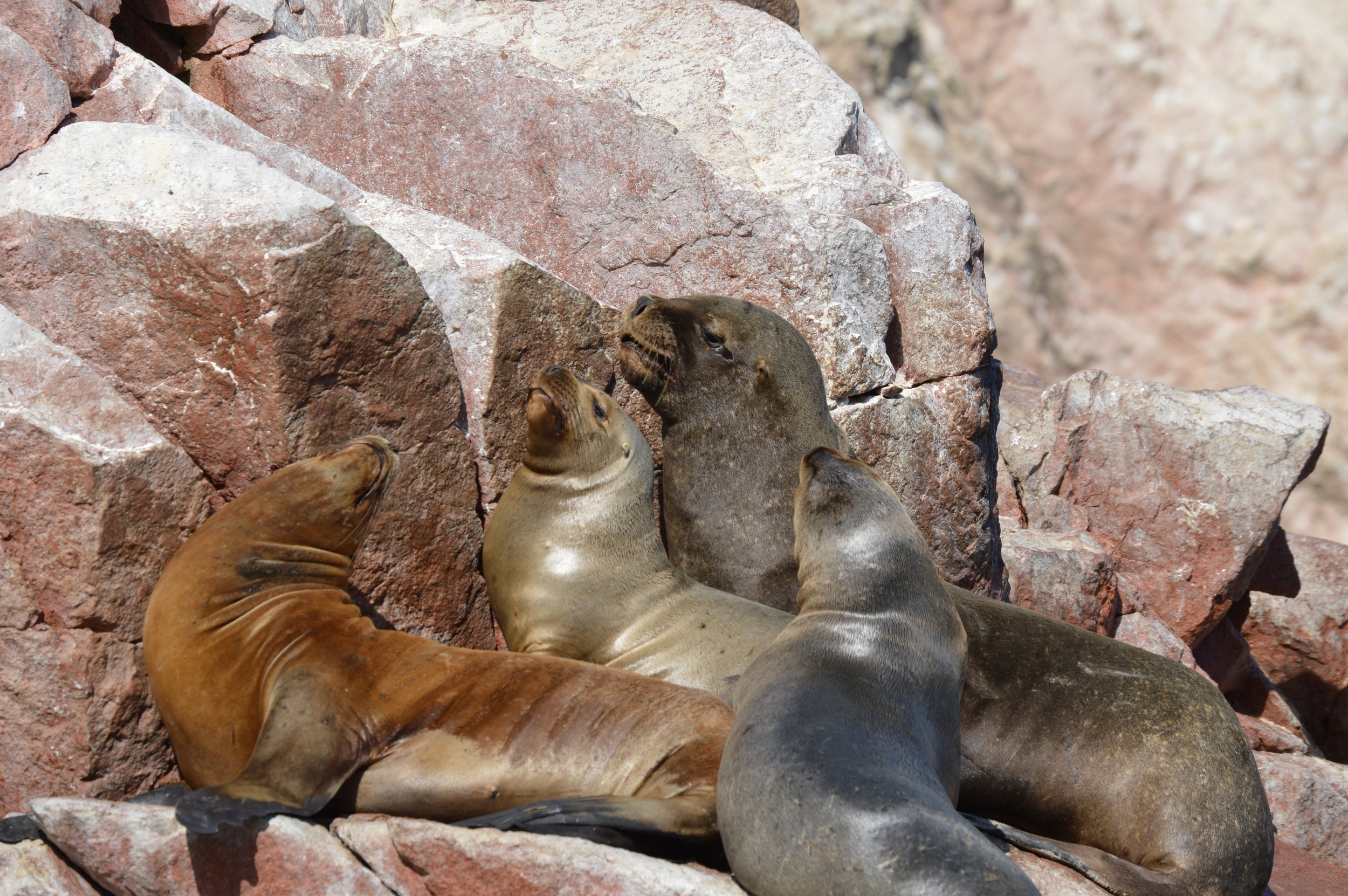
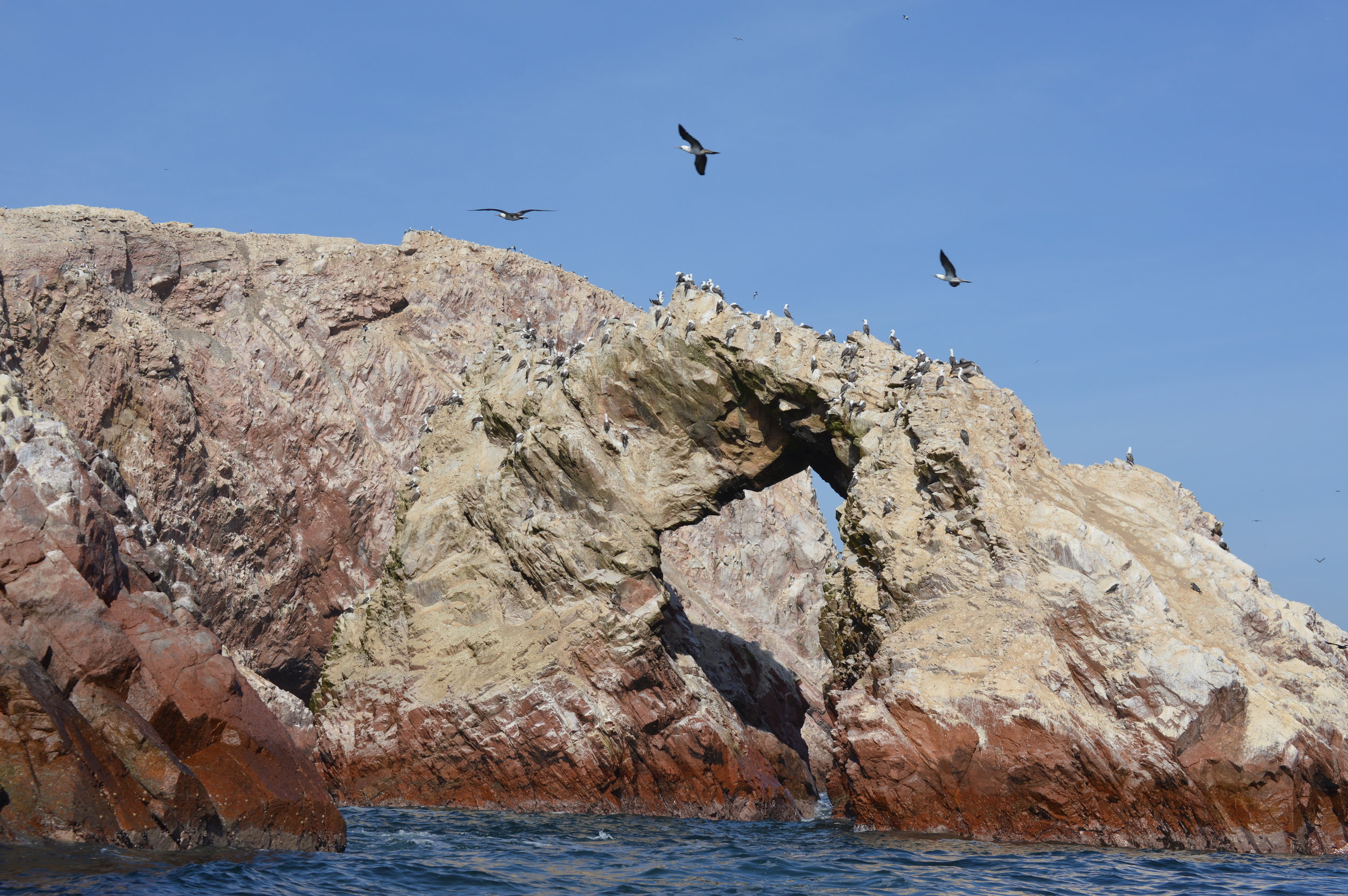
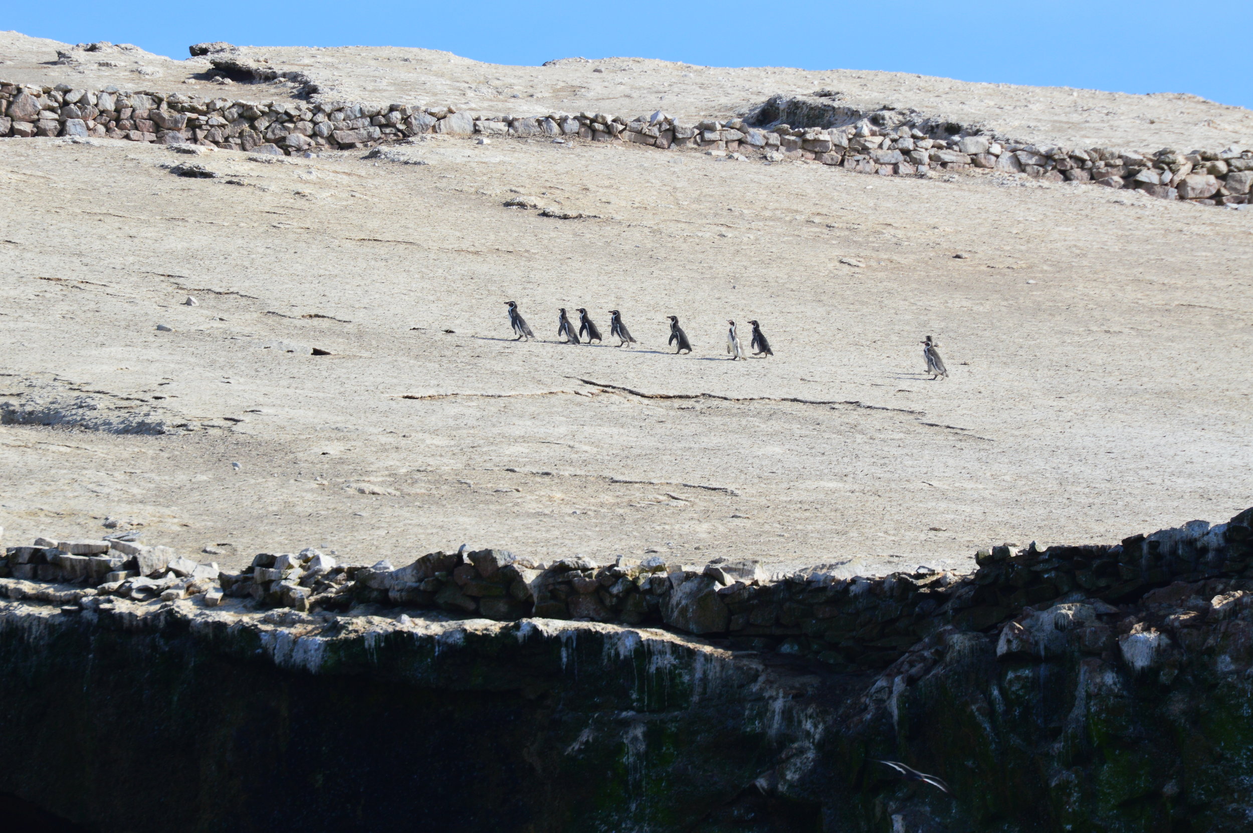
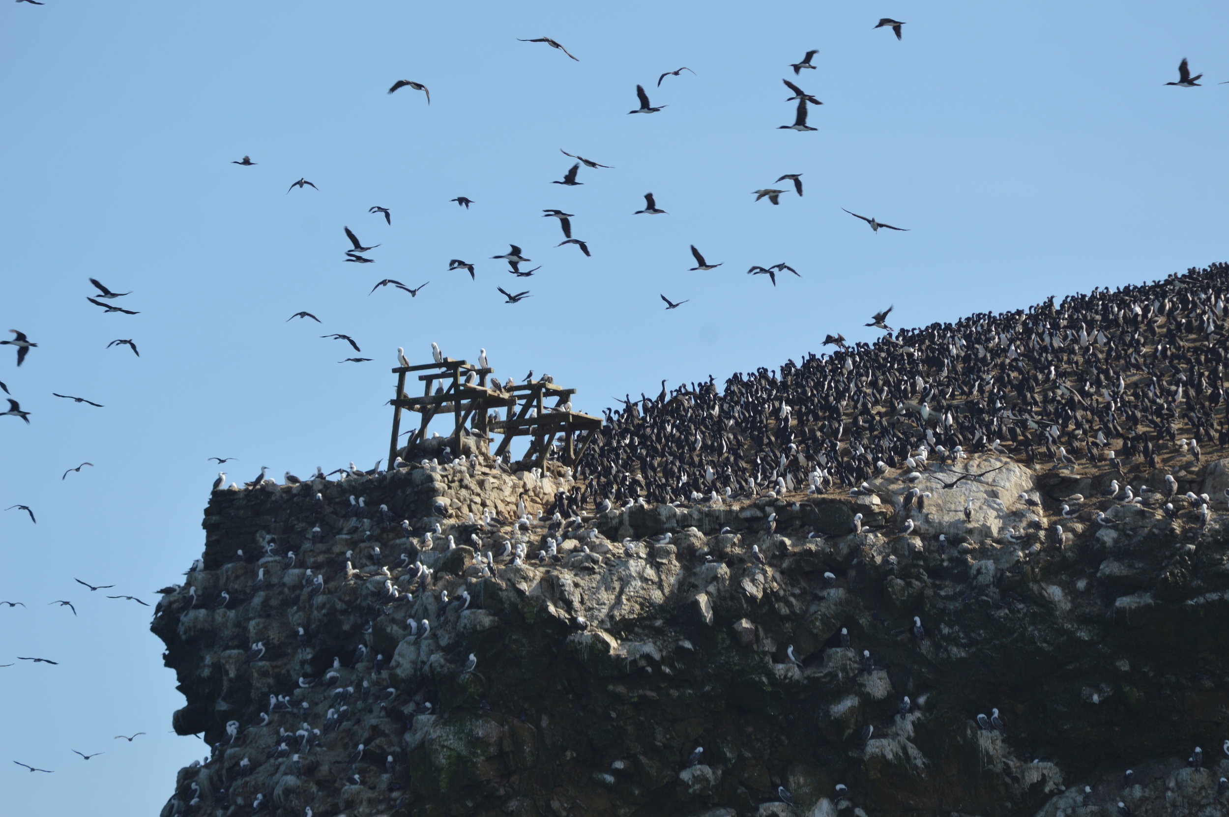
After snapping pictures, the boat sailed another 20 minutes until we arrived at the islands. We could tell we were getting close when the stench of bird poop began burning the inside of our nostrils. Since stepping off ashore was not allowed, the boat circumvented the rocks, and got up as close as possible to the islands for a view of the animals. In total, we spent about 30-45 minutes exploring Isla Ballestas, which I personally felt was an adequate amount of time to see sunbathing sea lions, waddling penguins, and an unprecedented amount of birds.
If you decide to go on the boat tour, here are a few tips:
- Sit on the left side of the boat for better views (and towards the stern if you are prone to seasickness)
- Wear sunscreen
- Bring a light windproof jacket (especially if you’re going on the morning tour)
- Don’t forget your zoom or telephoto lenses for your DSLR camera
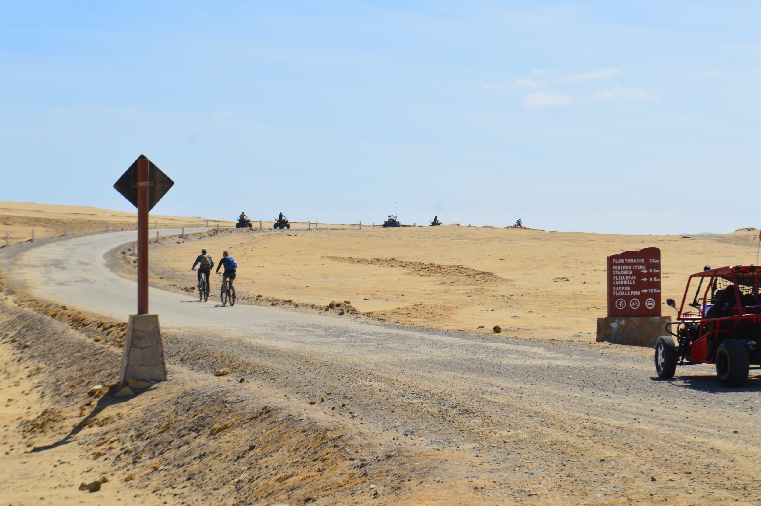
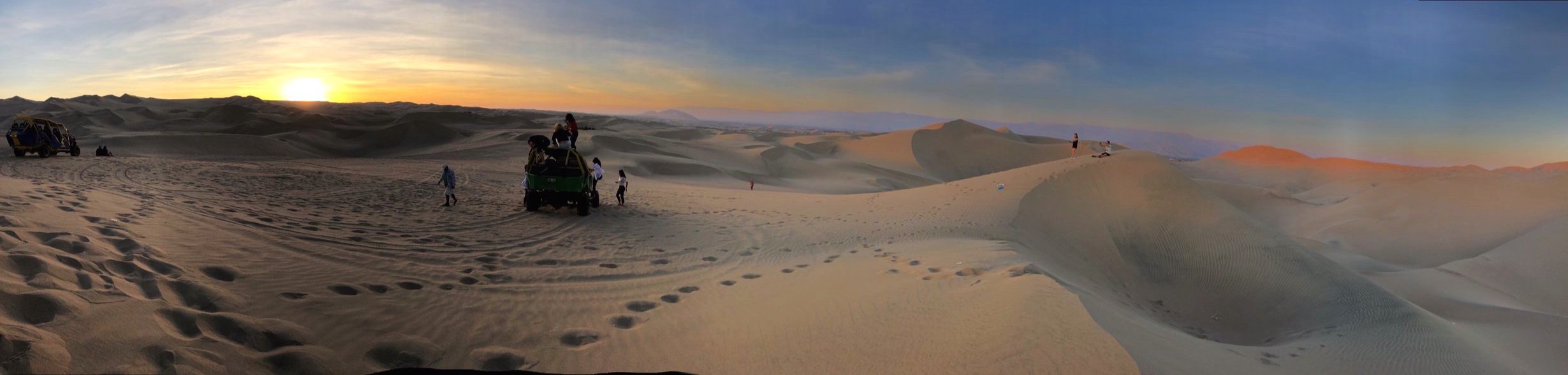
Huacachina
After getting back ashore, we took a bus to Ica, the closest city to our main destination, Huacachina. On arrival, you won’t have any issue finding a taxi to Huacachina as all the taxi drivers flock around the bus terminal and surrounding area. They’ll find you, no doubt about it.
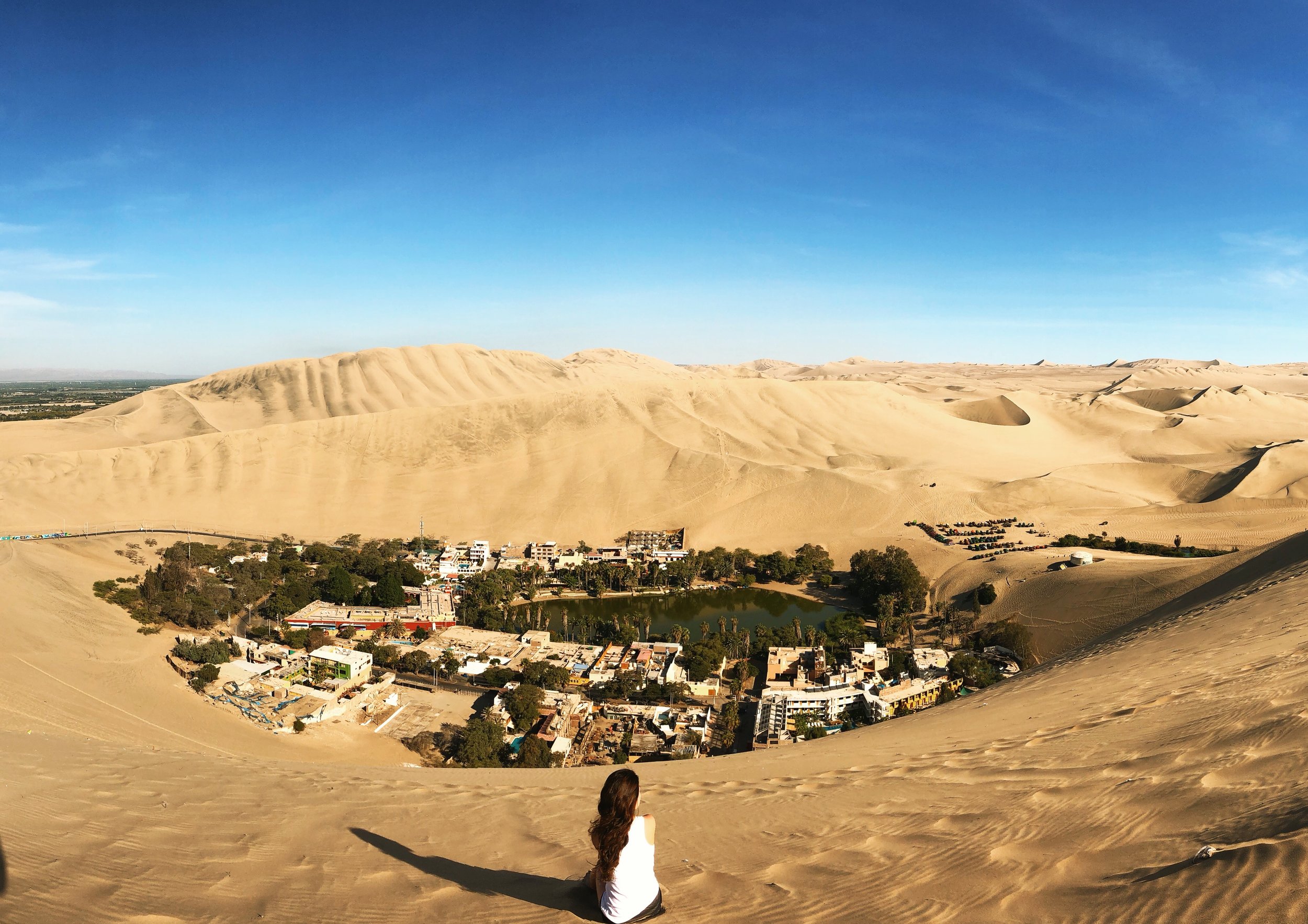
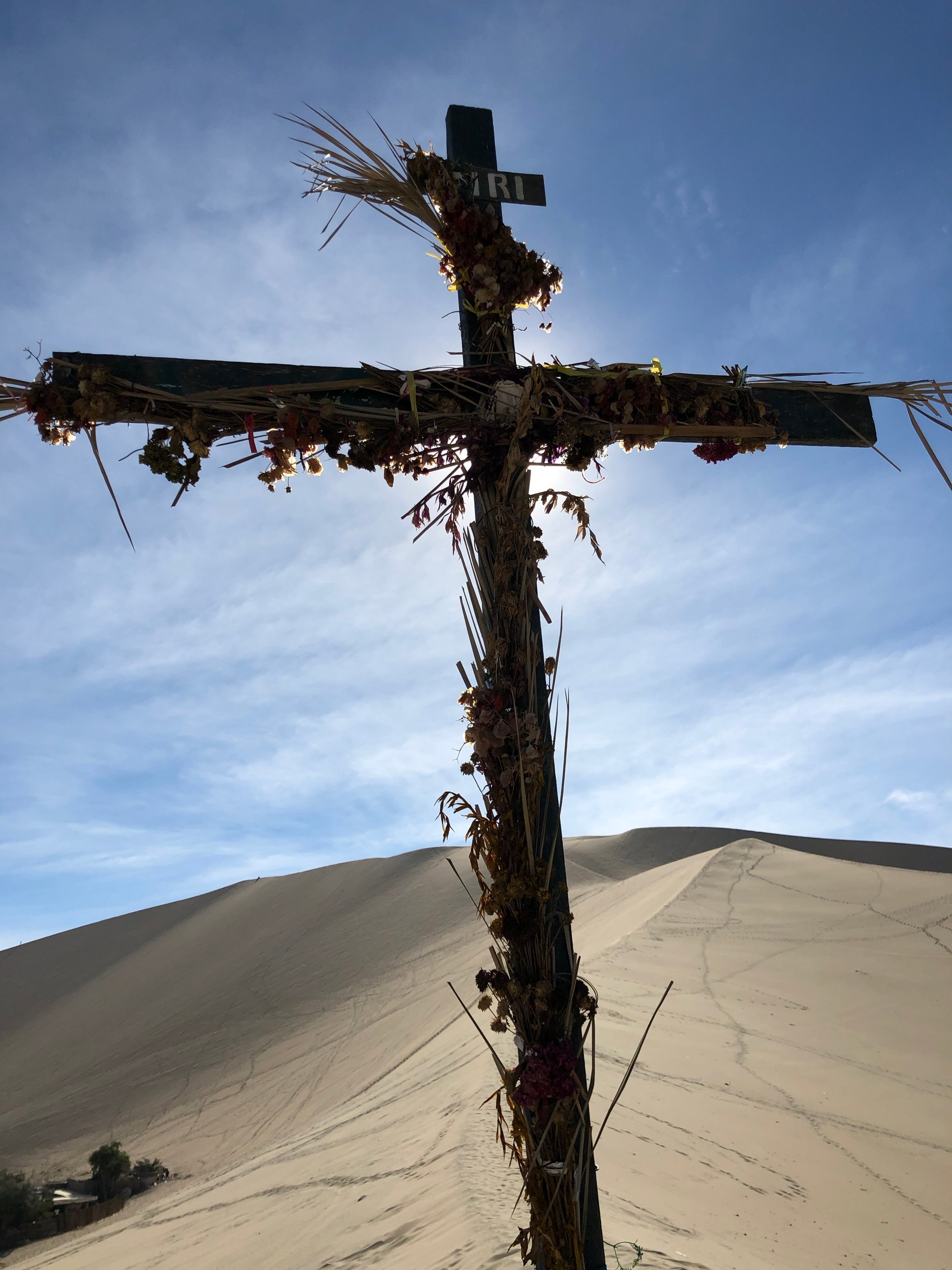
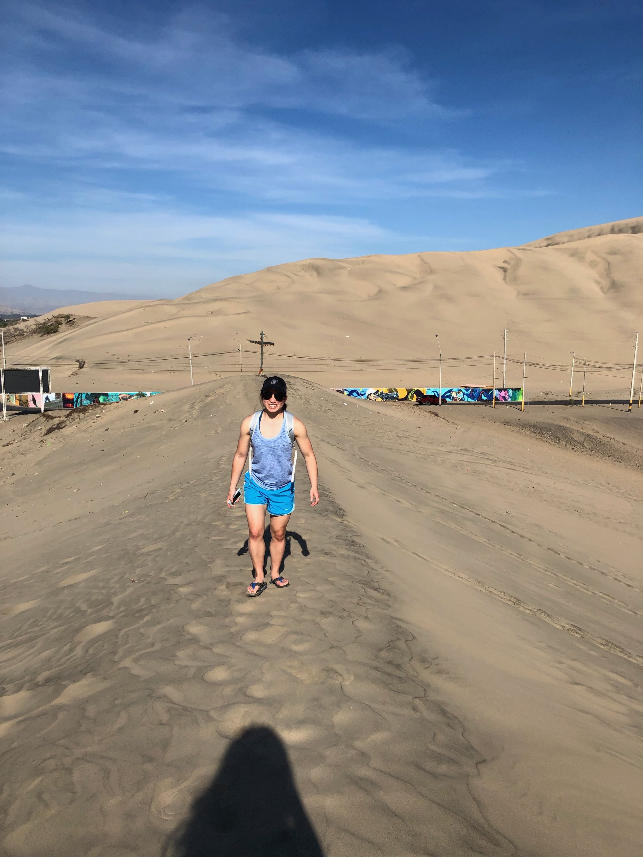
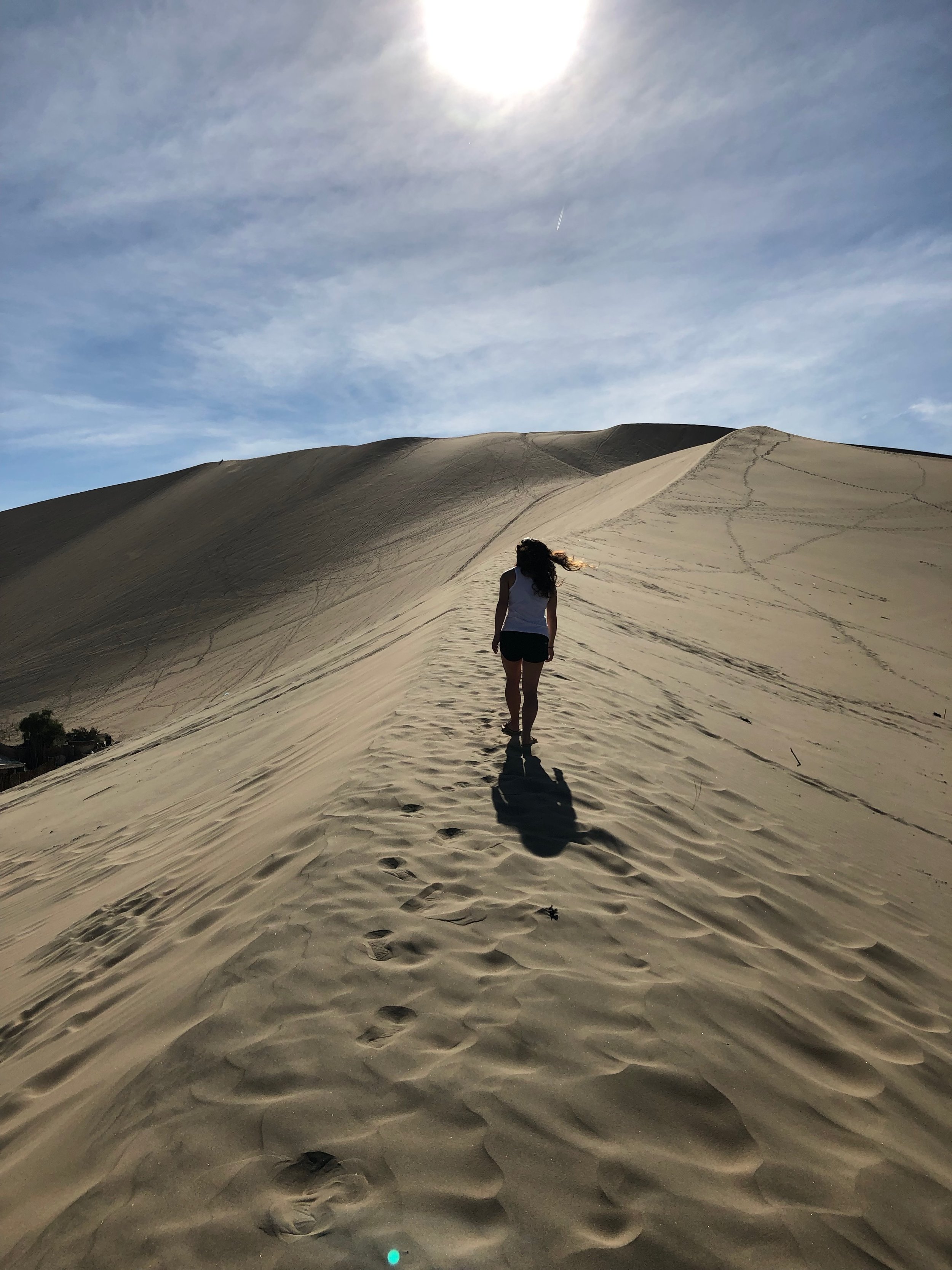
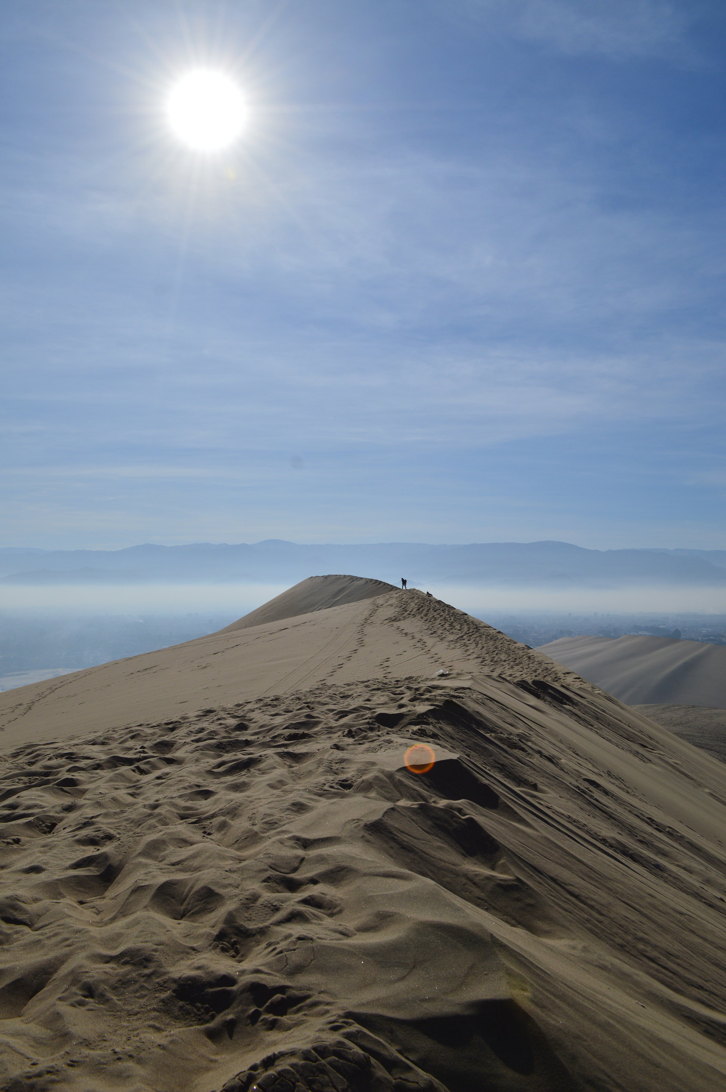
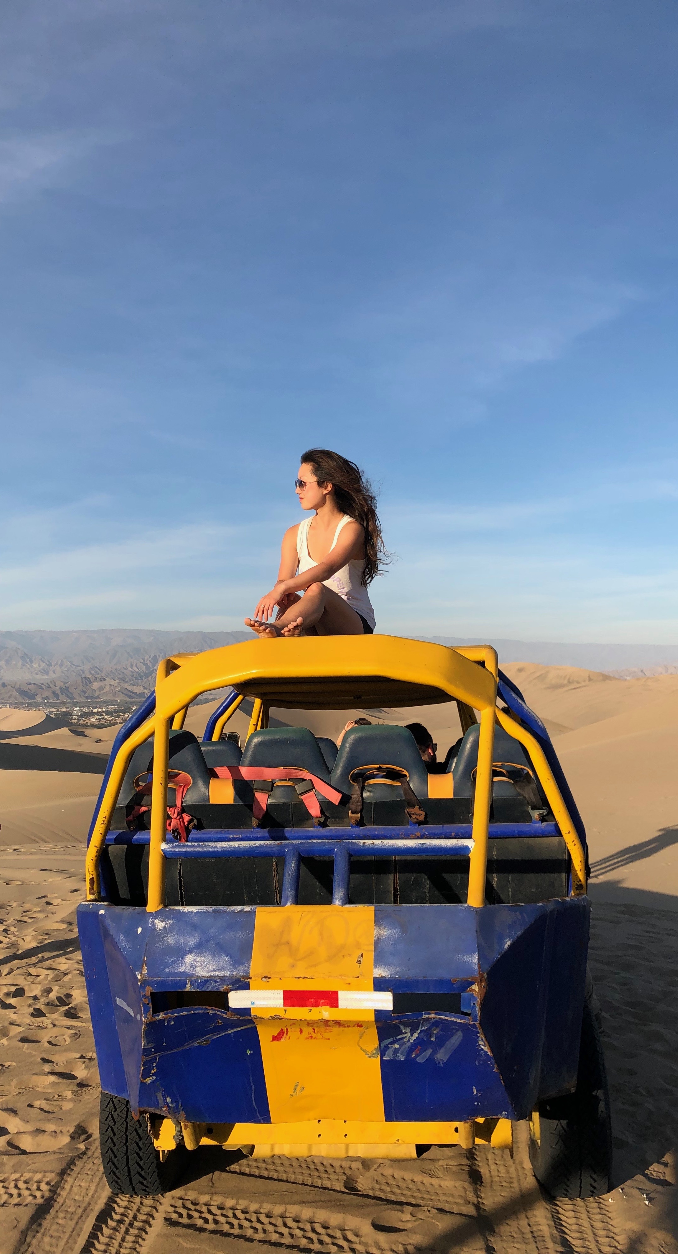
After settling in at the hostel, my sister and I walked along the ridge to the highest sand peak overlooking the small town. There are several ways up—and of course we took the longer (and naturally, less crowded) way. The most popular route starts on the west side of the lagoon by the dune buggies. It’s hard to miss. Just follow the over-beaten path, strewn with footprints. We started at the entrance to the town, where there was a large wooden cross protruding from the sand. We ascended along the ridge and after about 20 minutes, made it to the top. If you’ve seen those Instagram pictures of Huacachina, well voila, they’re taken here.
It was nearing 4pm at this point and we needed to get back to town to catch the dune buggy tour. The question was…should we be responsible adults and walk all the way back down on the path, or roll down the enormous dune? Let’s be real. Who’s got time for walking? We beelined down what seemed like a 60 degree slope and it was terrifyingly fun. Highly recommend.
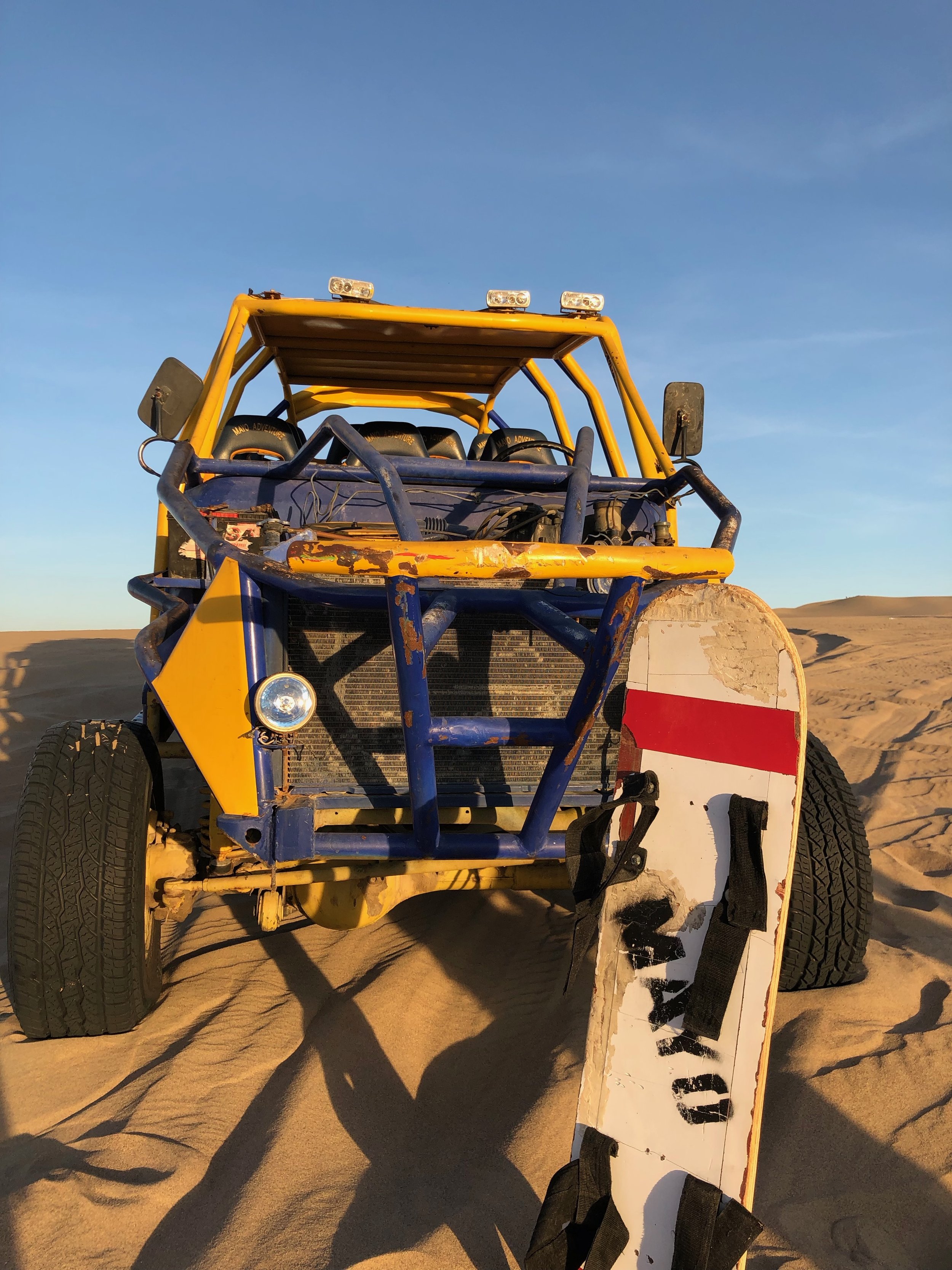
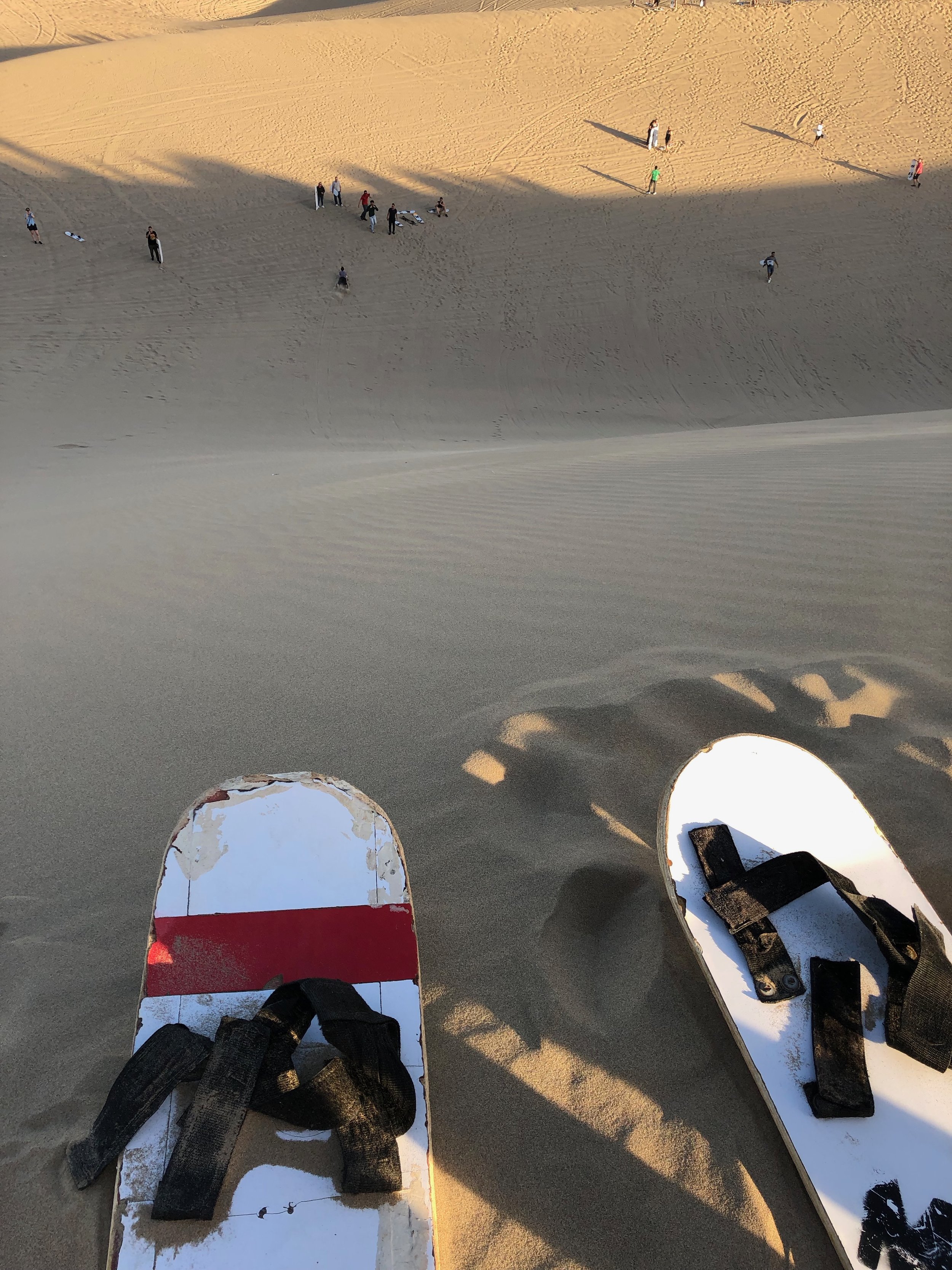
Huacachina is a popular tourist destination for sand sports; namely, dune buggying and sand boarding. The dune buggies have scheduled times throughout the day for these adventure tours and you can either book in advance or book in person. I suggest the latter because the companies tend to lower their prices as time gets closer to departure. We also went on the evening (4 p.m.) tour because the sun was less harsh, and we got the added bonus of watching the sunset on the dunes! 30-35 soles is the average price for the dune buggy and sand boarding combined tour. But if you waited like we did, we paid 19 soles per person. The dune buggies feature 3 rows of seats and carry 11 people total, including the driver. The two seats in the first row get the best view, but also the best taste of sand. You’ll literally be eating sand if your driver drove as crazy as ours did. The middle row is best for those who are prone to motion sickness and less inclined to eat sand. The last row feels all the buggy’s worn out suspension and shocks. It’s a rough ride. Pick your poison, friends! We, by default, got the last row.
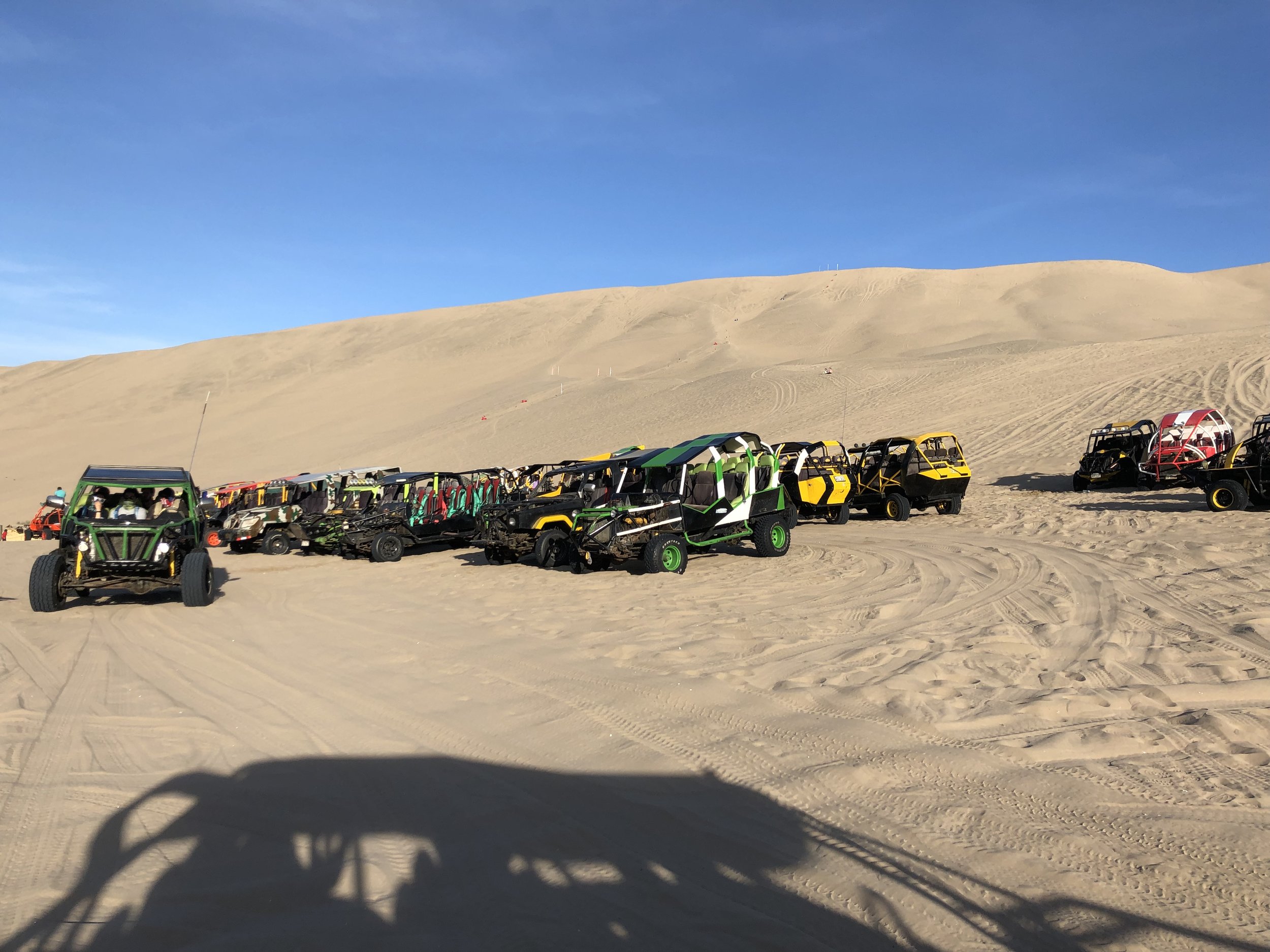
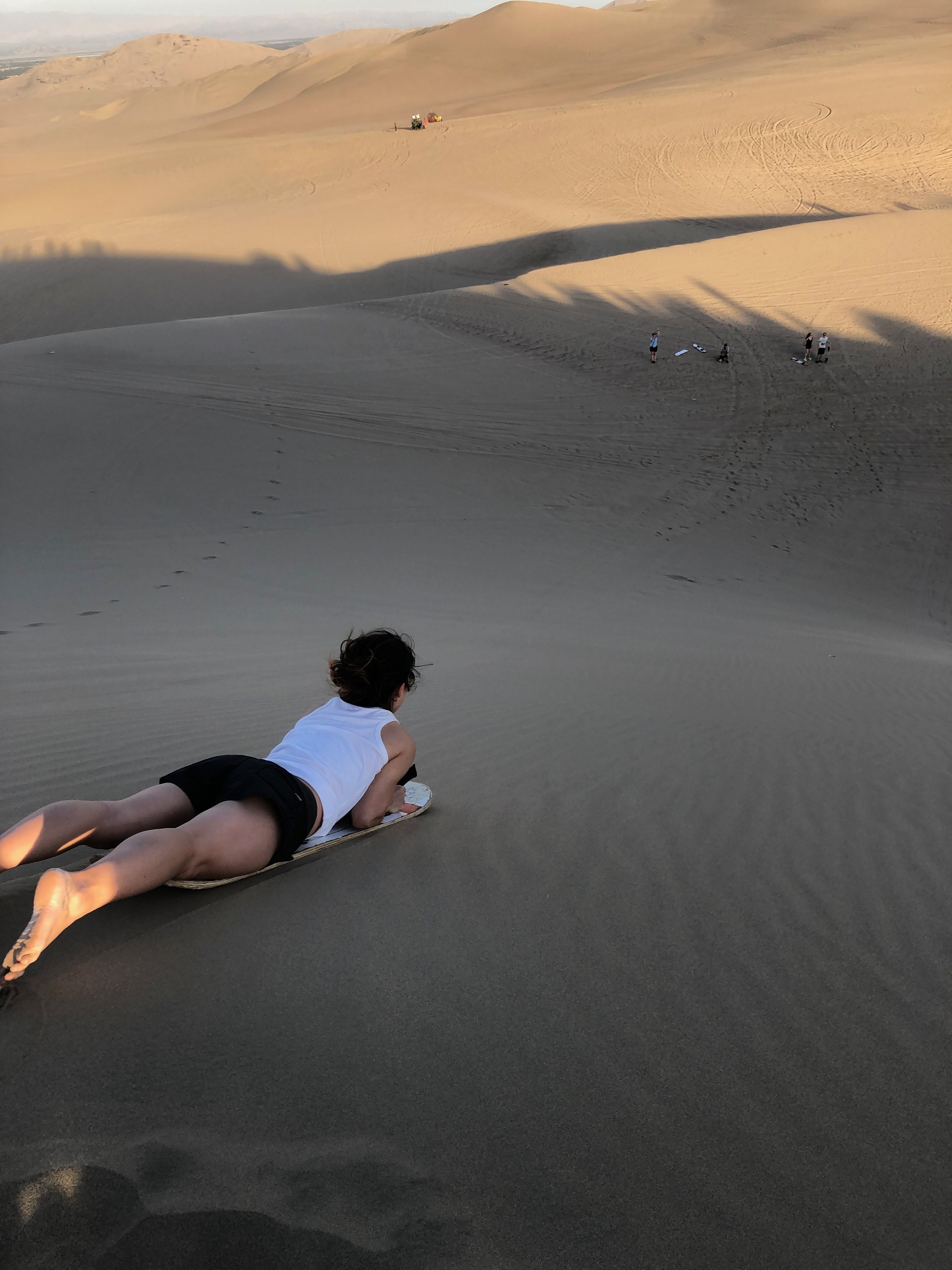
We were taken to a total of three spots. Our first stop overlooked dunes lining the horizon. At the second stop, they took the boards out for sandboarding. If you have sandboarding boots, make sure to take them with you since they don’t provide them! If not, then instead of strapping in your feet, you lay on your stomach, clench on the straps and slide down the dune that way. Keep your head up or wrap a bandana around your mouth to prevent eating boatloads of sand.
After everyone took turns going down the dunes, the buggy picked us up from below, and took us on another dizzying breakneck ride up and down the sand dunes before we arrived at the spot to view the spectacular sunset.
Tips
- Join the 4pm tour, if possible
- Leave your fancy cameras and valuables at your hostel/hotel
- If you bring any items with you, place them in a ziplock bag and/or somewhere securely strapped onto you. If you fly, so will your belongings!
- Bring sandboarding boots if you have them
- Bring plenty of water
- Wear copious amounts of sunscreen (if you’re going out midday)
- Wear a bandana to prevent inhaling/eating sand
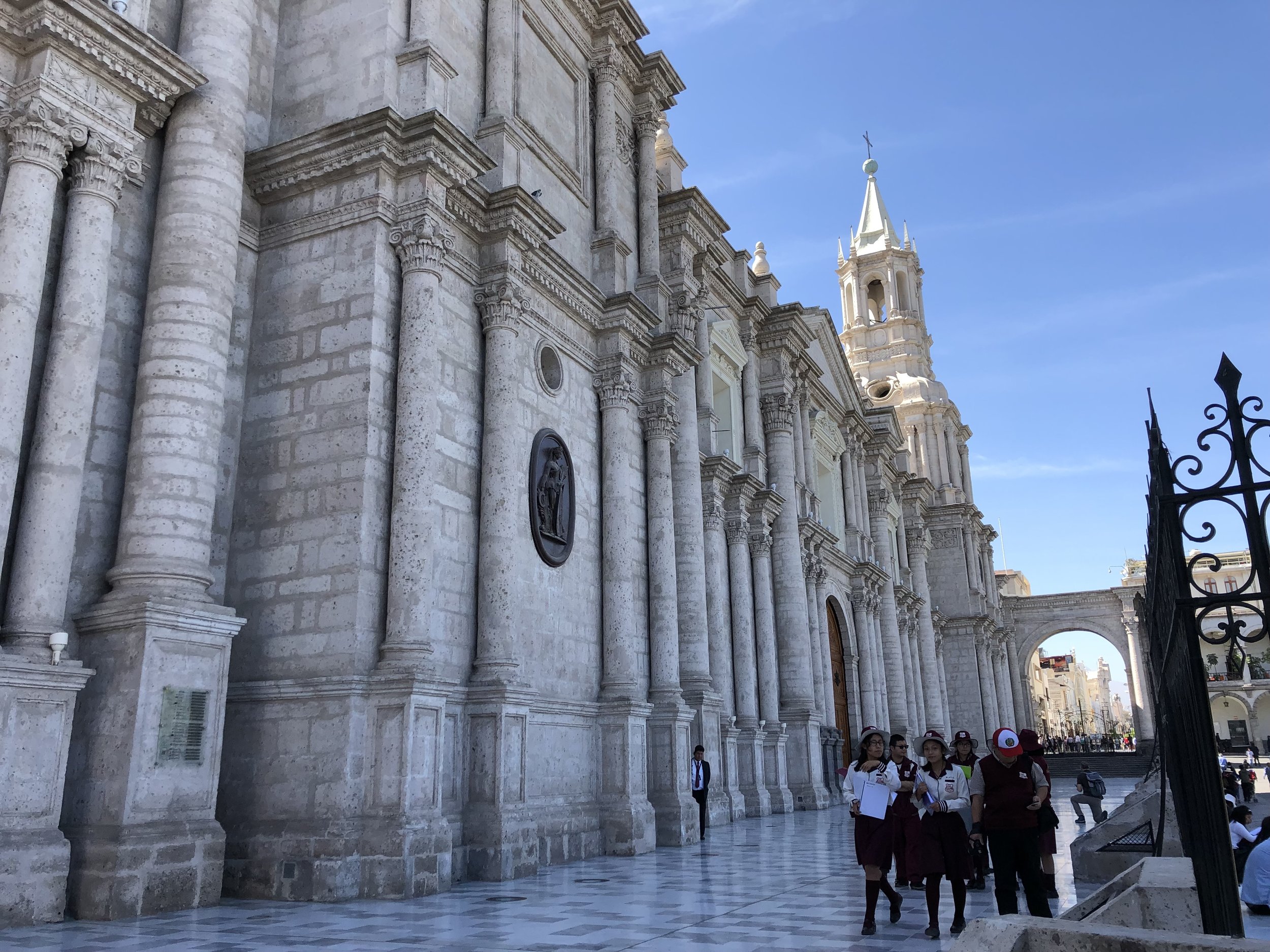
Arequipa
From Ica, we took a 12-hour bus to Arequipa. Unfortunately, there isn’t an airport in Ica, so you’re limited to two options: Take a bus back to Lima and fly to Arequipa from there, or take a 12-hour bus to Arequipa from Ica. If you decide the latter, I recommend taking a night bus to save more day time to doing activities.

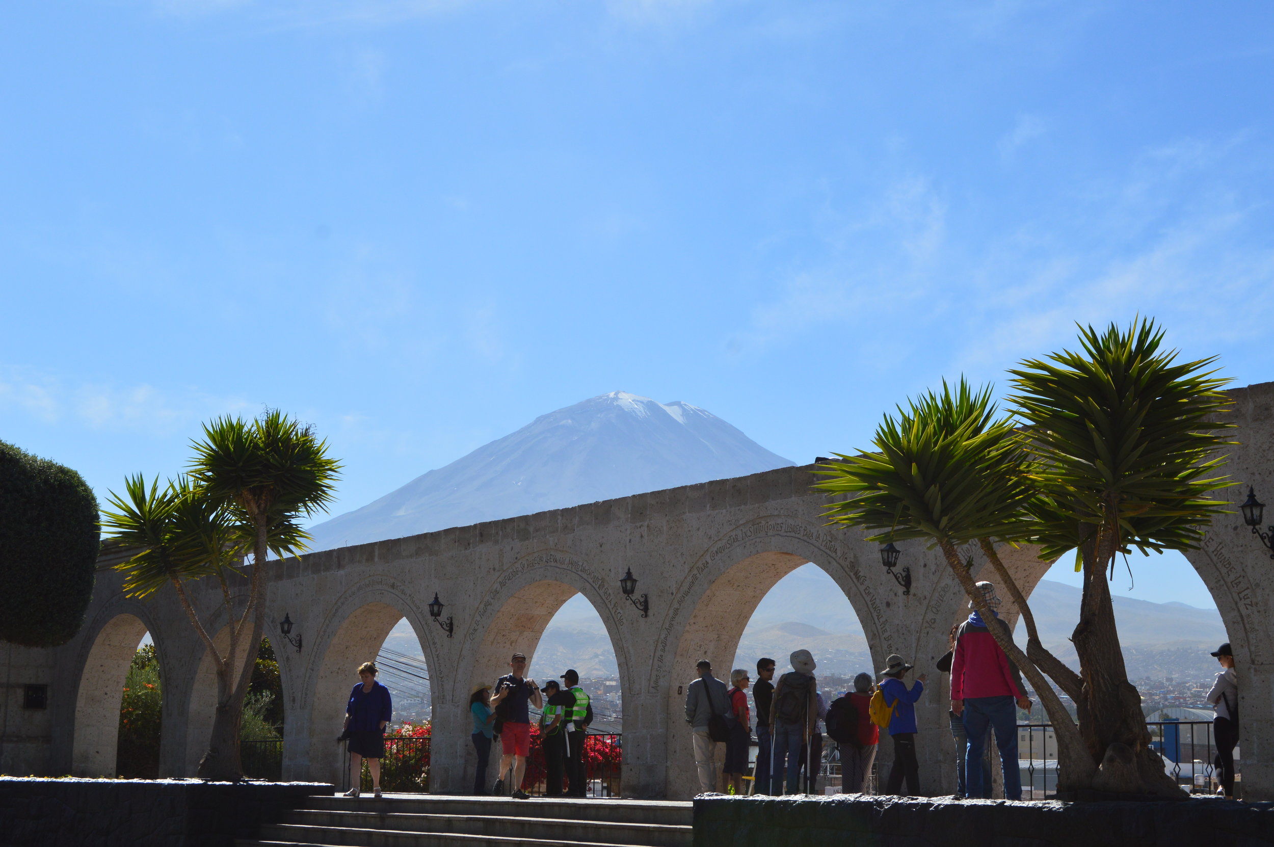
Yanahuara is a small suburb within Arequipa and not too far of a walk from the city center. The Yanahuara Lookout (Mirador de Yanahuara) located in the main square of the town features silar arches with a sweeping view of the city and iconic Misti Volcano rising behind it. It’s a nice spot for lunch or a quick coffee break.
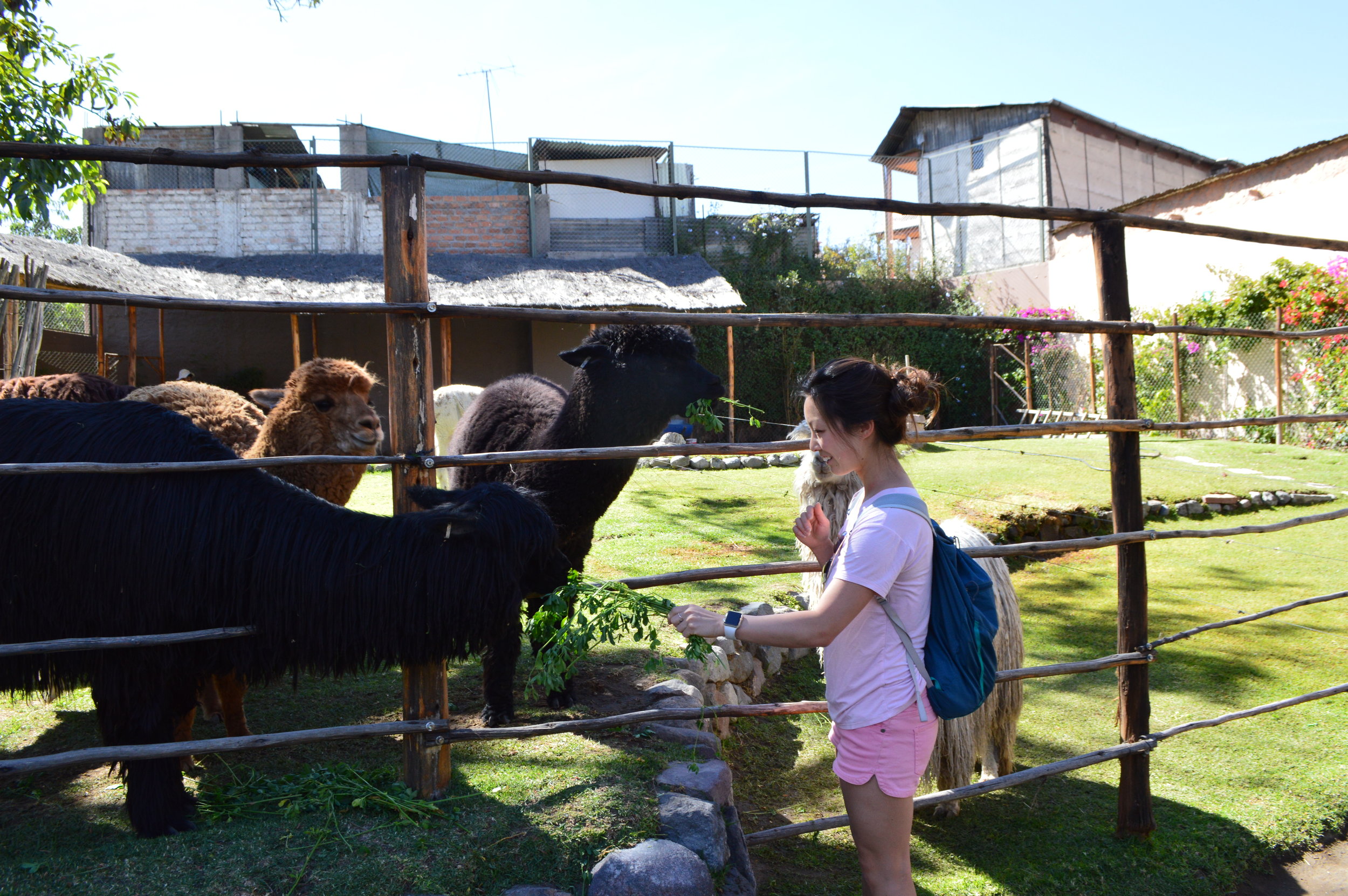
I was really impressed with Mundo Alpaca (Alpaca World) because entry was free and the tour (which was also free) was very informative. There’s a small farm in the back where you can feed the llamas and alpacas, and an area where they display piles of alpaca and llama fur, which you can touch. Further downstairs, the factory showcases machinery used in the process of cleaning the fur to creating yarn. After the short tour, you’re allowed to roam around freely and go through the exhibits again if you’d like. If you are walking there, be very cautious of the traffic because it is located next to a busy intersection where many accidents occur. Always remember, cross with locals!
Puno and Lake Titicaca
If you need an altitude adjustment, try Puno! Puno sits at 3,827 meters (nearly 13,000 feet) above sea level. Admittedly, we didn’t spend much time in the city itself since the main attraction was Lake Titicaca—the largest freshwater lake in South America, and the highest navigable body of water in the world.
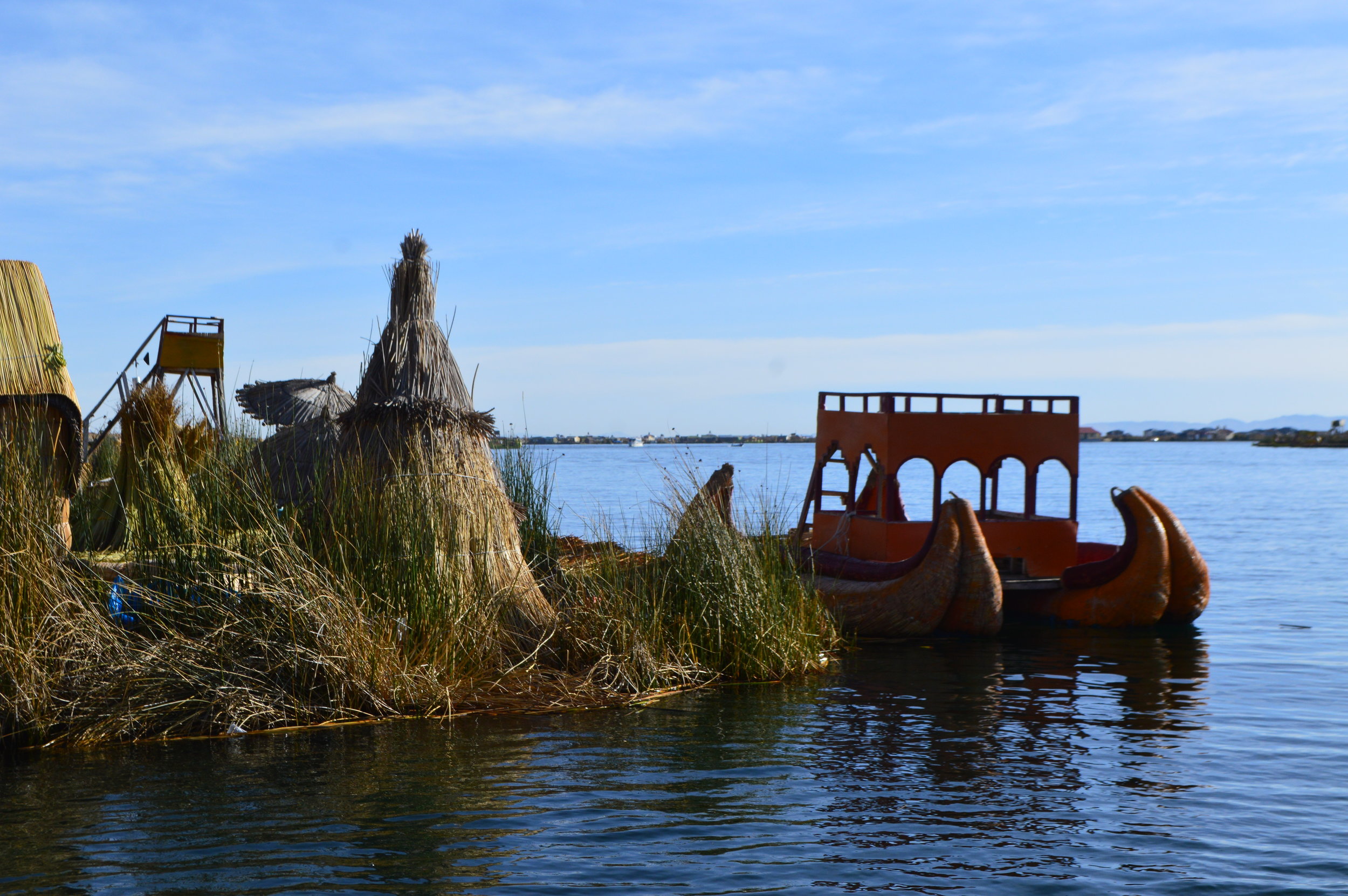
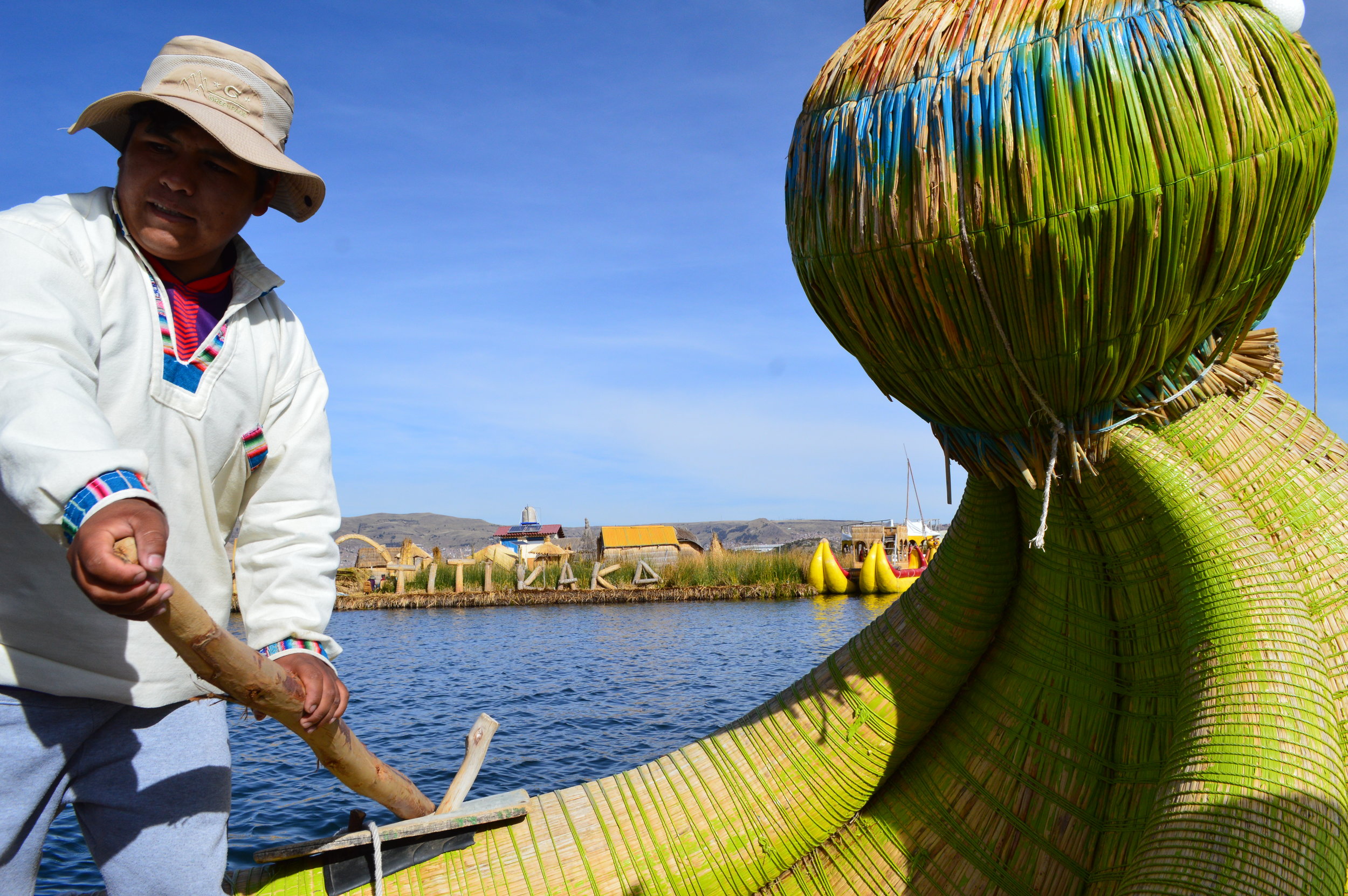
The floating islands of Uros are certainly a highlight of visiting Lake Titicaca. These artificial islands are made of totora reed, strategically layered up to 12 feet thick. The Uros are an indigenous race who migrated to Lake Titicaca before the time of the Incas. The totora reed is essentially their lifeline—not only does it keep them afloat, they also use it to build their homes and boats, as well as for food and medicine. The reeds disintegrate over time, so they are constantly replenishing supply by cutting the reeds from shallower parts of the lake and re-layering the island’s foundation.
Despite how it may seem, the Uros embrace modern technology such as solar panels and radio stations, which can be seen posted around the islands. However, they only live on the islands about 30% of the time. Although the entire experience felt a bit contrived, learning about their history and present day living arrangements was pretty remarkable.
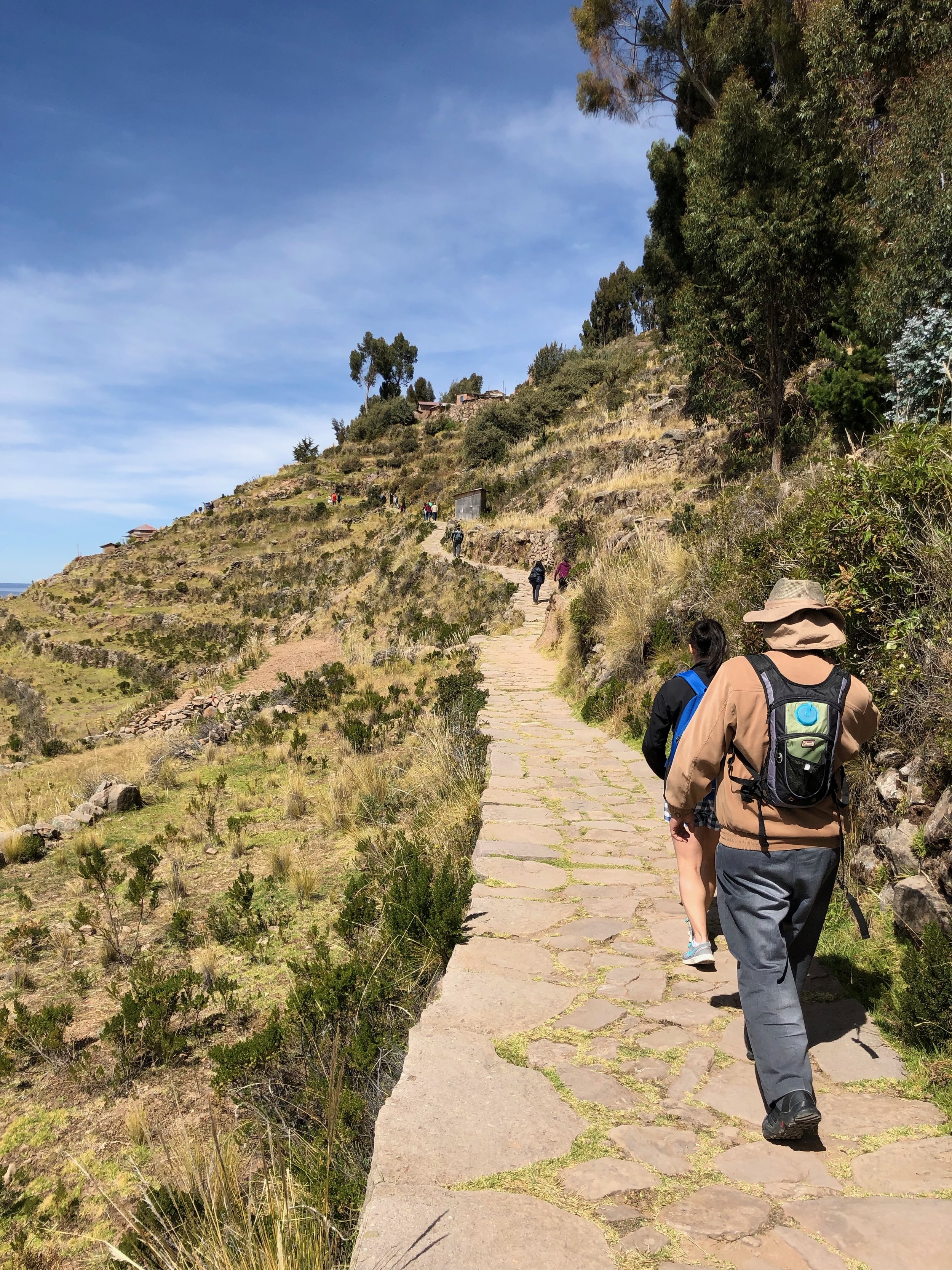
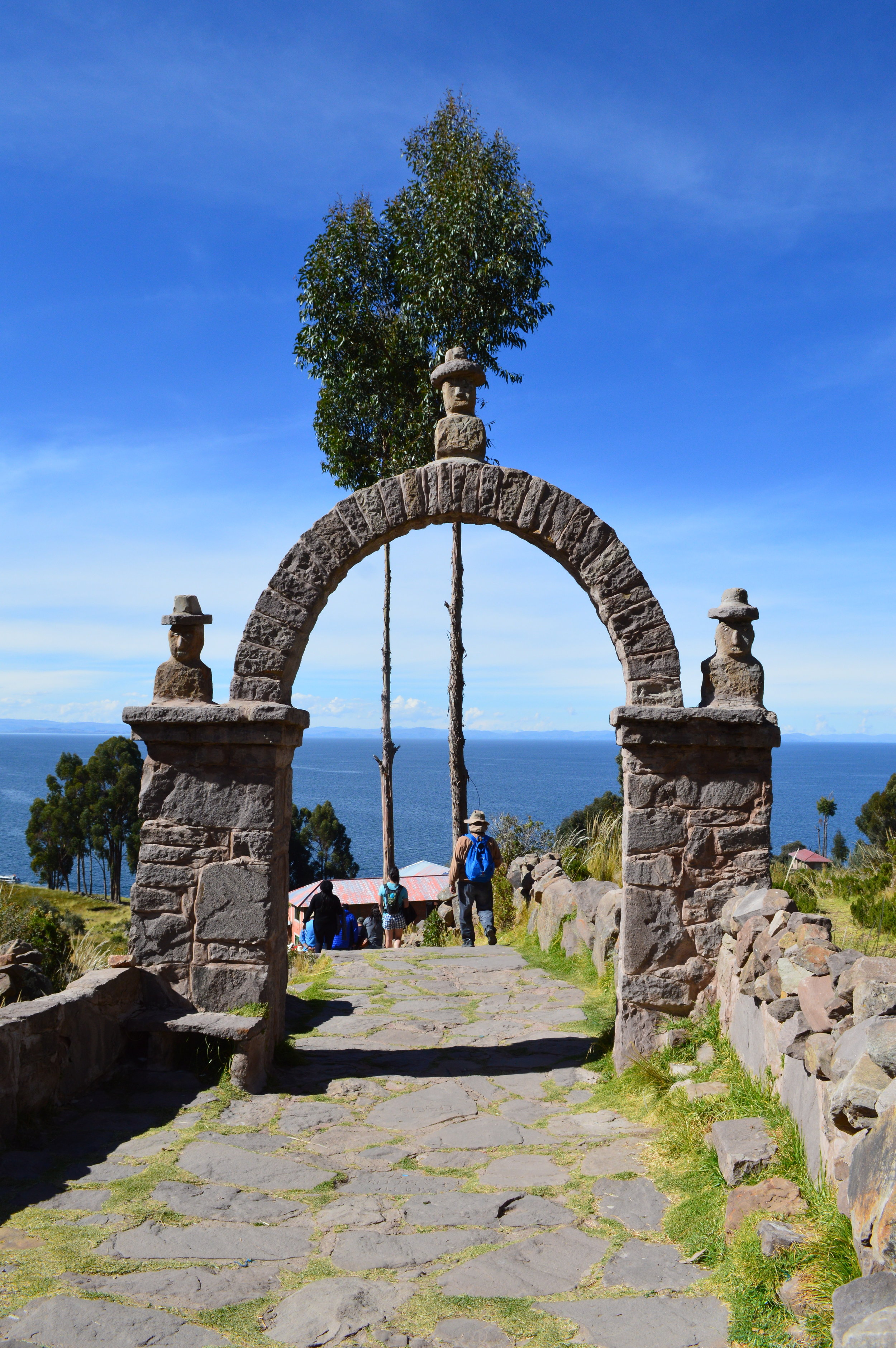
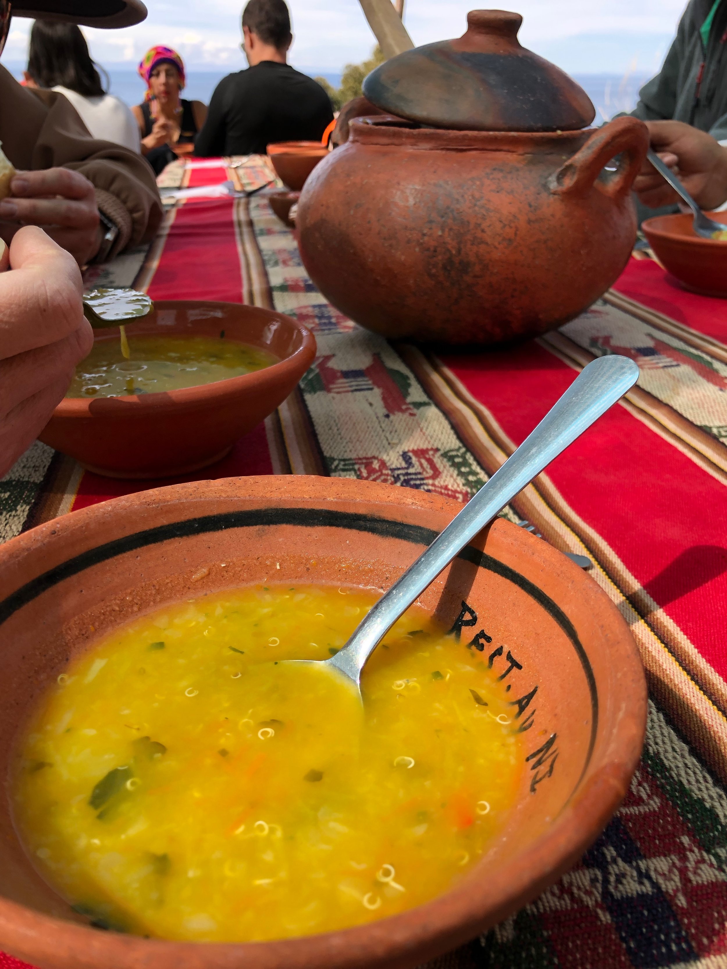
After spending the morning in Uros floating islands, we hopped aboard the boat and headed over to Taquile island. I dozed off for a bit, but before I knew it, we were docked at this little island adorned with narrow stone paths, beautiful green pastures, and flowering cantutas. From the dock, we walked for about 40 minutes on a gradual incline until we reached the restaurant for lunch. If you are still acclimating to the altitude, walk slowly and take breaks. There’s very little shade along the path, so you’ll probably start shedding some layers, while also providing a convenient excuse to pause and soak in the stunning views of the island.
Devil’s Balcony
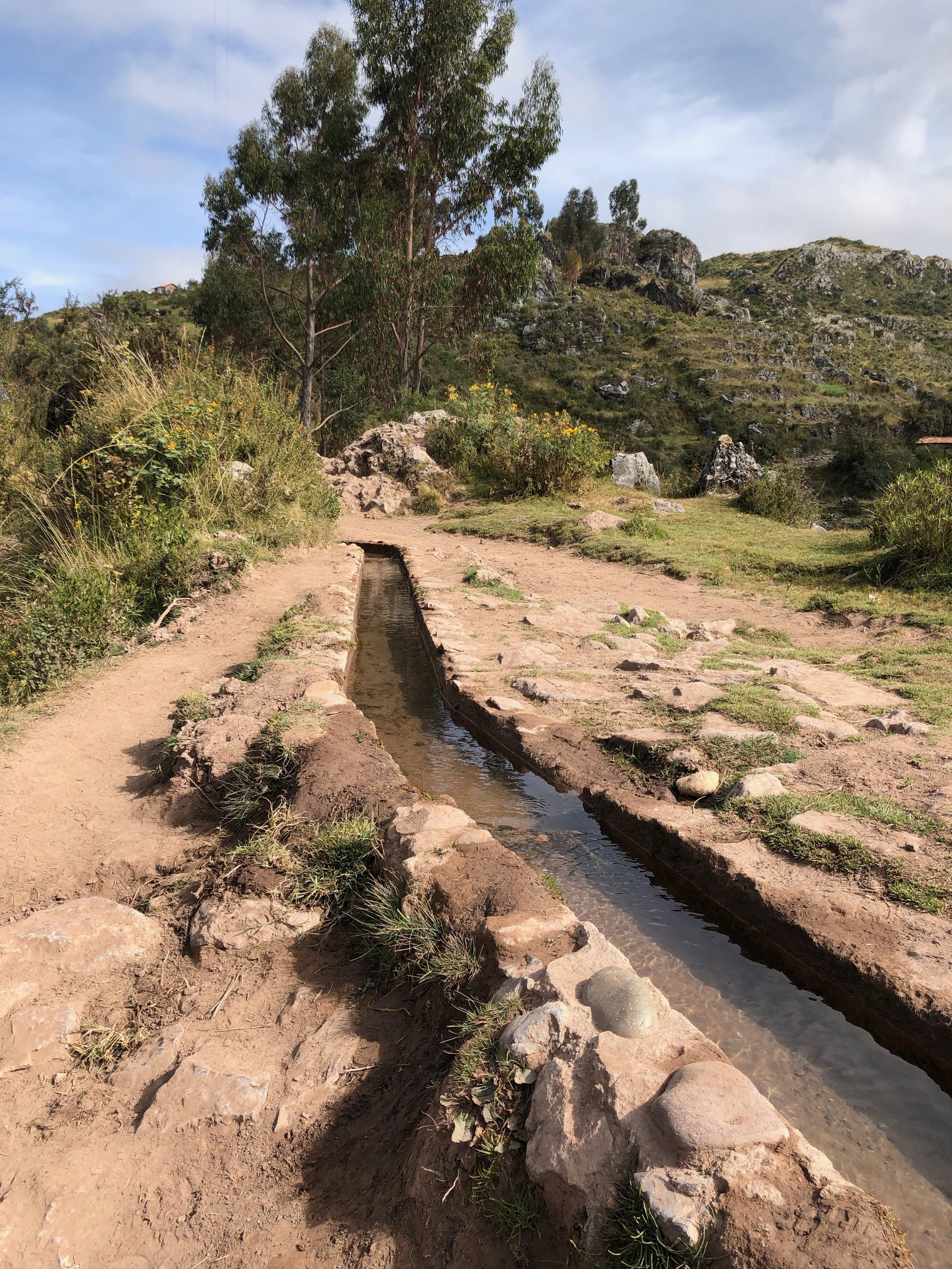
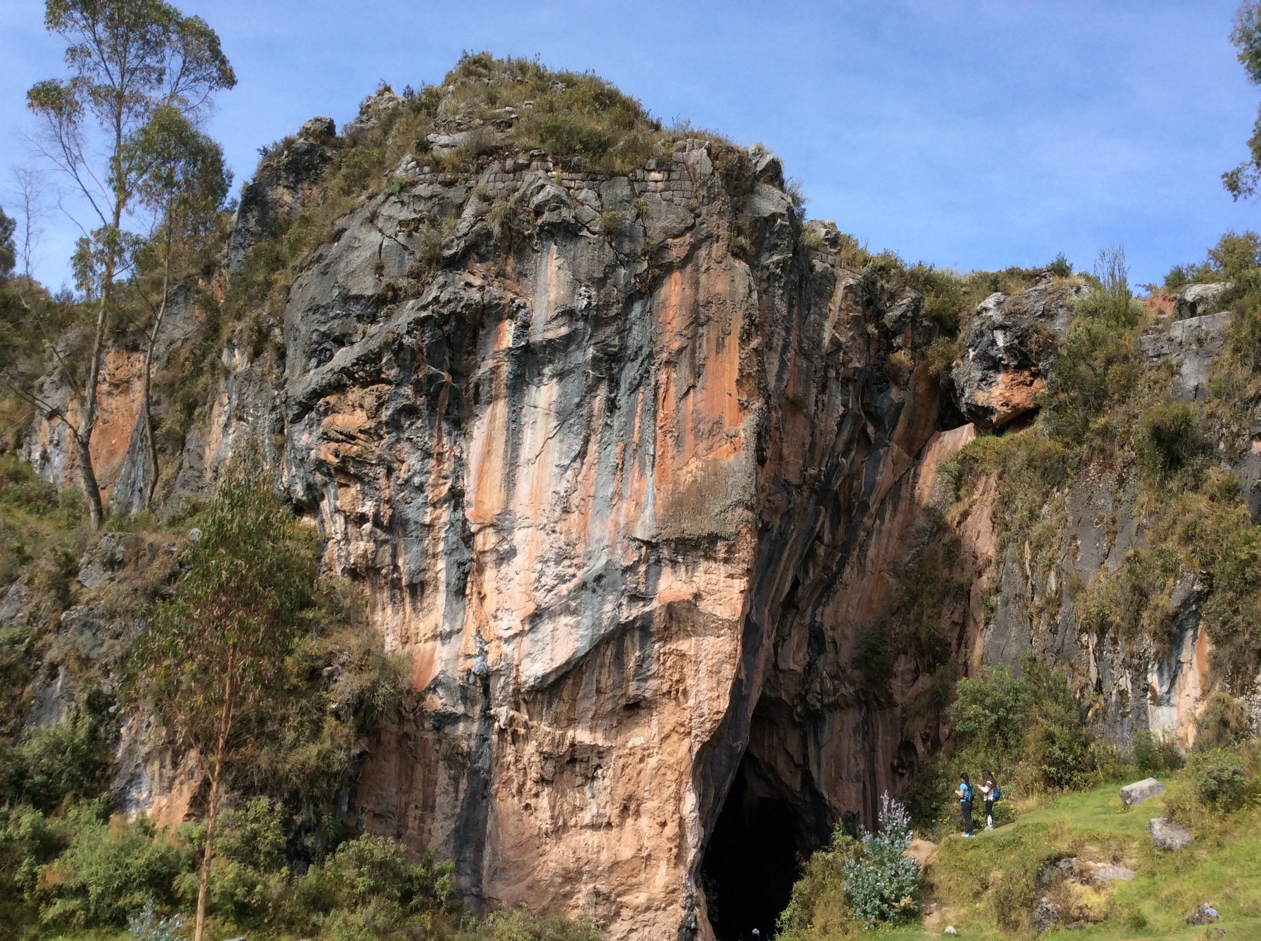
A hike to El Balcón del Diablo (the Devil’s Balcony) is one you don’t want to miss! Surrounded by lush greenery, The Devil’s Balcony is known for being a large striped rock with a spectacular view of a chasm in the middle. Right below, a river runs through the cave towards the other end of the rock.
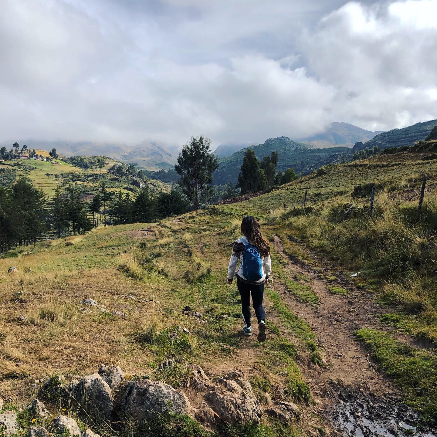
This was a tad tricky to get to without a guide. You essentially start on a dirt road behind the Sacsaywaman ruins and continue up along that dirt road until you hit a fork in the road. Stay to your right and continue on the dirt road, which eventually narrows. Just follow the river (which should be on your left) and the aqueducts. If you get lost, ask any local and they’ll point you in the right direction. You actually end up on top of the rock formation where you can take a break on the Devil’s Balcony before climbing down to the chasm. It’s easy to miss because you can’t really see the full rock formation when you’re standing on top of it. We shuffled down the side of the hill to the large cave opening for a closer look. There’s a spot where you can climb down into the cave, but be very careful because there isn’t much of a grip.
Cusco Ruins
Tambomachay | Puca Pucara | Q’enko | Sacsaywaman
To make the most of your time while traveling on a budget, I recommend taking a taxi up to Tambomachay and working your way down to Sacsaywaman. If you’re staying at a hostel, your best bet is to ask the owner or host to call a taxi for you. Often times they have deals with certain taxi operators (or their friends) who are willing to drive at a lower/contracted price. We took a taxi from our hostel to Tambomachay for 25 soles.
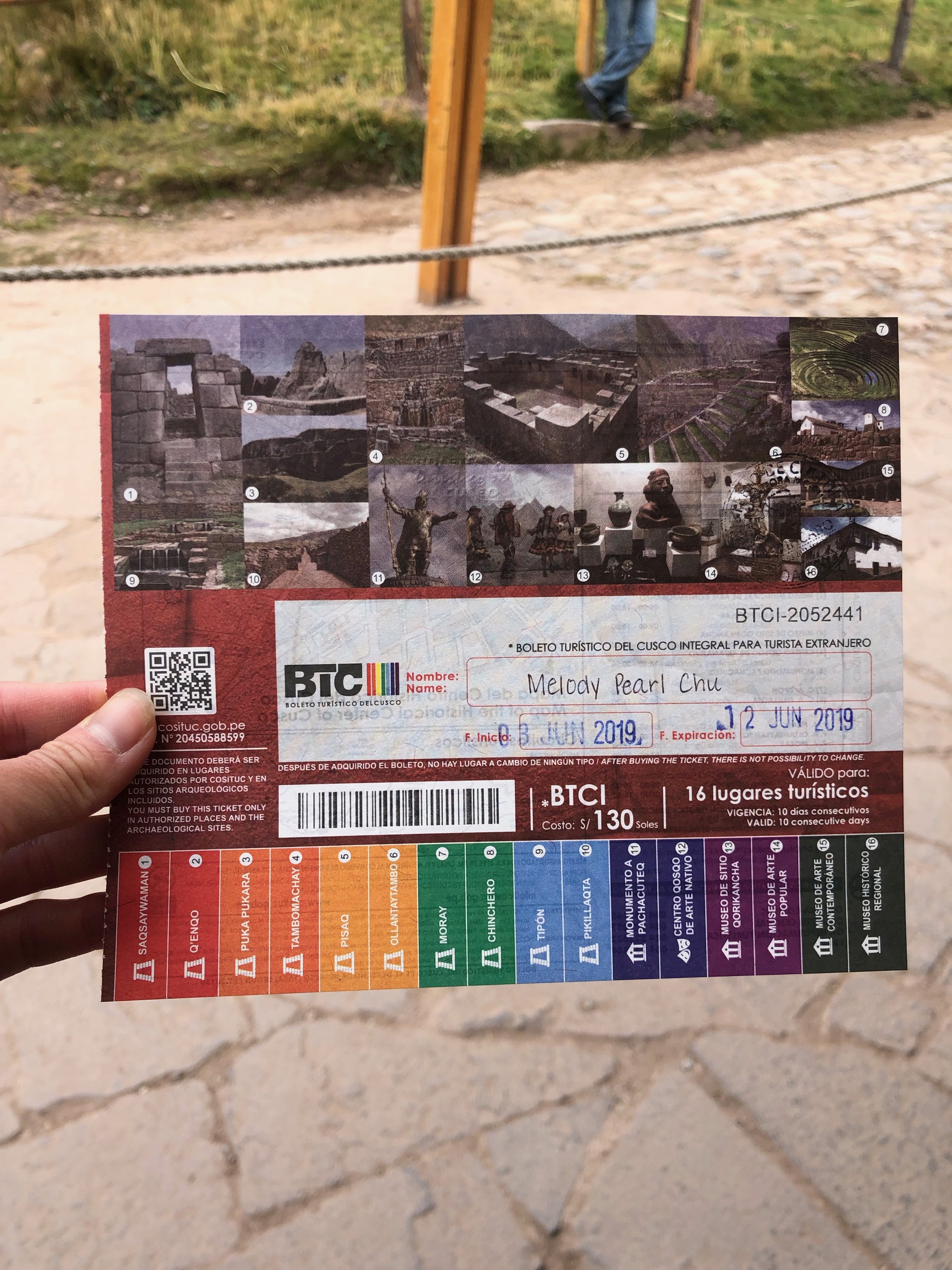
Be aware that you need to purchase the Boleto Turístico del Cusco (Tourist Ticket) to enter these ruins and many other attractions in the area. This ticket allows entrance to multiple attractions in and around Cusco and the Sacred Valley. There are several ticket types available; and depending on how much time you have, you can choose the ticket that best fits your budget and itinerary. The most popular and best bang-for-your-buck ticket would be the Full Cusco Tourist Ticket (S/.130), which includes entrance to 16 attractions. It is valid for 10 days, unlike the other tickets which are valid for only 1-2 days. You can purchase this Tourist Ticket at the entrance of any of the attractions listed on the ticket or at the official tourist information center called DIRECTUR. Don’t forget your passport! You will need it to purchase the ticket.
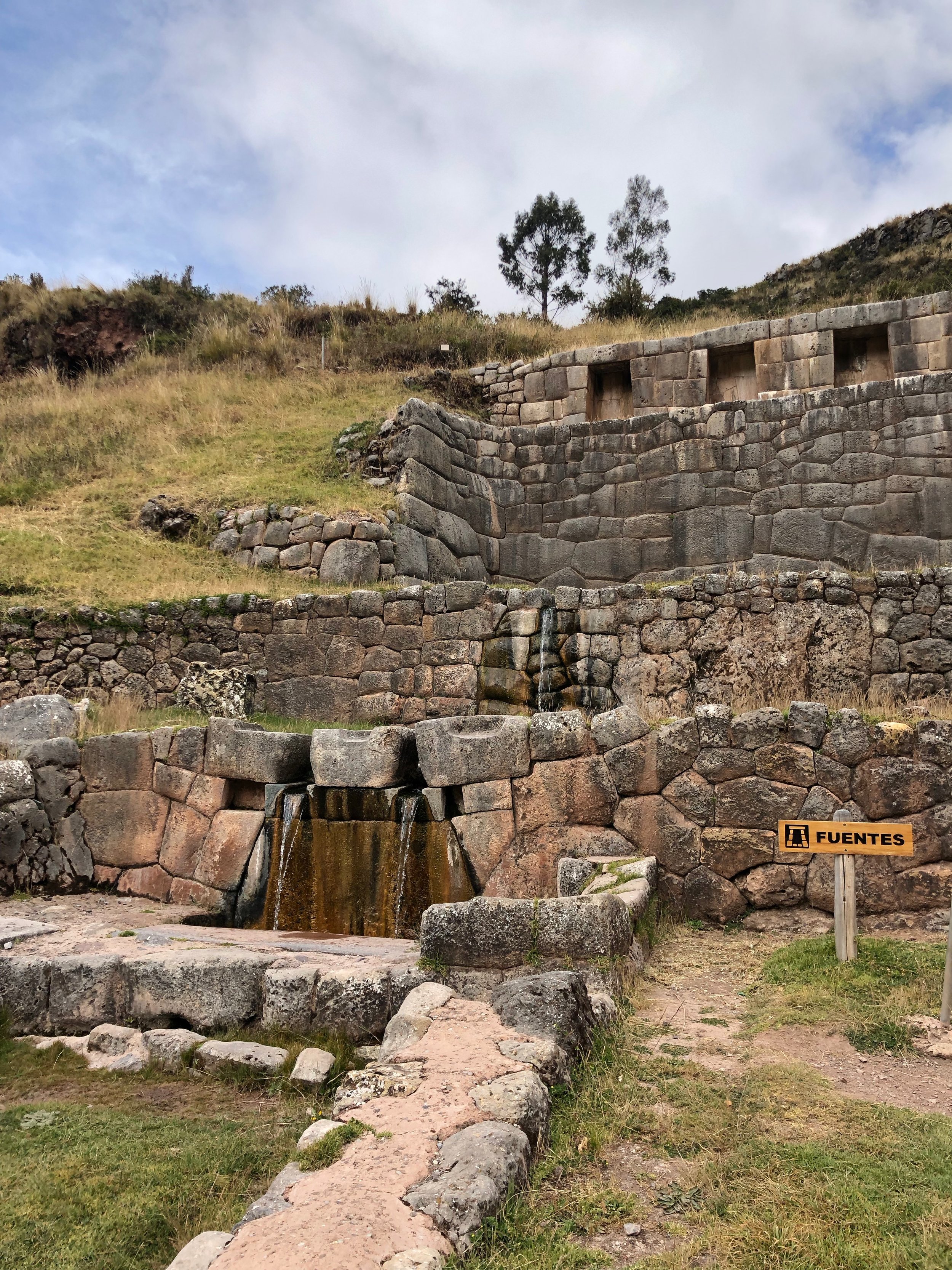
Tambomachay is popularly known as the “Inca’s Baths” although its precise functions are not entirely known. There are theories that Tambomachay may have served as a ceremonial site, an Inca spa, or military outpost. The structure is built over a natural spring, which to this day, is still continuously flowing into a series of aqueducts and canals woven into the terraces.
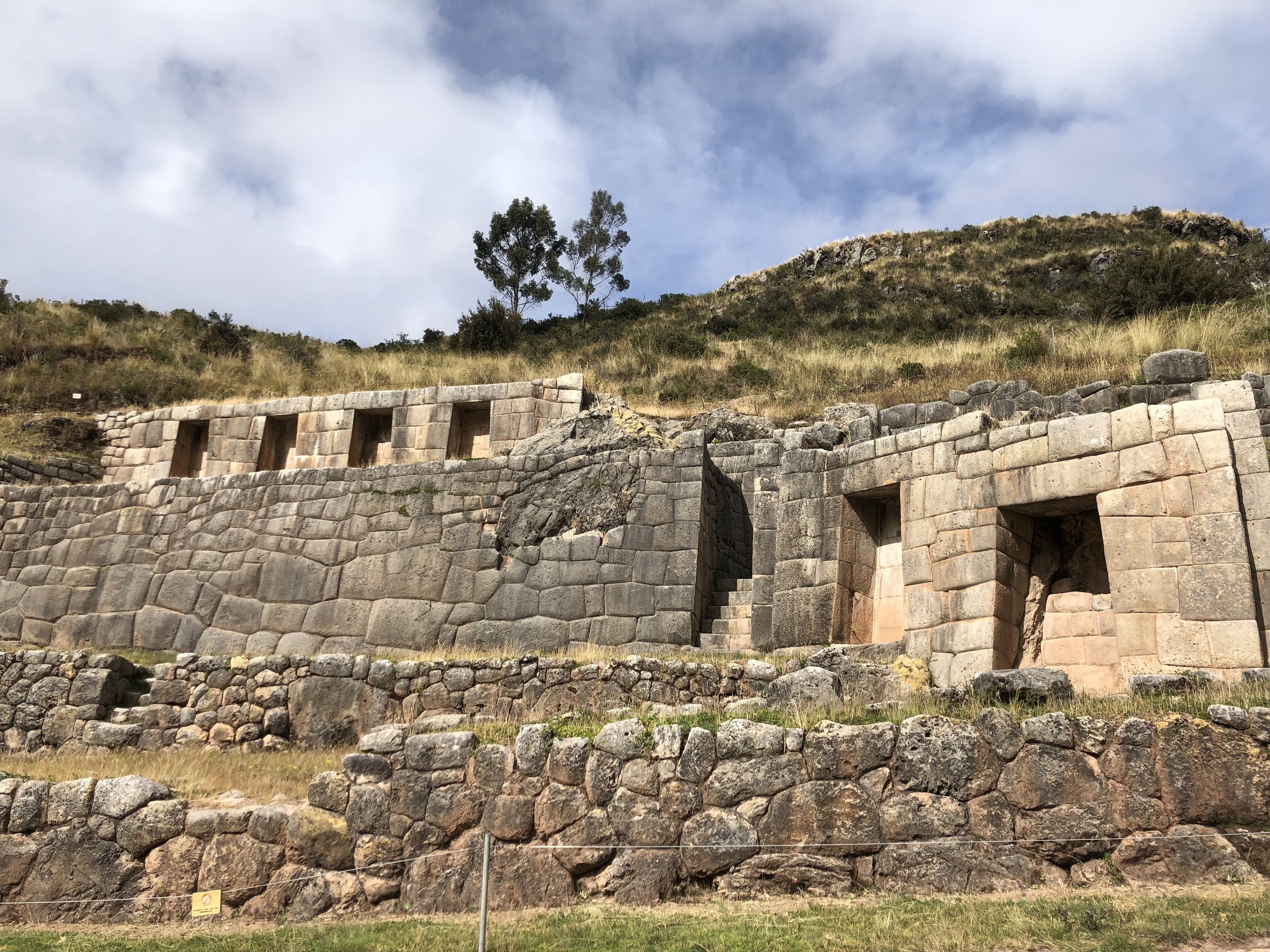
Only a stone’s throw away from Tambomachay is Puca Pucara, the name meaning “red fortress” in Quechua, was a military checkpoint. This fortress sits atop a hill overlooking the Cusco Valley boasting views of cascading mountain ridges in the background.
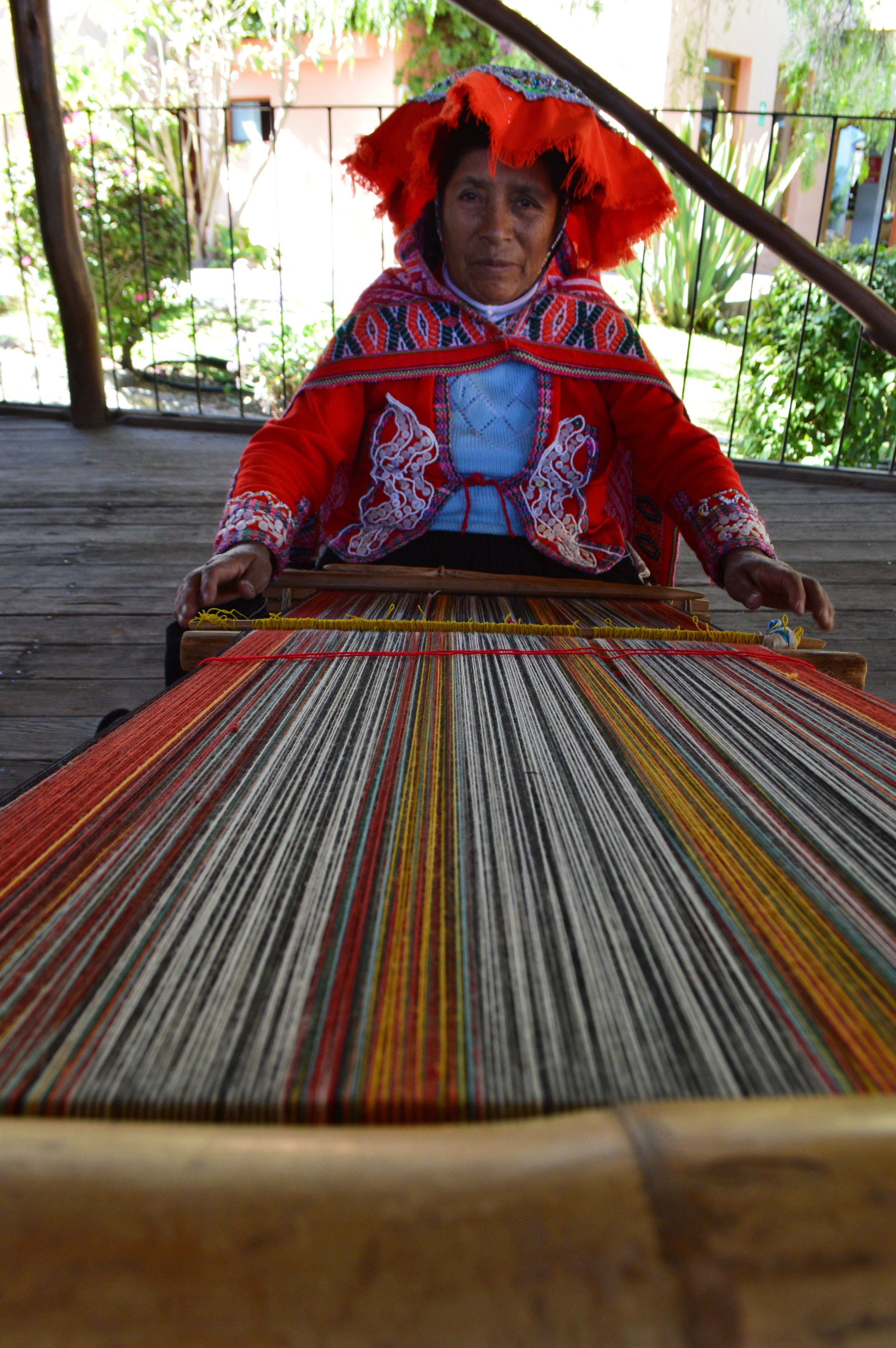
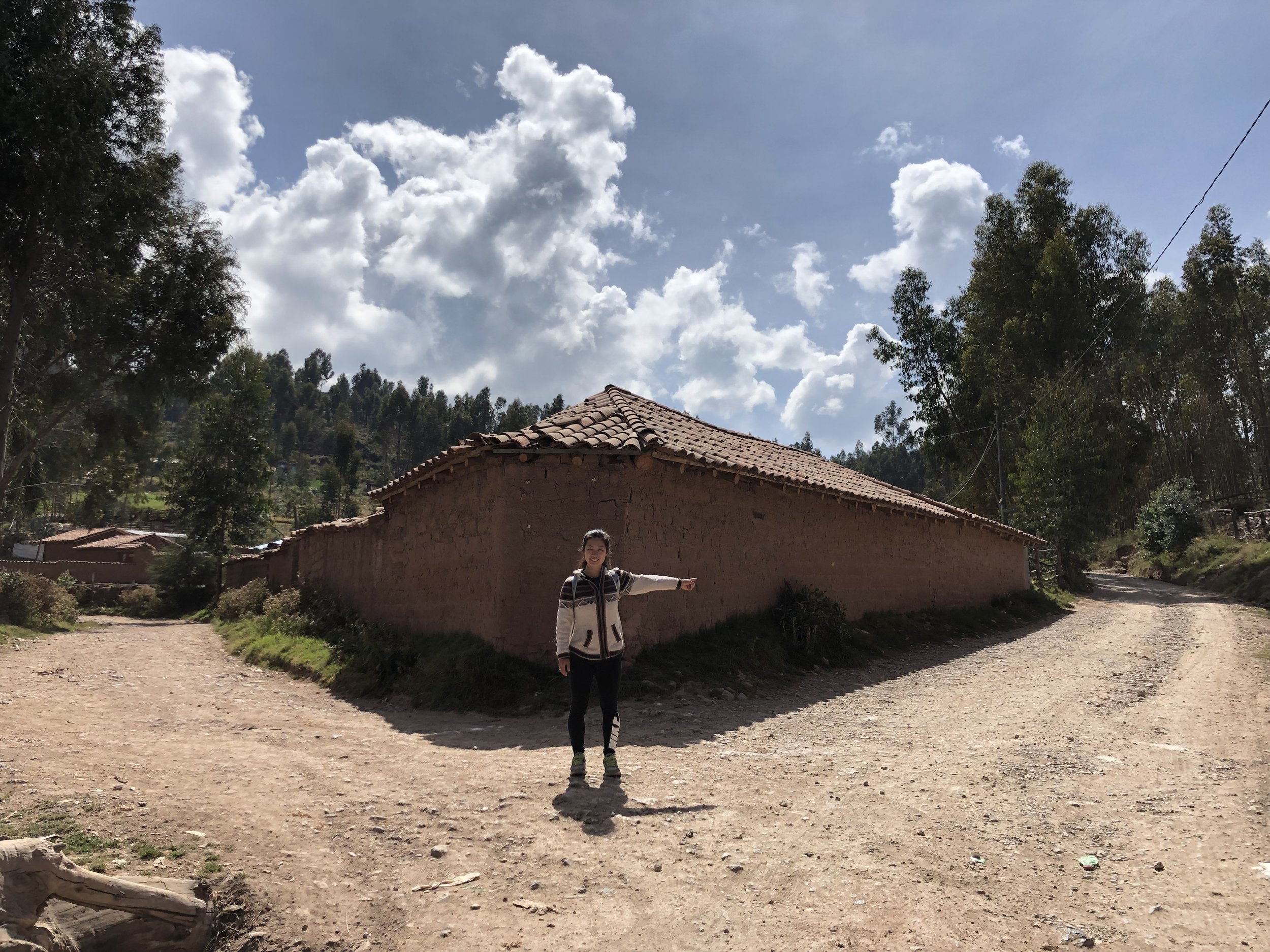
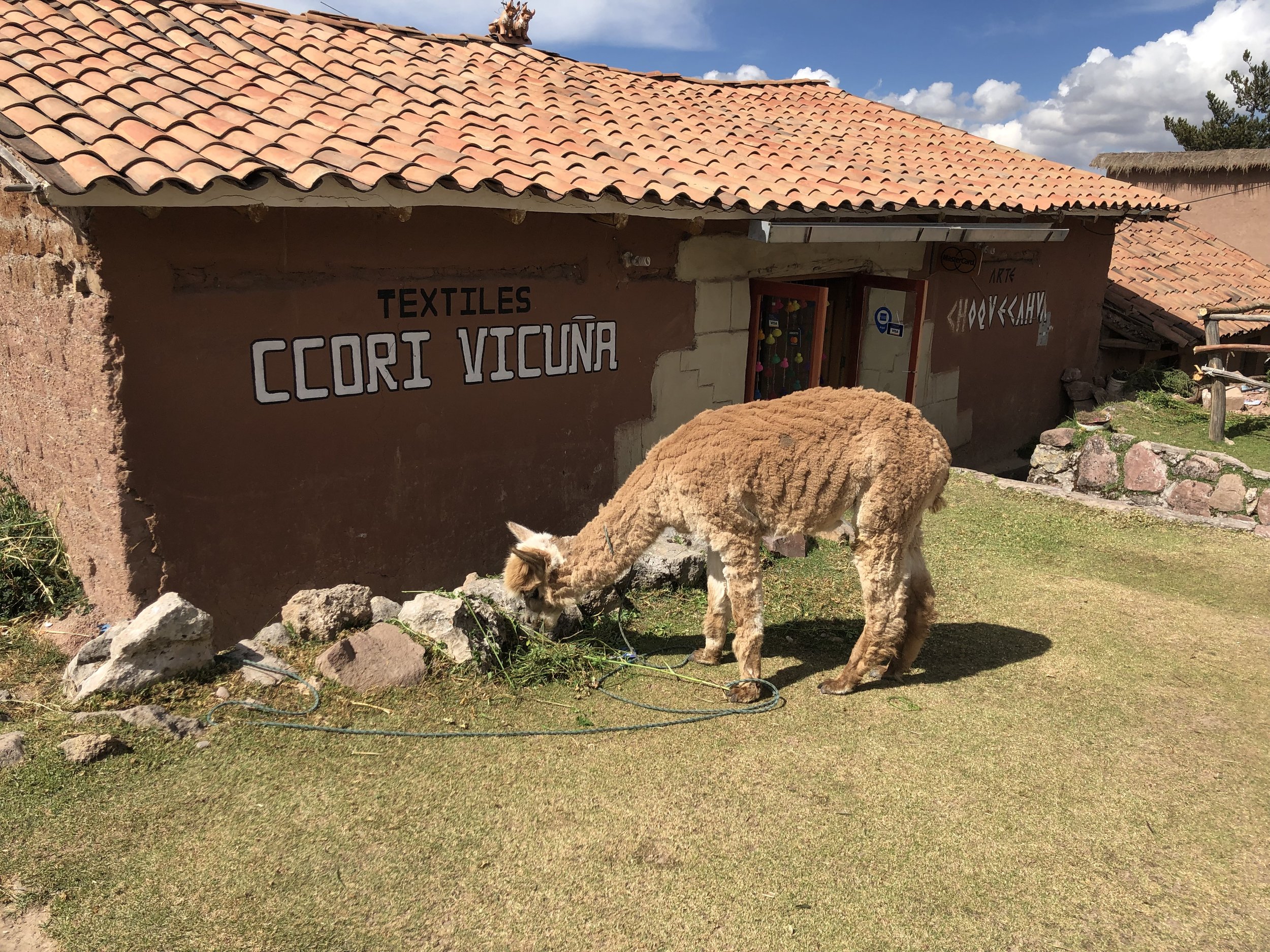
As we walked downhill to the next ruin, we walked past this small store, Textiles Ccori Vicuna, with alpacas and llamas out front. I stood at a distance taking photos of the alpacas until a man walked out from the store and motioned for me to get a closer shot. He encouraged me to pet the alpaca, but I was hesitant (because on numerous occasions, I was asked to pay a fee after petting/holding the animal). He told me it was absolutely free and so I reluctantly petted the baby alpaca…oh boy, it was so soft! As he motioned for us to come in to check out his store, I began thinking to myself “Great, another tourist trap…” but I followed him inside anyway. He served us some hot tea, and guided us to the center of his store where a table of fur, textiles, and coloring agents were neatly spread out. He started by explaining how to discern between real alpaca textile and what people claim is “real”. He pulled a small wad of thread from an alpaca scarf and lit a match underneath it. It immediately caught fire. He held it up and asked us to smell it. It smelled like burnt hair. I quickly pulled out an “alpaca sweater” I bought from a street vendor, and he immediately shook his head. “Mixto.” He pulled a wad of loose thread and lit it on fire. It caught fire, but didn’t smell like burnt hair. He pinched the burnt wad in between his fingers, then placed it into my palm. “Feel. It is hard like plastic. Mixto. Mostly synthetic material, mixed with a little alpaca.” Real 100% alpaca sweaters typically run in between 300-600 soles (approx. $100-200 USD). I bought my sweater for 35 soles, so go figure.
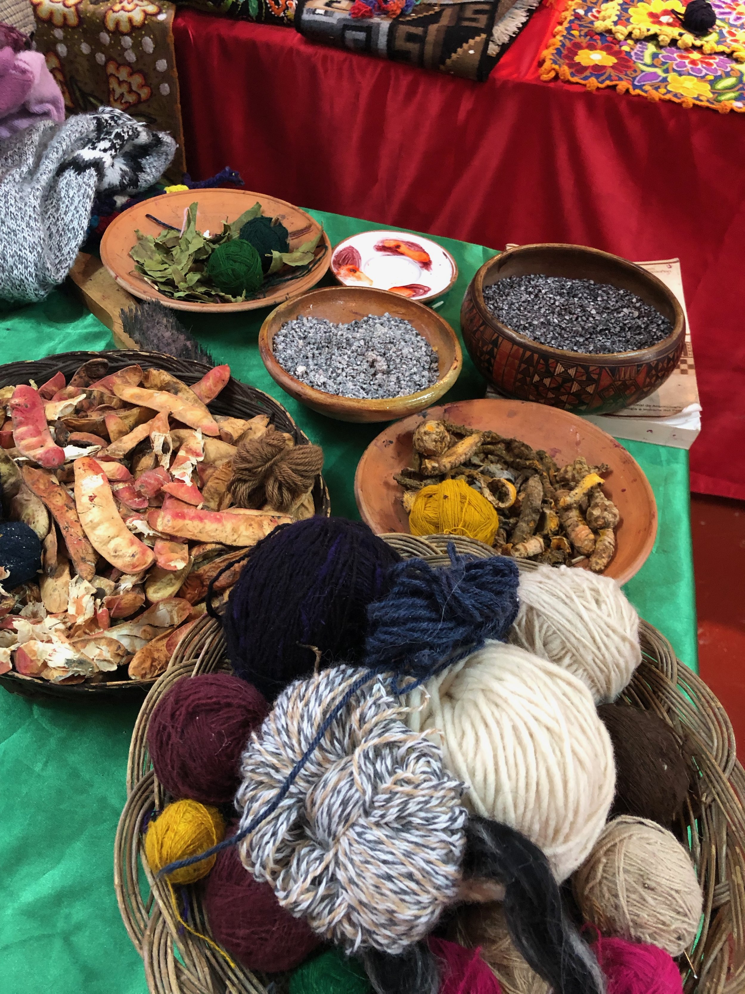
He showed us the variety of natural materials ranging from parasites to plants that they use as dyes for the textiles. Afterwards, he led us through a door which opened up to a backyard patio behind his store where this young boy was diligently weaving an intricate piece. My first thought was “Why isn’t he in school?” I asked him if he attended school, and he happily responded that he works in the morning and goes to school in the afternoon. I was truly humbled by his response.
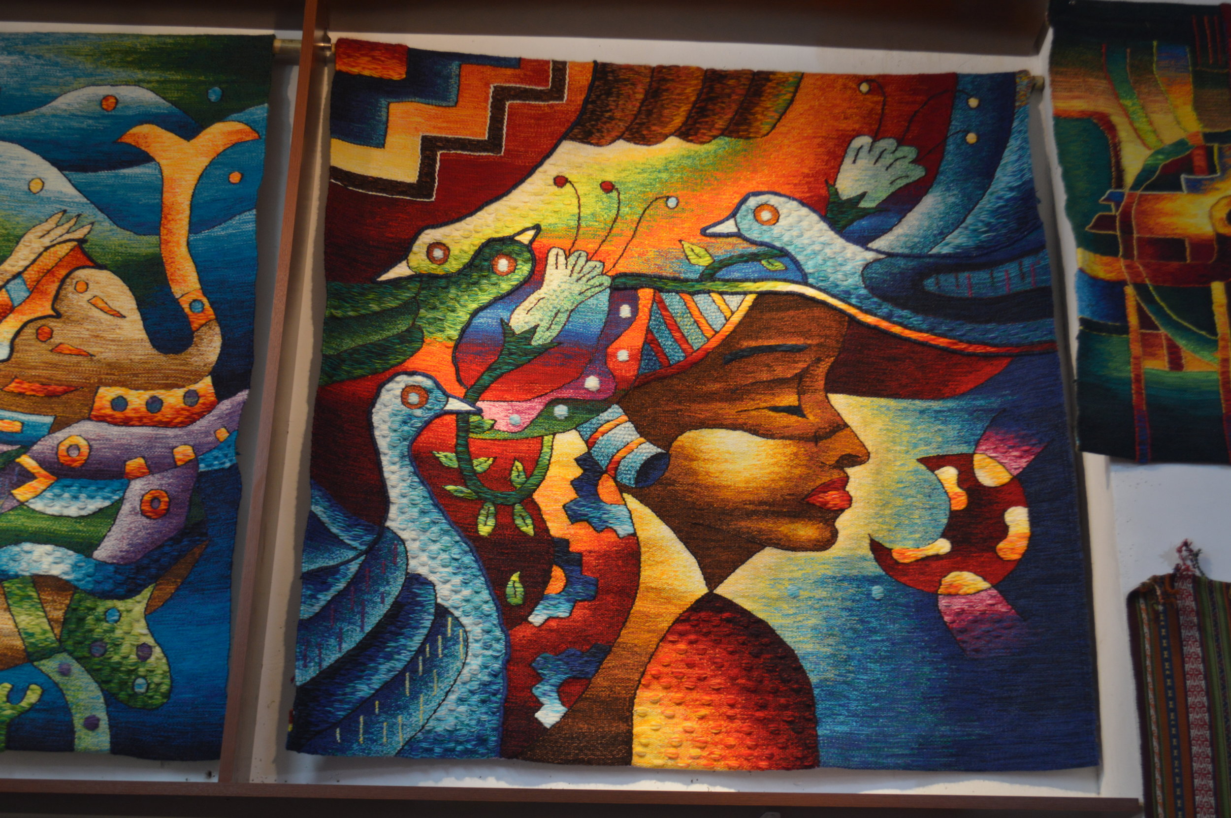
At no point did the owner make us feel uncomfortable or obligated to buy any of his products. But because he was genuinely kind and honest, I felt compelled to purchase something to support his business. I bought a neat handmade beanie that could convert into a scarf. Best purchase ever. After thanking him and waving goodbye, we set off onto the next ruin: Q’enko.
We began walking down the hill, passing several other small stores along the way, alpacas grazing in the pastures, and donkeys crossing the road with no herder in sight. There’s a bit of distance (about 4km) between Puca Pucara and Q’enko so I suggest either hailing a taxi down if you’re short on time, or taking a public bus (Senor Del Huerta) for 2 soles.
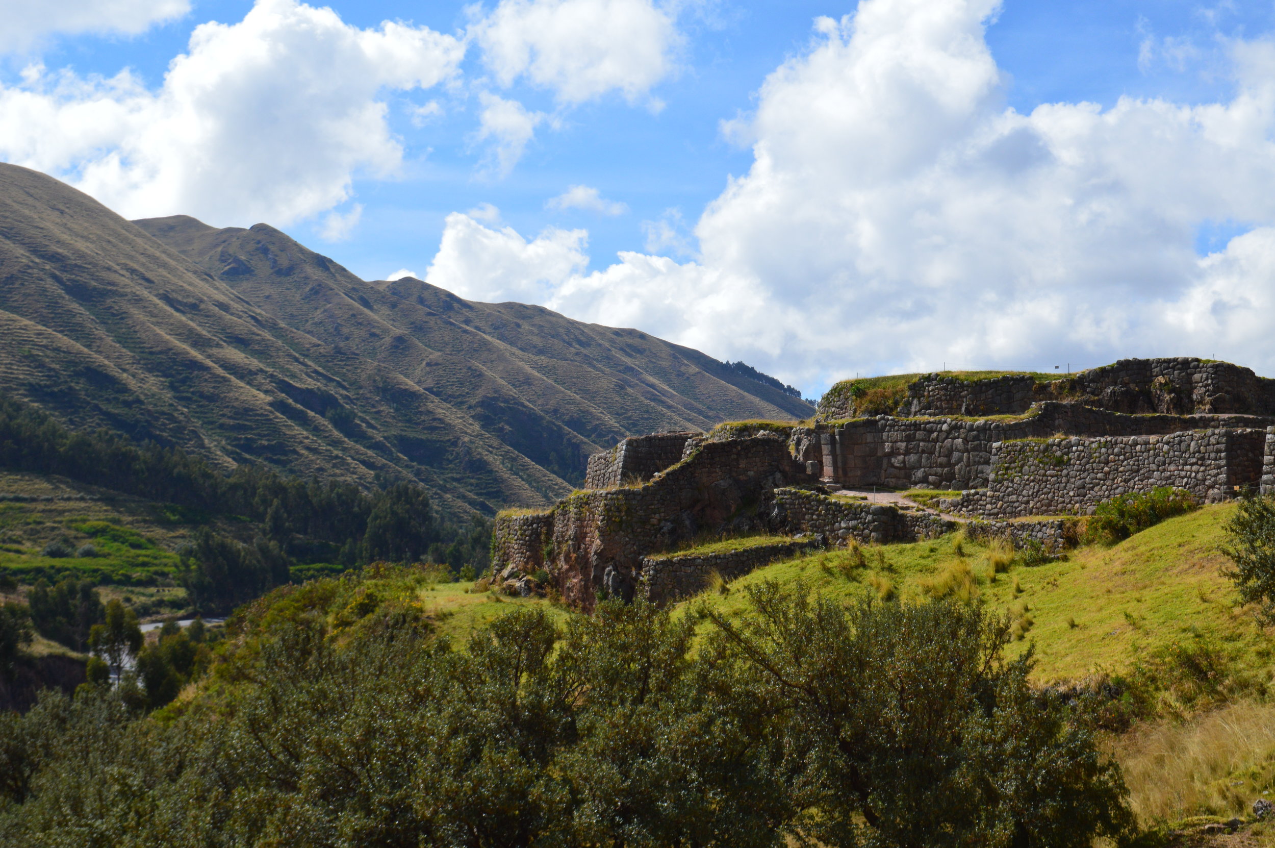
Q’enko is a pretty extensive ruin, so much that there’s Q’enko Chico, another section of the ruins but largely destroyed that there’s not much for visitors to see. Because of the labyrinth like caves carved within the massive rocks, Q’enko was thought to have been used for ceremonial purposes. However, there is still a lot of mystery surrounding the rock formations and its carvings.
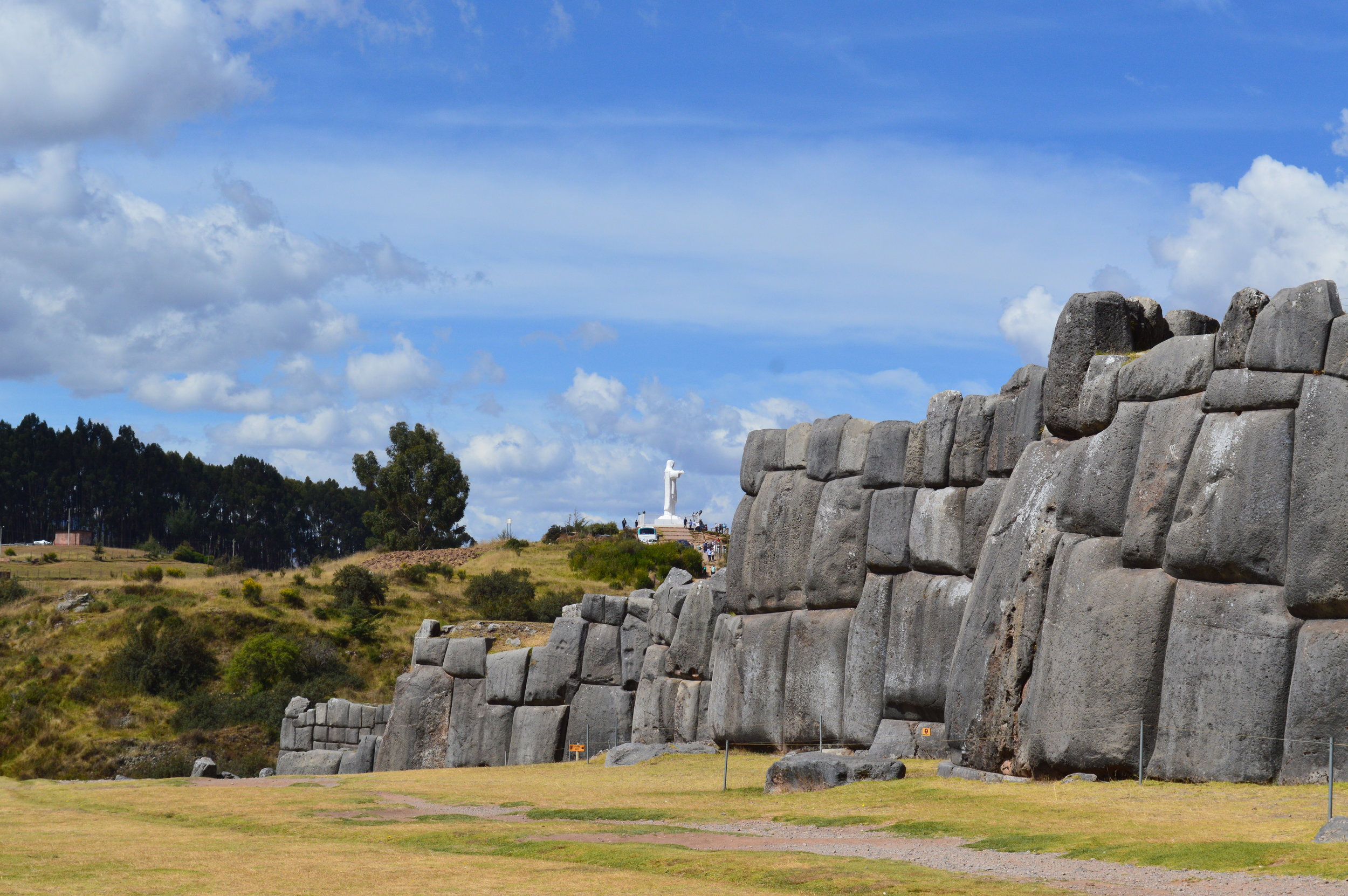
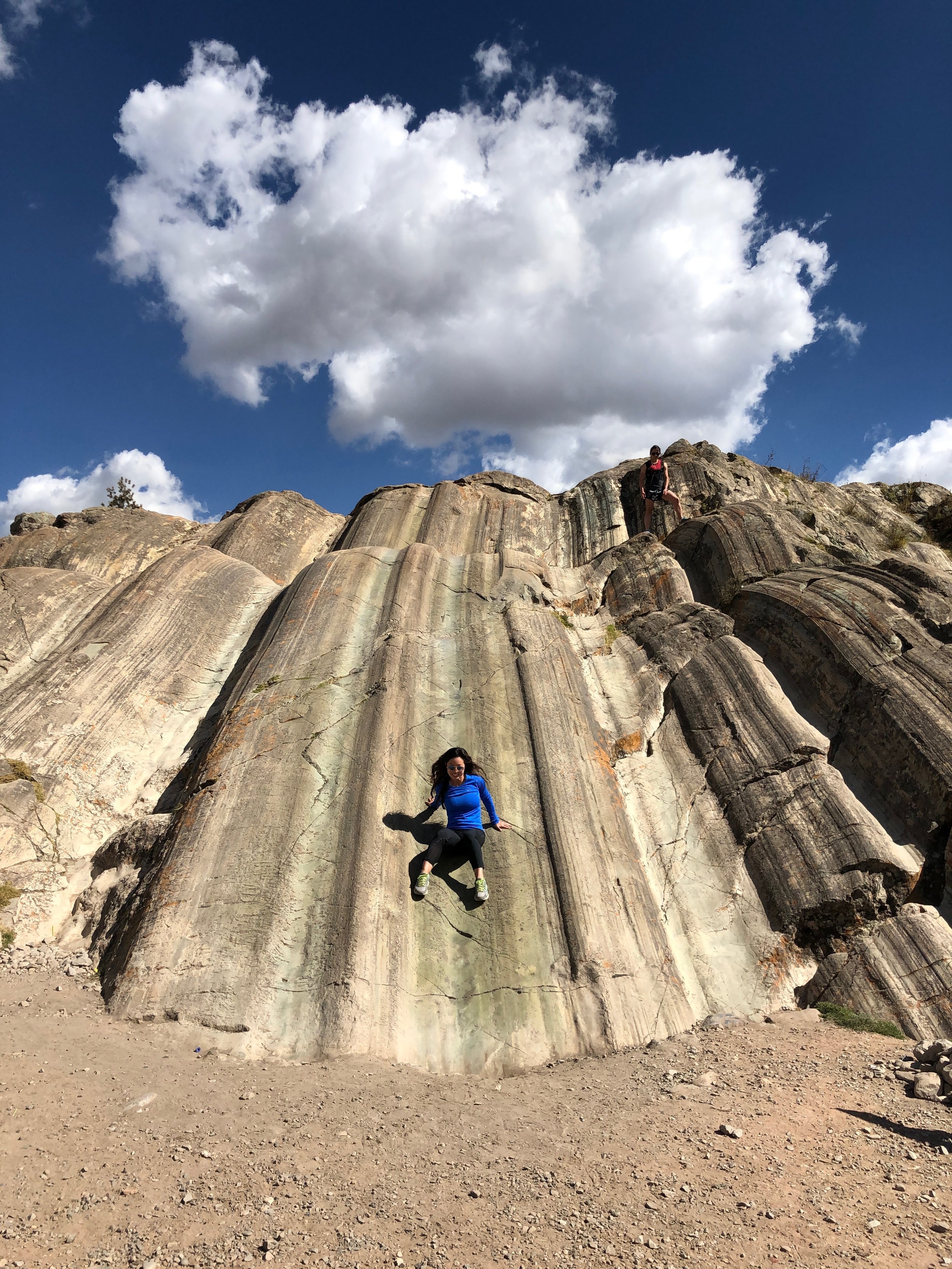
Sacsaywaman was the largest of all the ruins we visited, and also the largest structure built by the Incas. The massive stones used to create the zigzag walls are estimated to weigh between two hundred and three hundred tons each. What’s more remarkable is how each stone was carefully cut to fit together tightly without mortar.
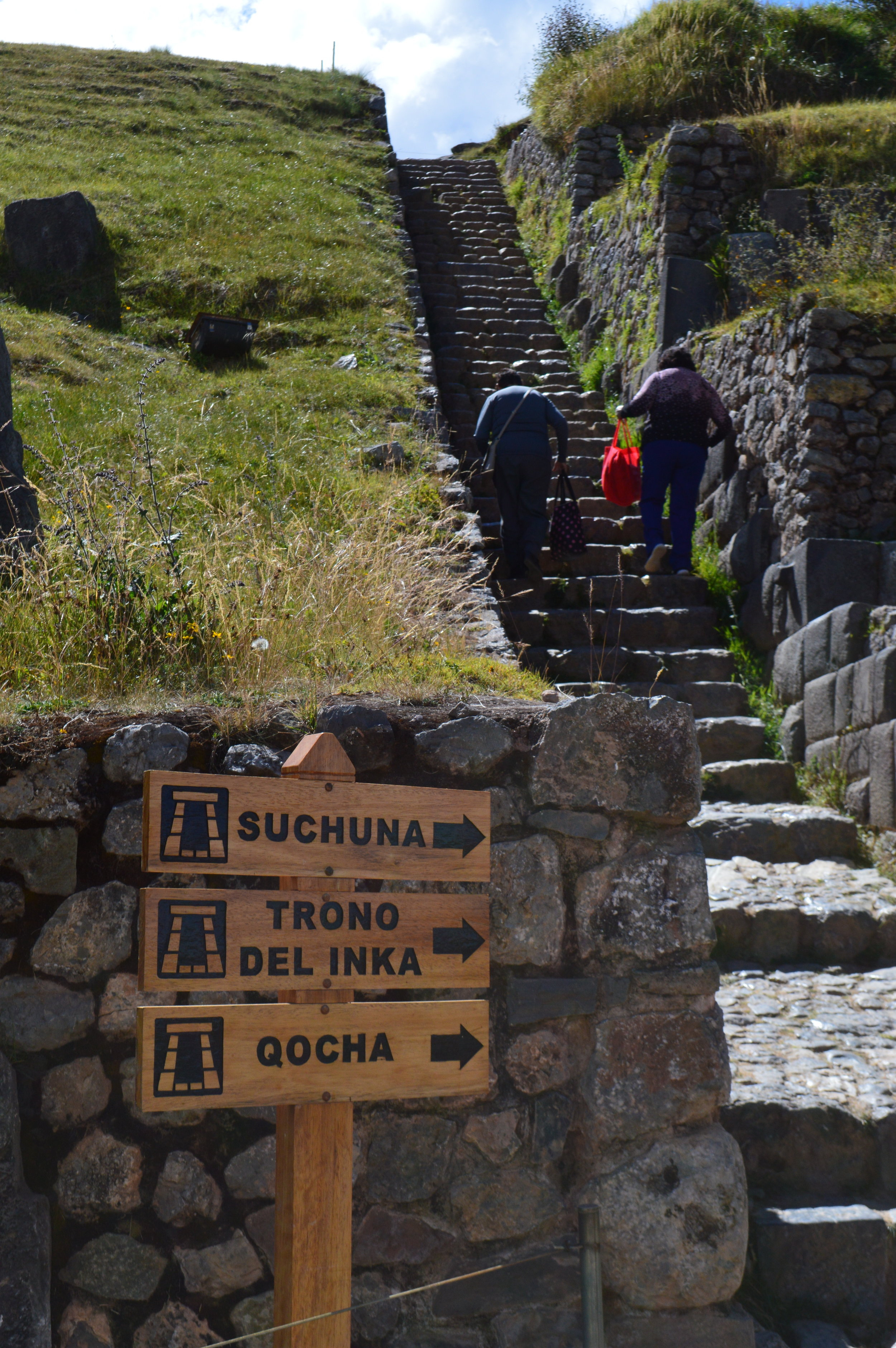
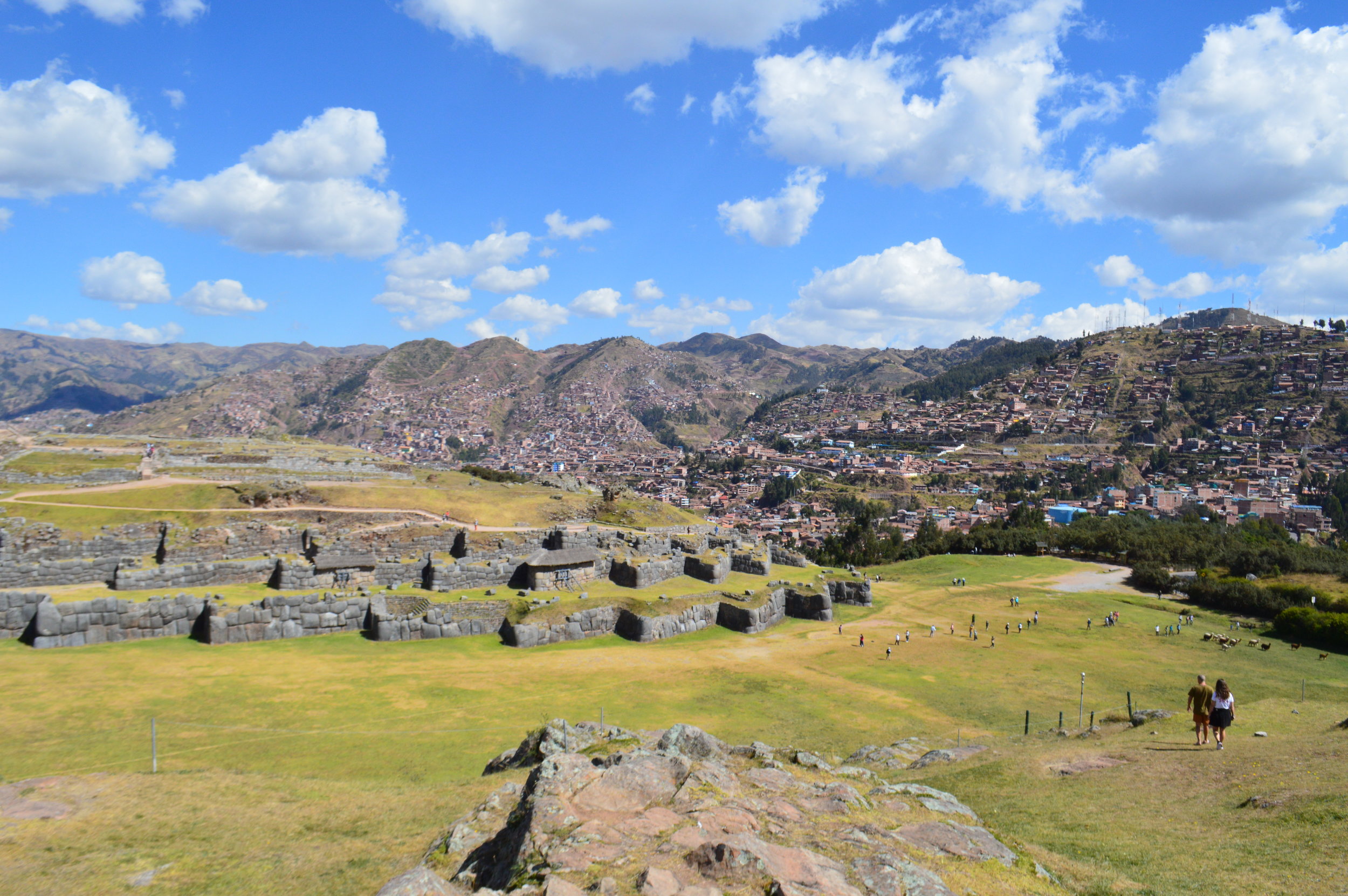
Sacsaywaman is divided into different sectors, and by far, my favorite sector was Suchuna, also known as Rodadero. This place was of great spiritual and ceremonial importance to the Inca people but it also served as a recreational sliding area, which is still enjoyed to this day. Rodadero slides is a huge geological formation of diorite rock, and thanks to humankind’s propensity for sliding down things, the grooves in the rocks are well-polished from years of sliding down on them.
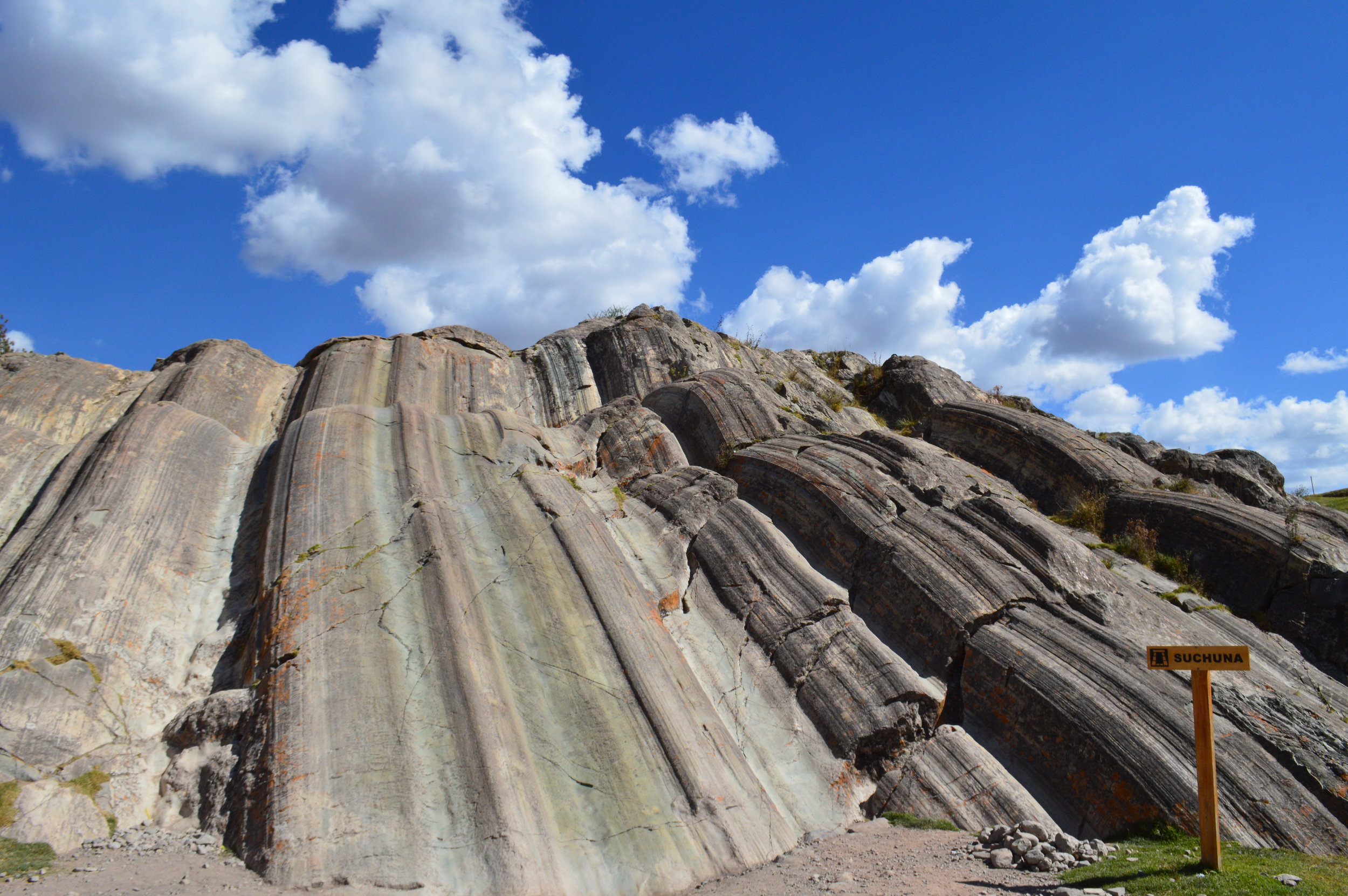
I recommend wearing long pants or at least leggings so you don’t get friction burned! The slides are surprisingly very slippery, so use caution going down and use your arms and legs to slow yourself down as you get to the bottom otherwise you’ll slam into the ground!
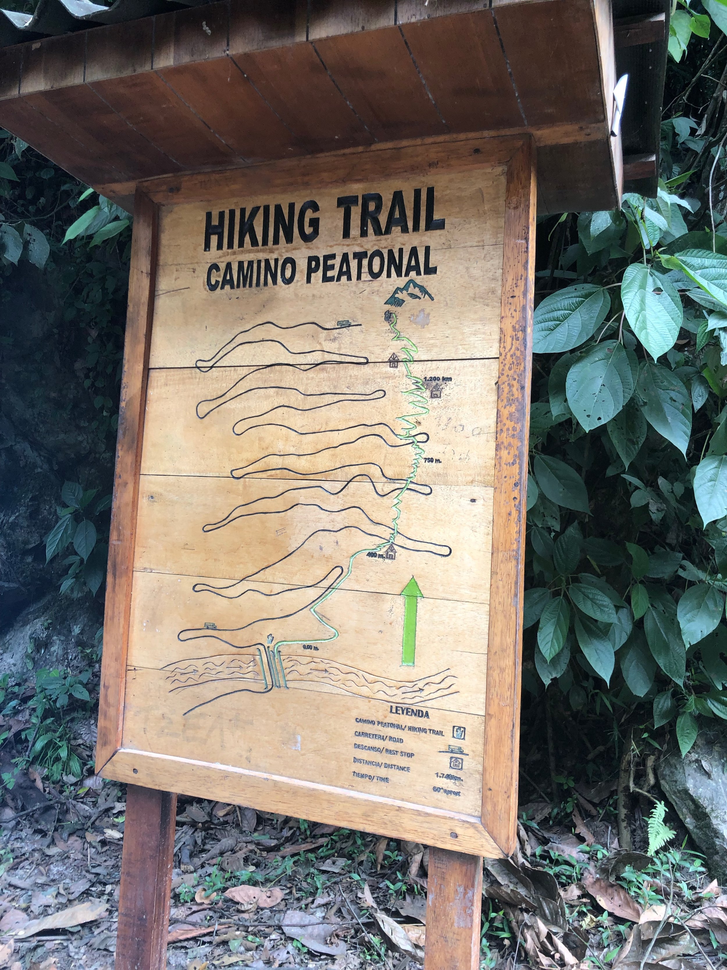
Inca Trail to Machu Picchu
We hiked the 2D/1N Inca Trail with Alpaca Expeditions. They are a fairly new tour company, but have quickly gained popularity in the last couple of years due to their raving reviews on TripAdvisor. I had fairly high expectations going in because of that, and was happily not disappointed.
At around 4:00 am, we were picked up at our hostel in Cusco by the company and driven to Ollantaytambo where we caught the train to Km 108, the start of the trailhead. We rode the train for about 1 hour and 15 minutes and was dropped off in the middle of the jungle right off the railroad tracks. I kid you not, there was no sign or marker, and it didn’t seem like a safe place to disembark 10+ passengers. But everyone got off nonetheless and walked a couple hundred feet to the trailhead.
Our guide, who went by the name Smith, was really knowledgeable and accommodating to everyone in the group. We were briefed at the trailhead, given a liter of water and some snacks, and shortly after began our trek. We went in a group of 8 that consisted of an older French couple, a young American couple in their 20s, a sister and brother (American), and of course, my sister and I. We all ranged in hiking ability, which to my surprise, didn’t hinder the experience all too much. Smith recognized that my sister and I were avid hikers, so after the first couple of sites, he allowed us to hike ahead of the group to the next site where we would wait for everyone else to catch up. This was really nice because we ended up having most of the trail and sites to ourselves before everyone else arrived and was able to get nice pictures without crowds of people in it.
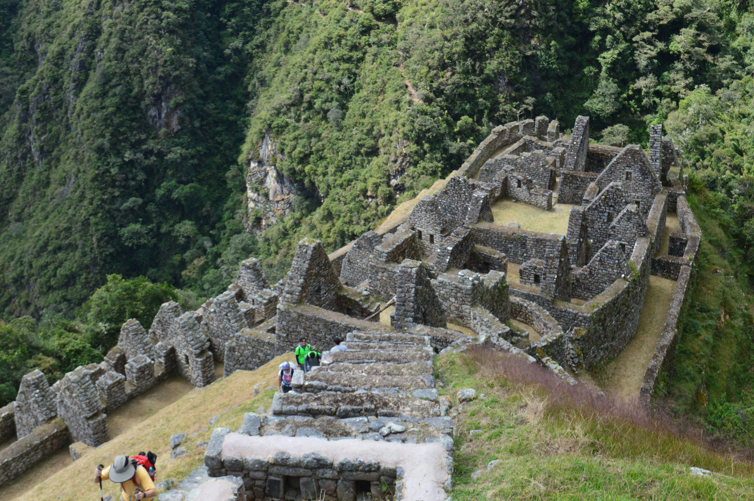
Our first site was within a couple hundred feet from the trailhead. The ruins of Chachabamba suggest that this used to be an important religious site where the Incas performed ceremonies dedicated to Mother Nature.
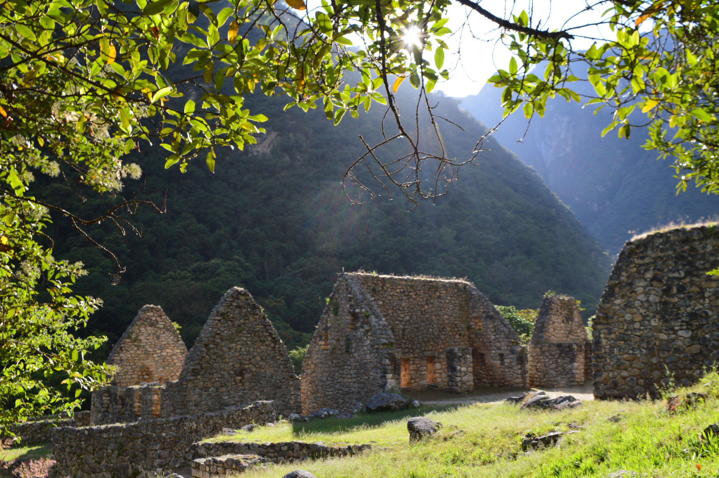
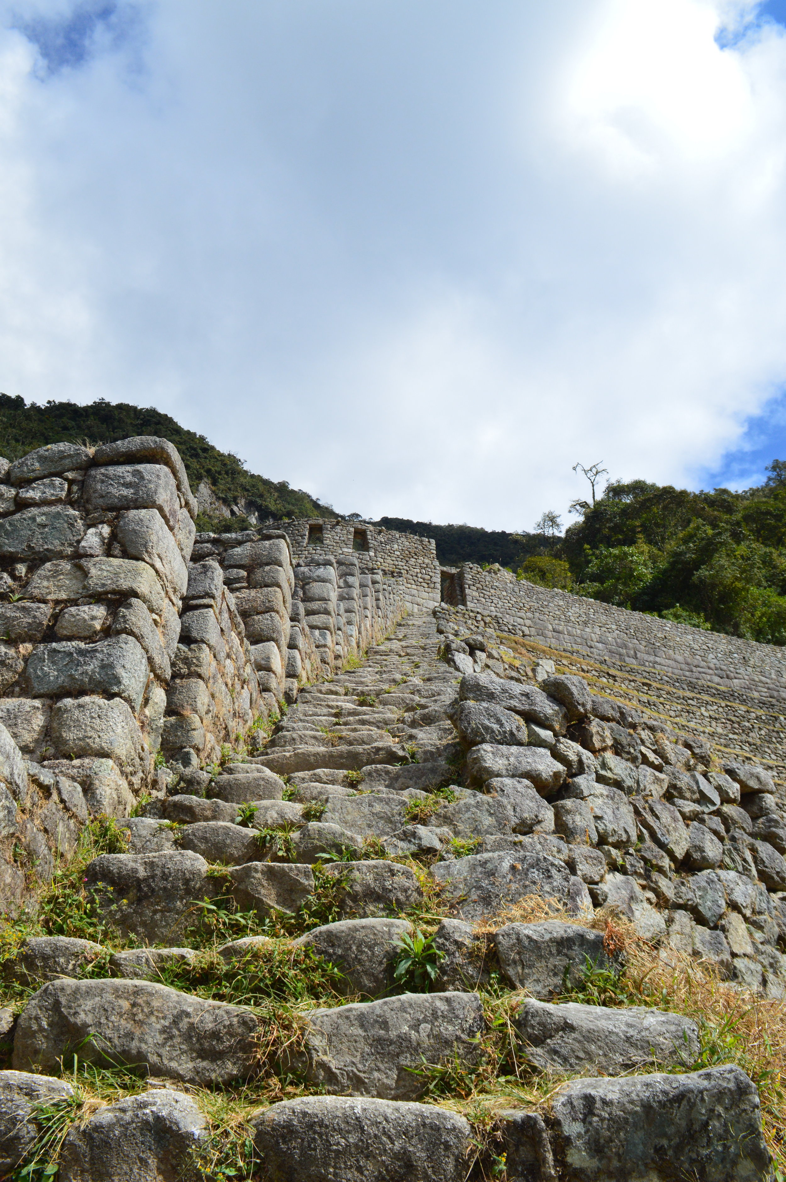
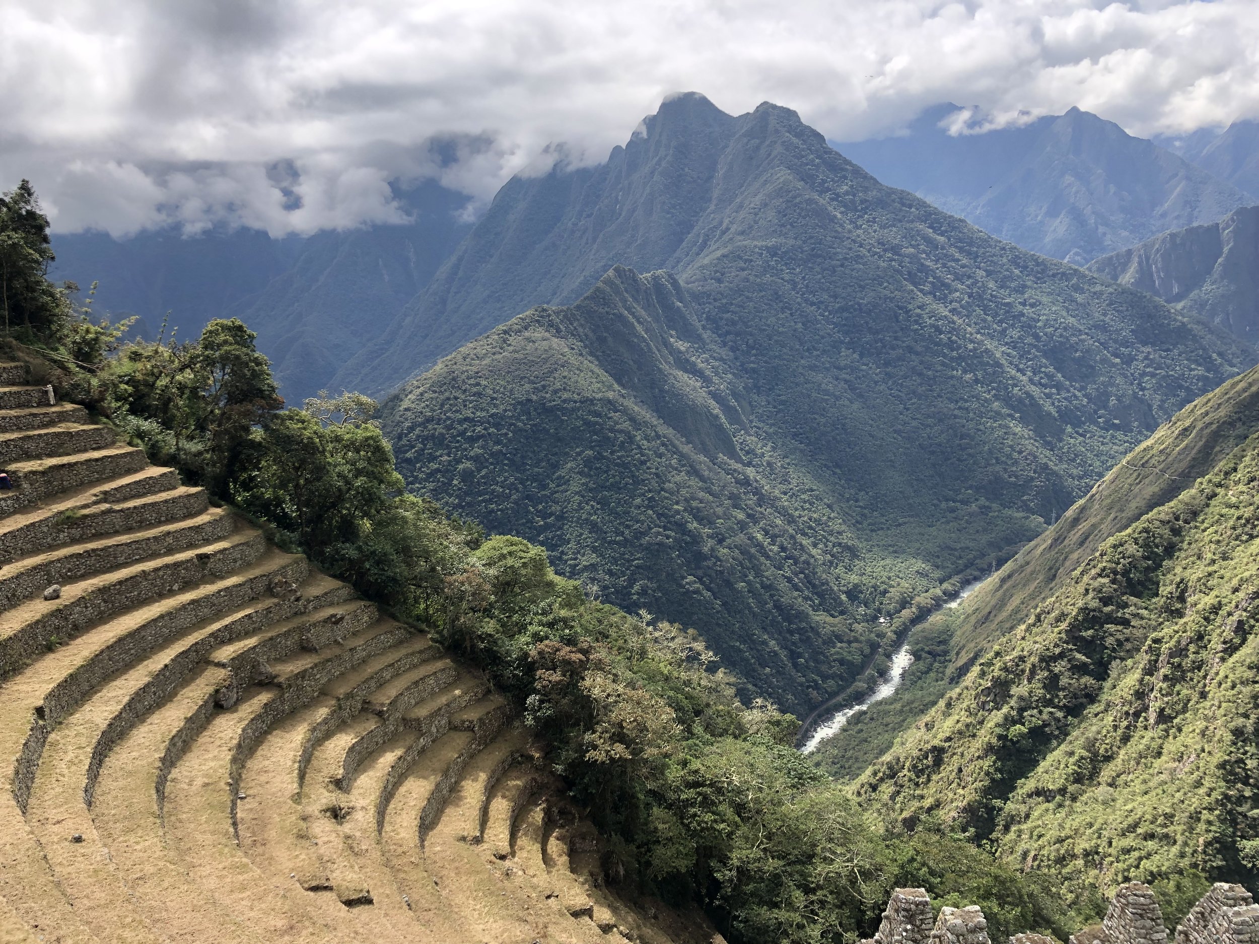
About 3 hours into our hike (with occasional breaks), we arrived at Wiñay Wayna, named after the delicate orchids found throughout the landscape, meaning “forever young”. Wiñay Wayna is in a cloud forest, with mist rolling in and out, a lush deep-green on steep mountain slopes, and a steady waterfall casually reclining in the distance. Its most prominent feature is the agricultural area with terraces built into the steep hillside overlooking Urubamba River and Sacred Valley. The site consists of upper and lower house complexes connected by a steep staircase.
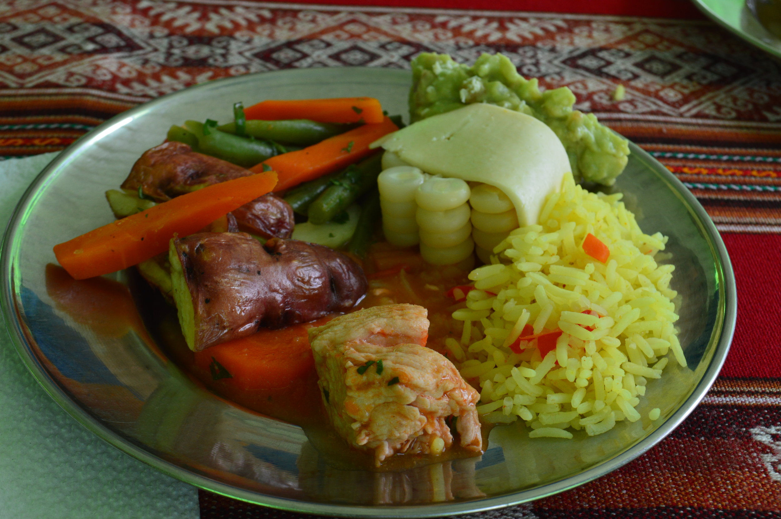
Wiñay Wayna was also our lunch spot. The amazing porters and cooks whipped up a mean lunch with stewed chicken, a variety of vegetables, potatoes, and rice. Did you know there are over 4000 types of potatoes in Peru?! Be sure to tip the cook after the meal!
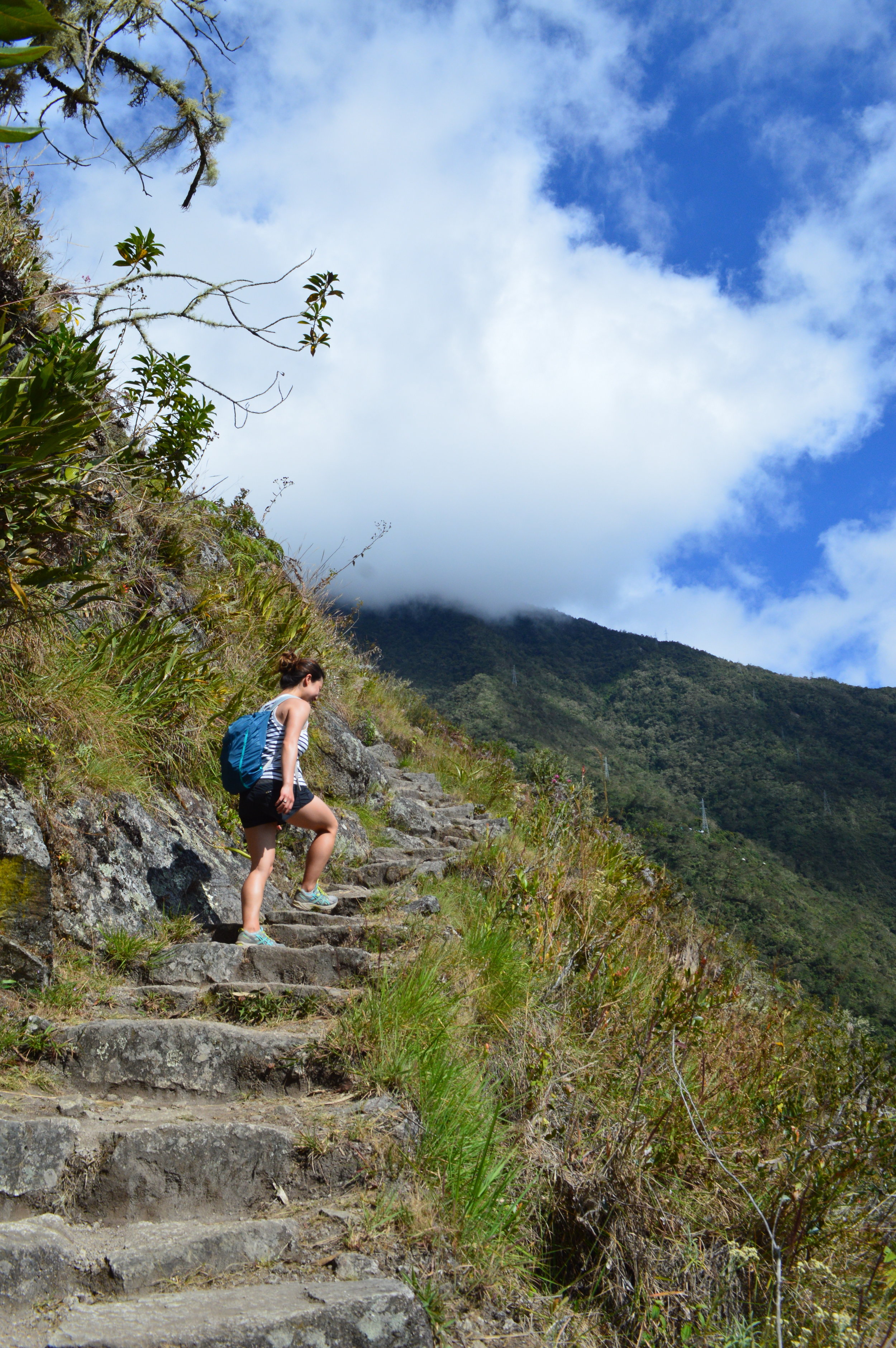
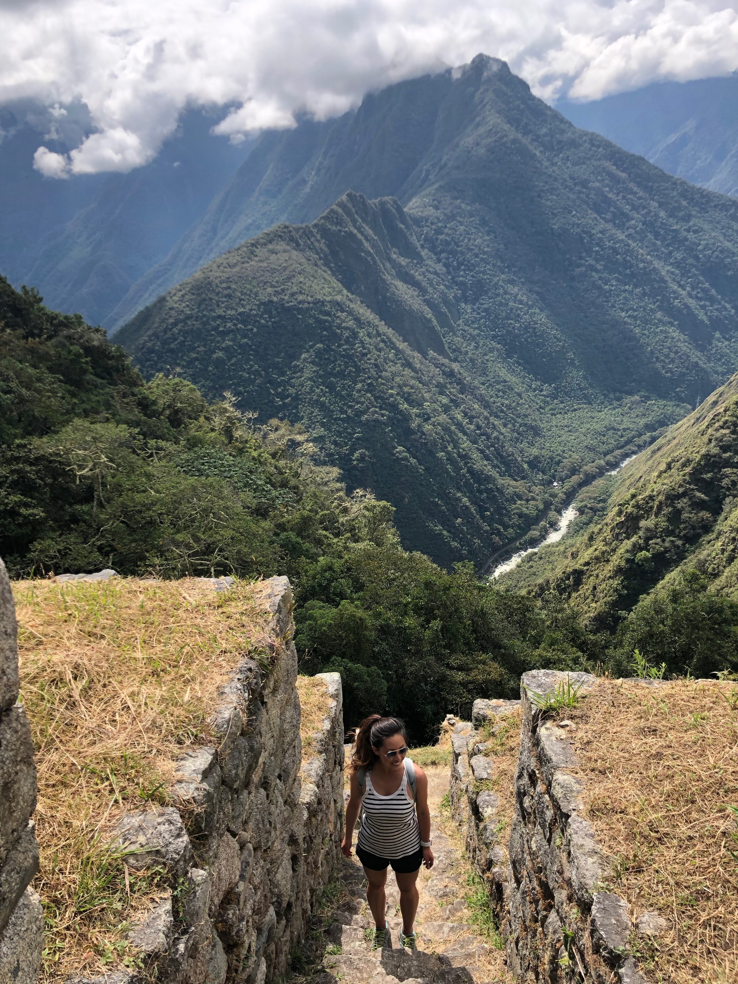
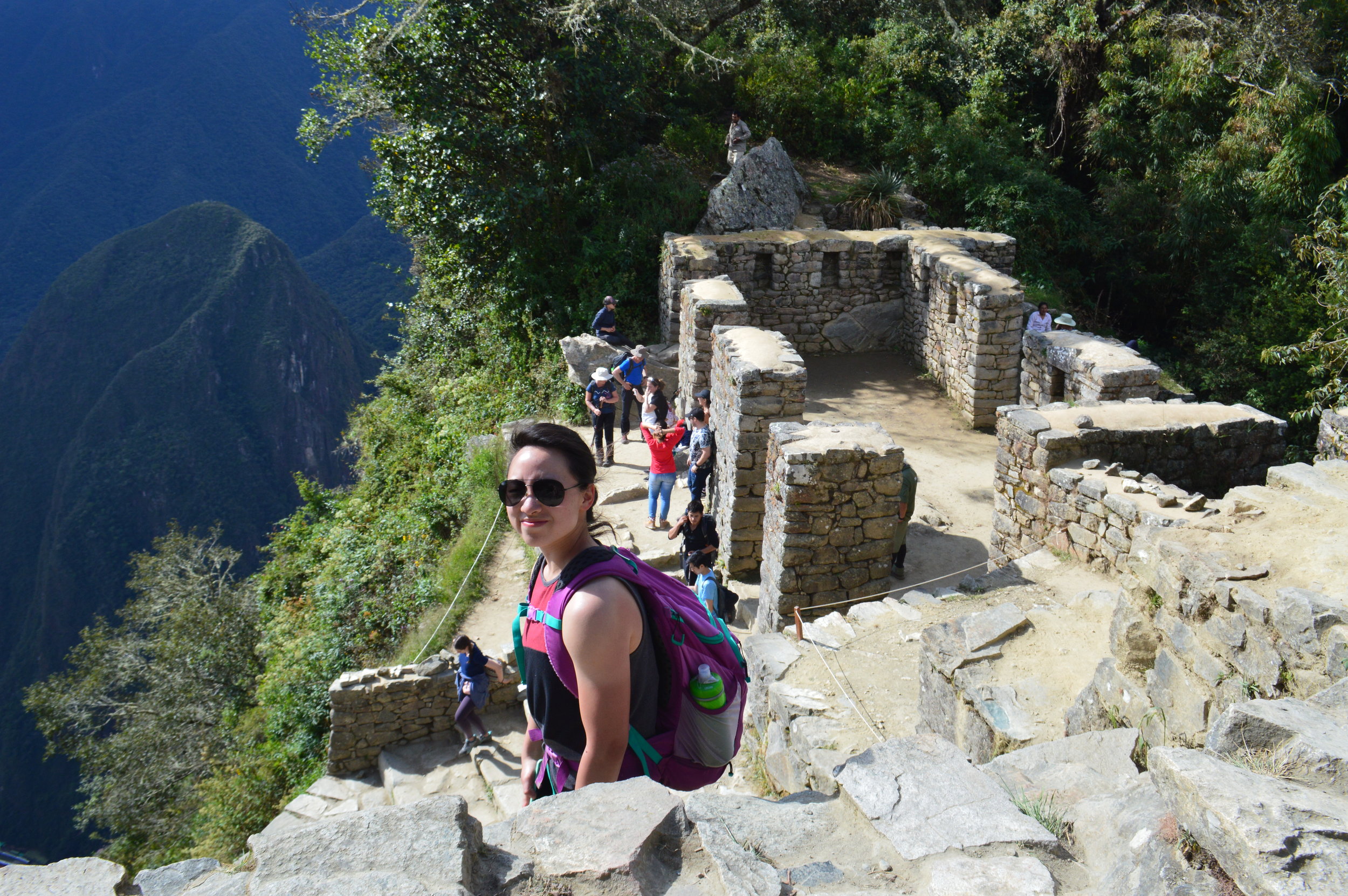
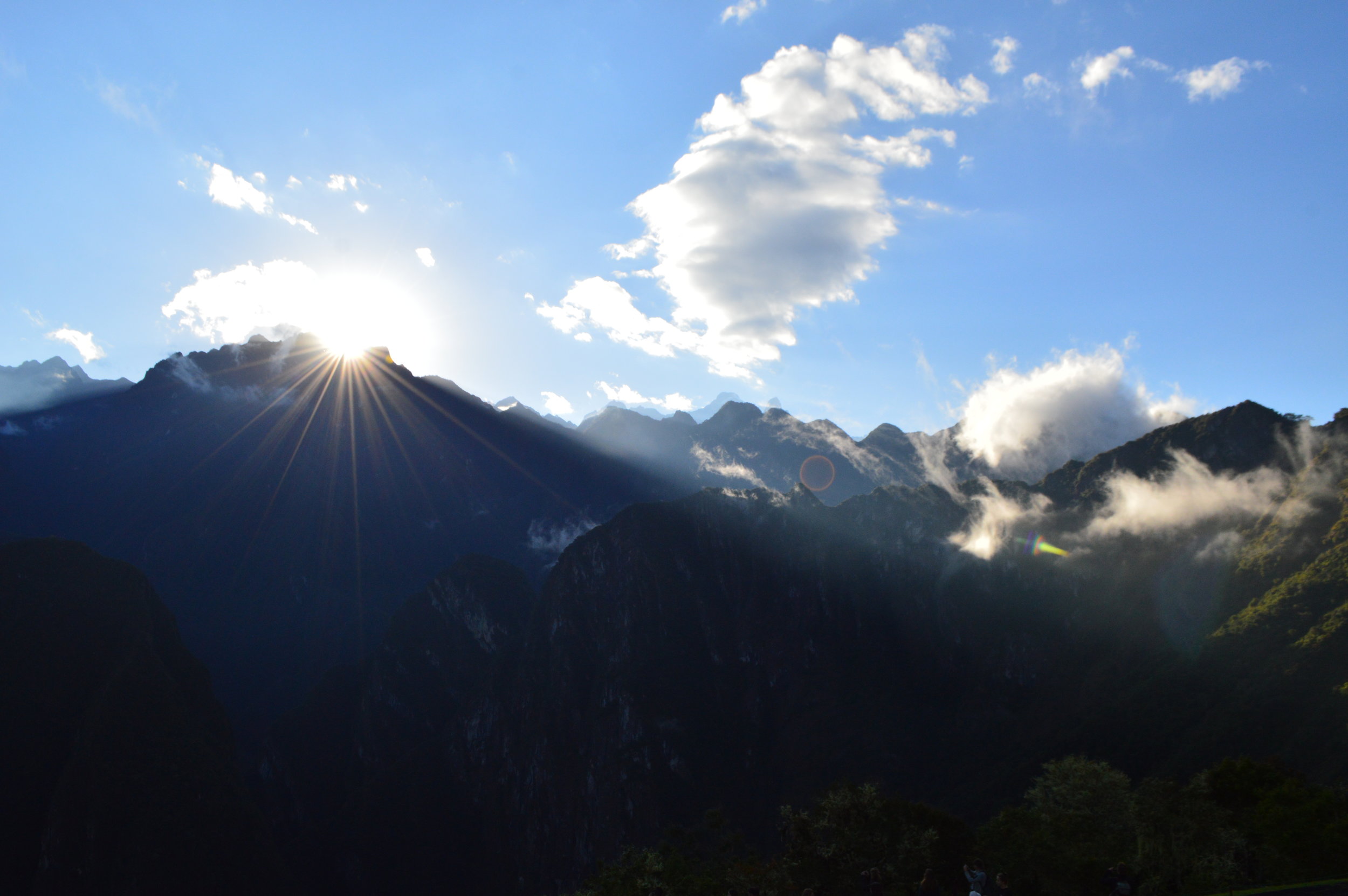
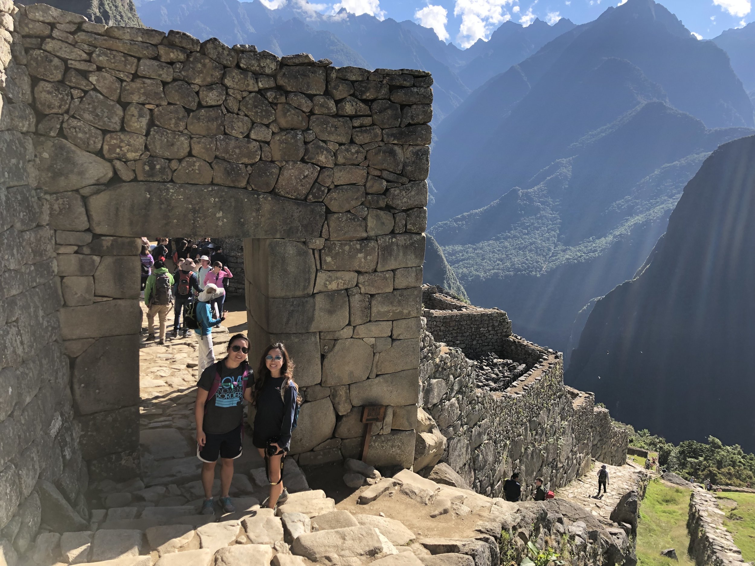
From Wiñay Wayna, the trail is a consistent rollercoaster of ascents and descents, but nothing too grueling. However, the last 100 feet before reaching Intipunku (the Sun Gate) was no joke. The steps on the ascending stairs were at least a foot high each and very steep.
This is where we caught our first glimpse of Machu Picchu from above, albeit, a small far away glimpse. While we waited for our group to catch up, we found ourselves a little shaded spot above the ruins and snacked on mandarins. People began flooding in steadily, and by the time the rest of our group arrived, the place was packed. It’s a very small area, so I highly suggest taking whatever pictures you can if you can catch a break between waves of tourists.
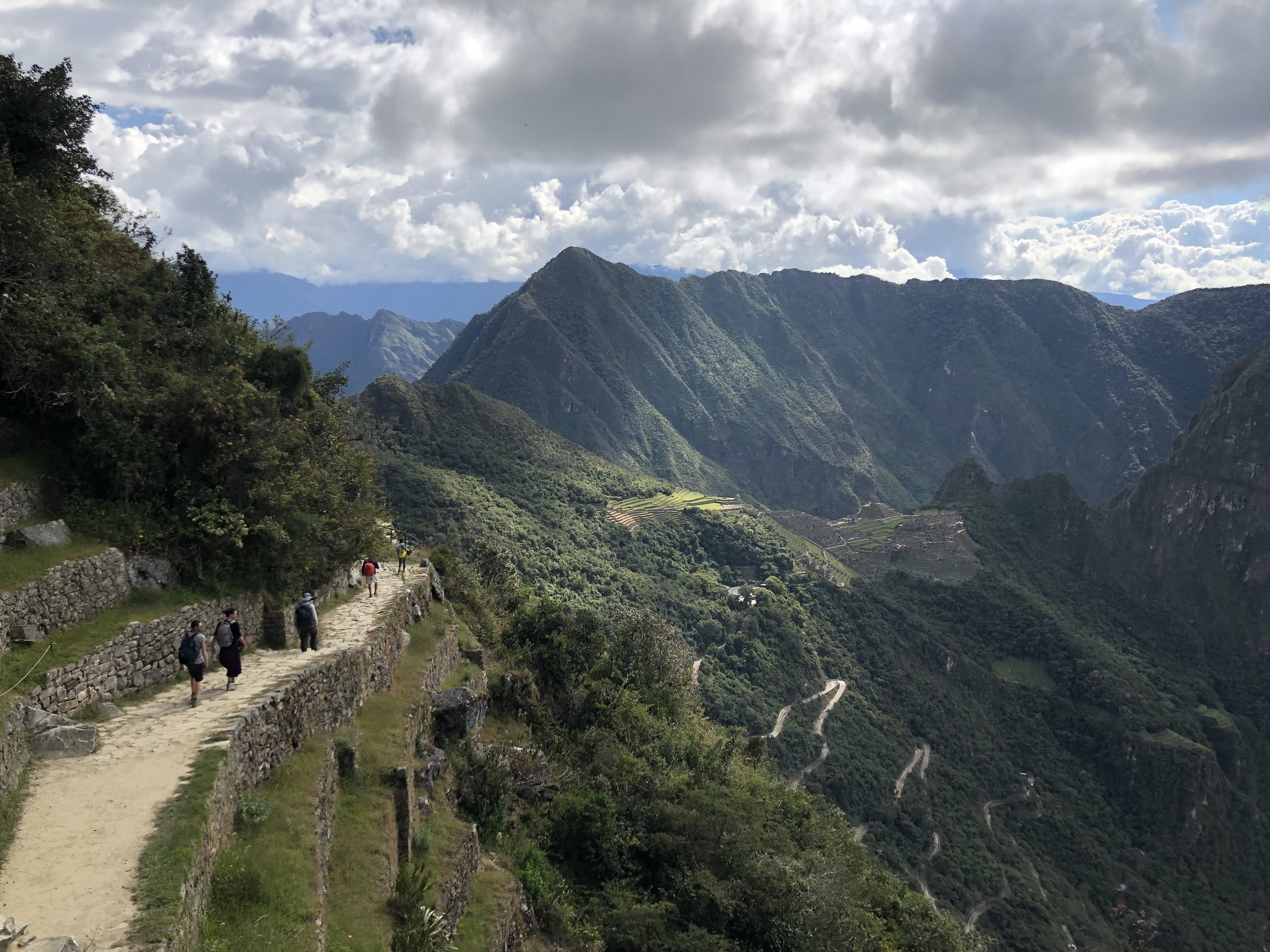
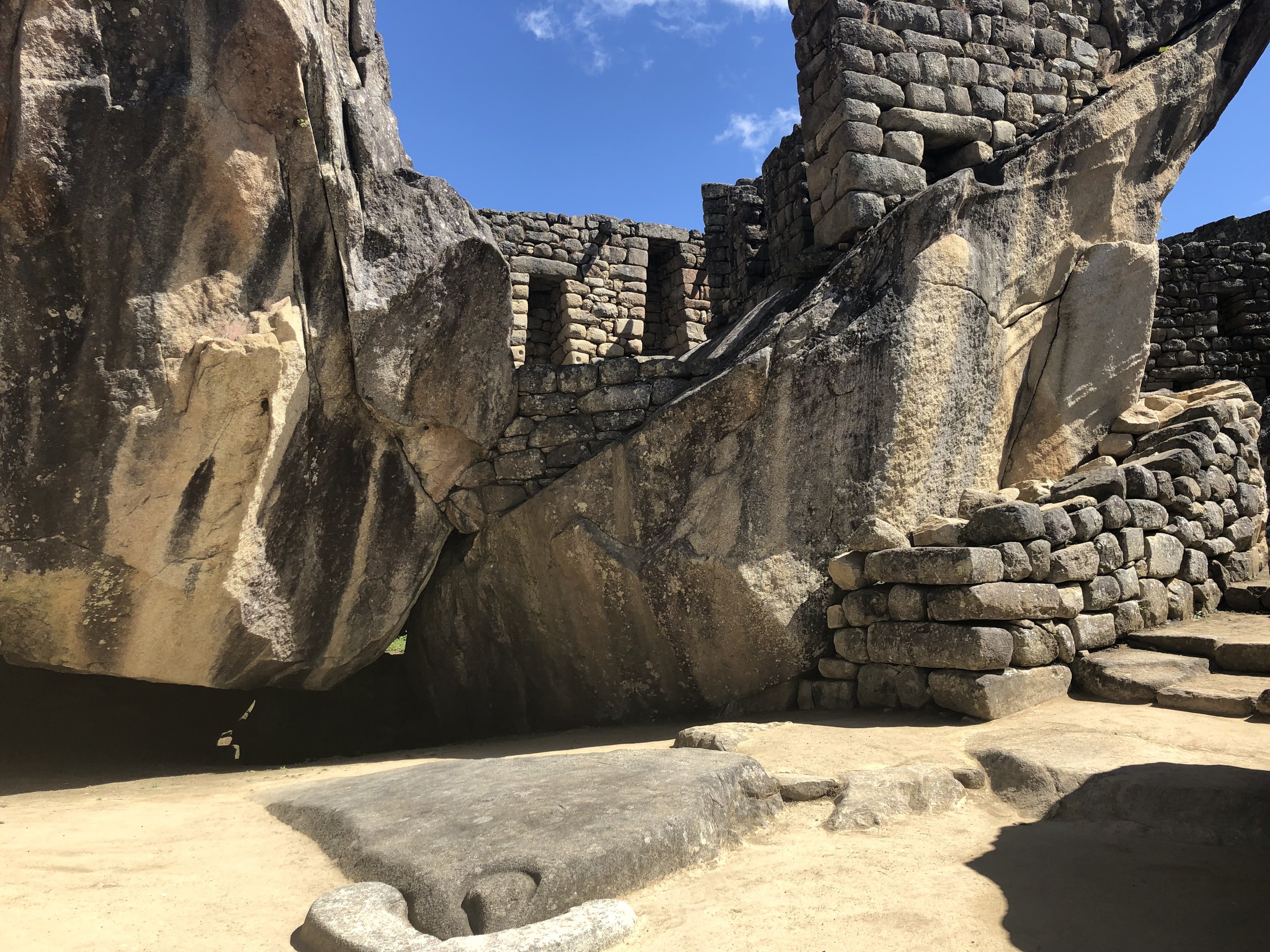
From the Sun Gate, we walked down into the outskirts of Machu Picchu before heading towards the exit to catch the bus into Aguas Calientes. (We would explore the actual city the next day). I was really surprised that there weren’t crowds of people where we took the idyllic postcard picture of Machu Picchu. In fact, there was hardly anyone around. As the golden hour crept up, we took picture after picture—these were undoubtedly the best we took of this mystical city.
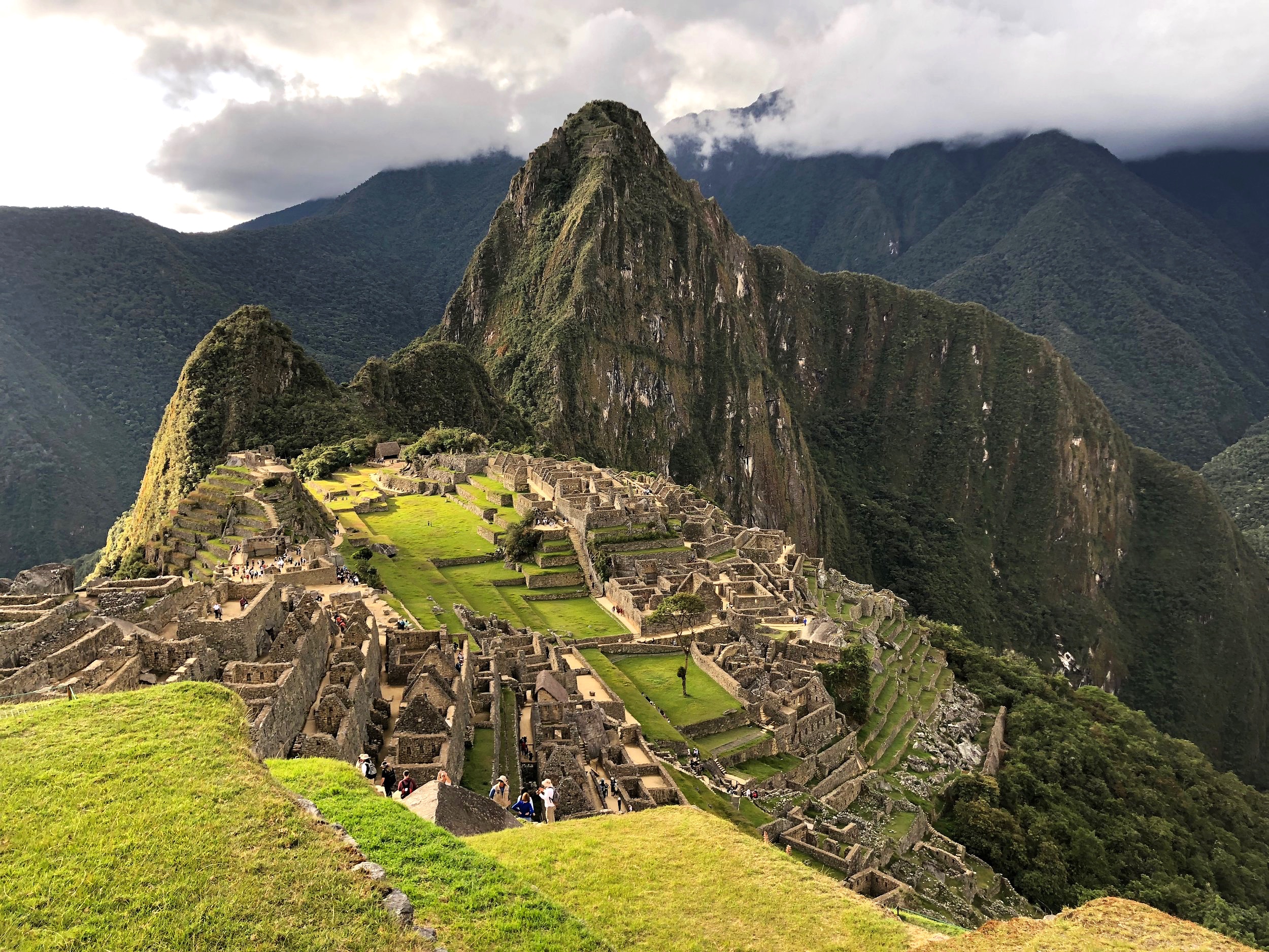
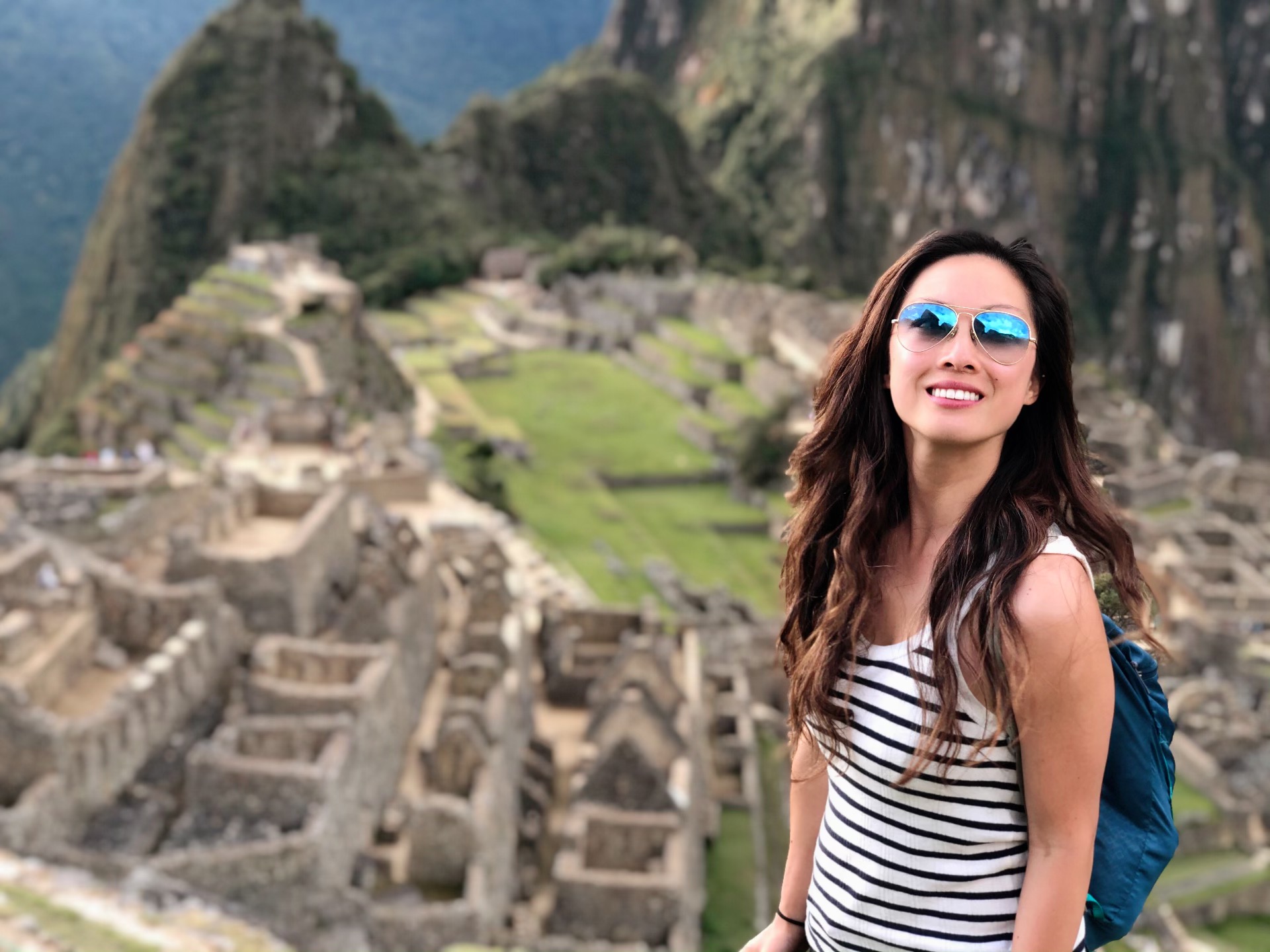
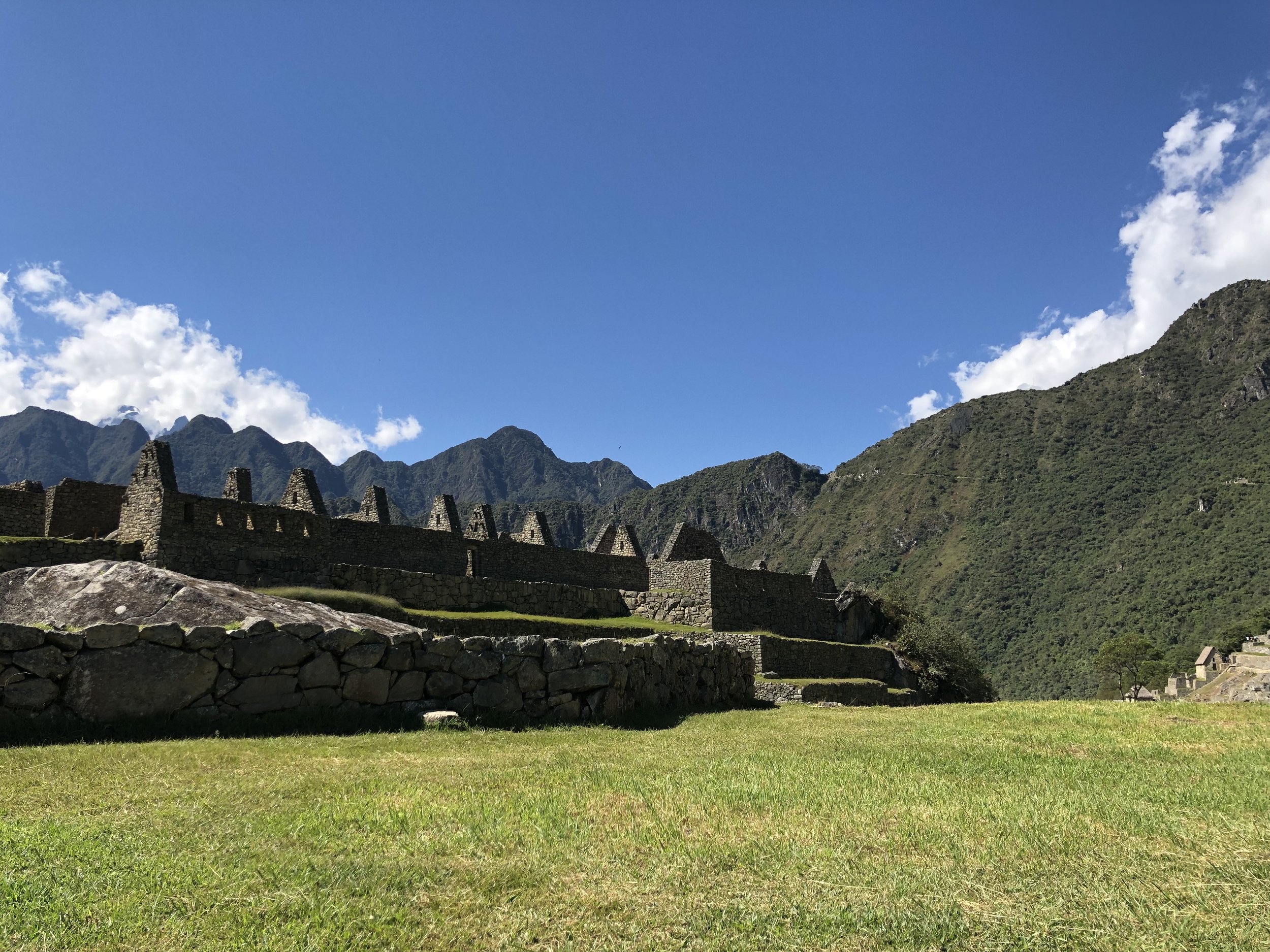
The second day in Machu Picchu was barely a walk, much less a hike. We spent most of the time sitting on grassy areas listening to our guide narrating the history and mysticism of the city; and later had the opportunity to stroll around on our own. We probably spent a total of 4 hours in Machu Picchu, which was more than enough time to see the whole city and take ample pictures. We stayed a lot longer than the average visitor, but that’s because we wanted to take our time going through the city squeezing through every nook and cranny possible.

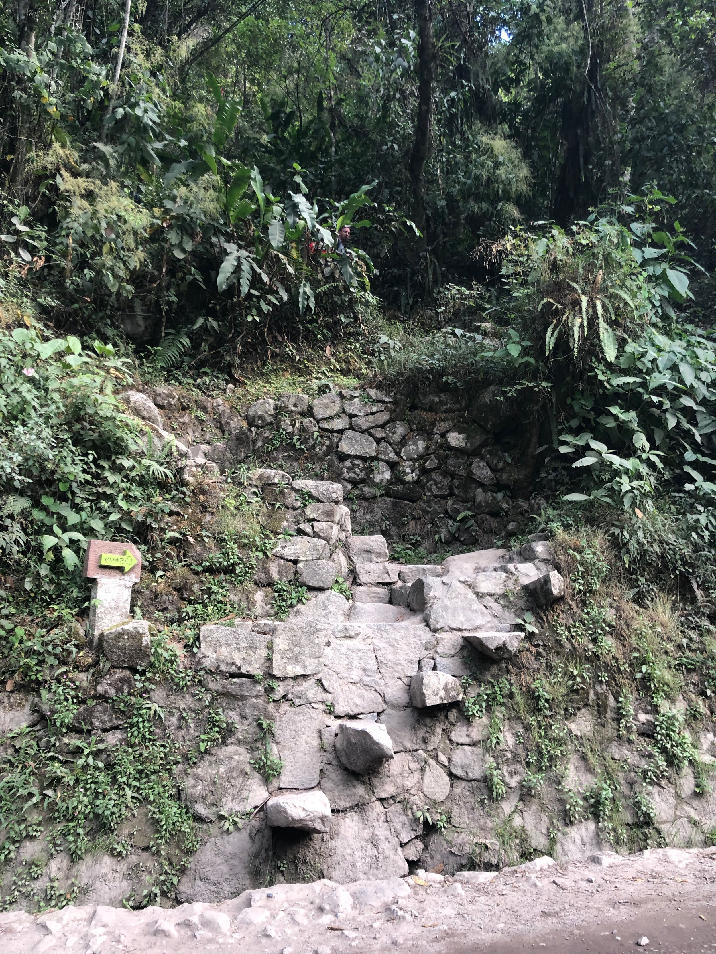
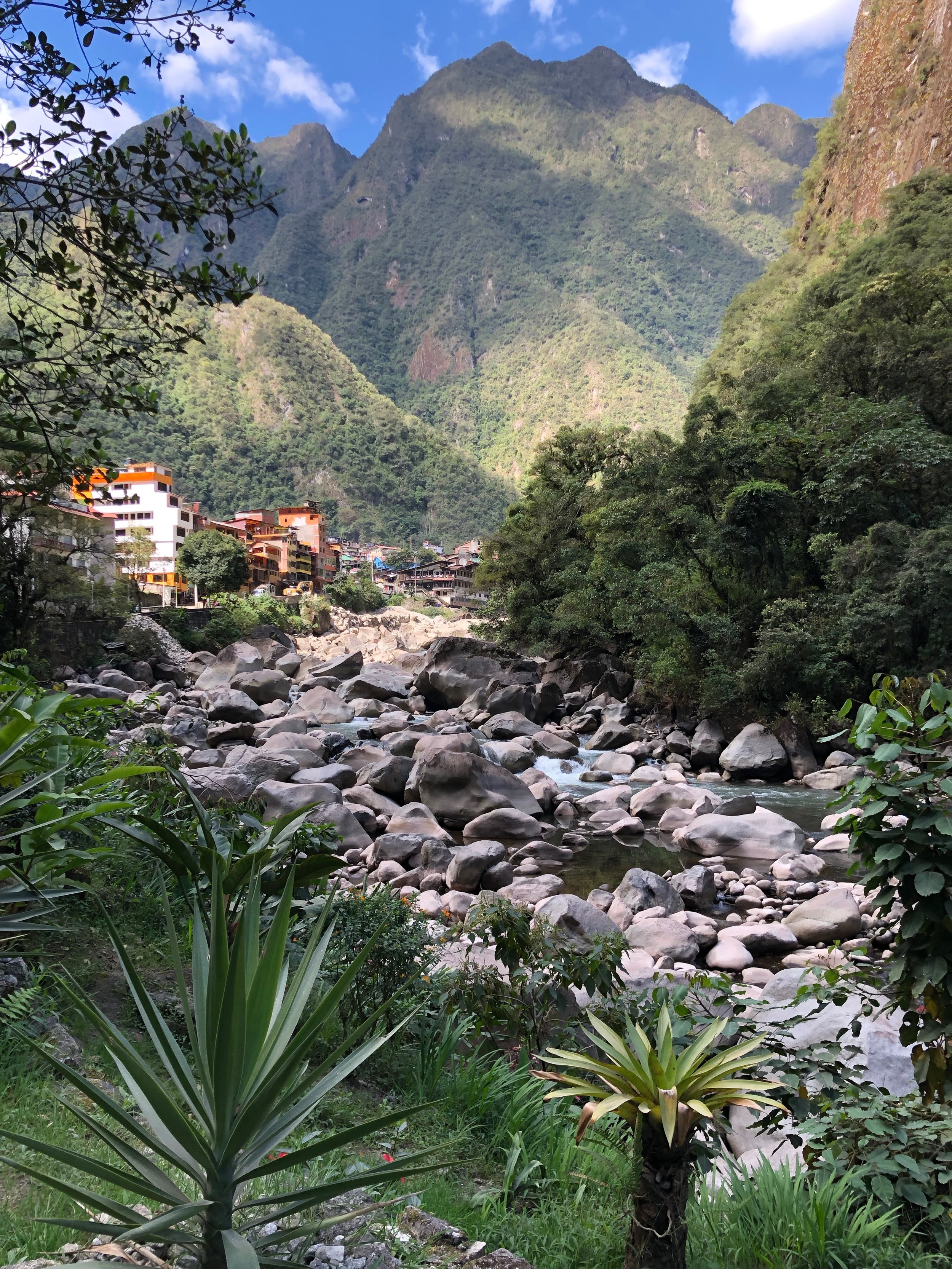
By the time we left, we had a little under 3 hours before our train departure, and thought we had plenty of time to get back to Aguas Calientes…until we saw the queue for the buses. It easily stretched back a half a mile. We had two choices: Wait in line (which also meant waiting for the next wave of buses, passport checks for every passenger, the de-boarding and boarding of passengers) or walk/run down. We chose the latter—which in hindsight, probably wasn’t the best idea only because we took a long-winded way down. We began running down the main road, composed of what seemed like never-ending switchbacks, until halfway down, we spotted a “shortcut” through the forest. There was actually a path for folks who opted to hike up/down to and from Aguas Calientes to Machu Picchu. (Doh!) It took us about 90 minutes total to get down from the control gate in Machu Picchu to the entrance into the city of Aguas Calientes. Admittedly, it was pretty fun, but I wouldn’t recommend it if you’re crunched on time. We made it though!
The Inca Trail to Machu Picchu was probably the highlight of the trip however much touristy it was. Pictures don’t do it justice. If you’re an avid hiker, you’ll be fine. My sister and I didn’t feel the altitude at all, granted, we had been in Puno and Cusco before hiking the Inca Trail. In hindsight, the 2D/1N trek was too easy and over too quickly. I would suggest doing the classic 4D/3N trek to experience the full adventure with camping if you have the time and budget.
Cusco
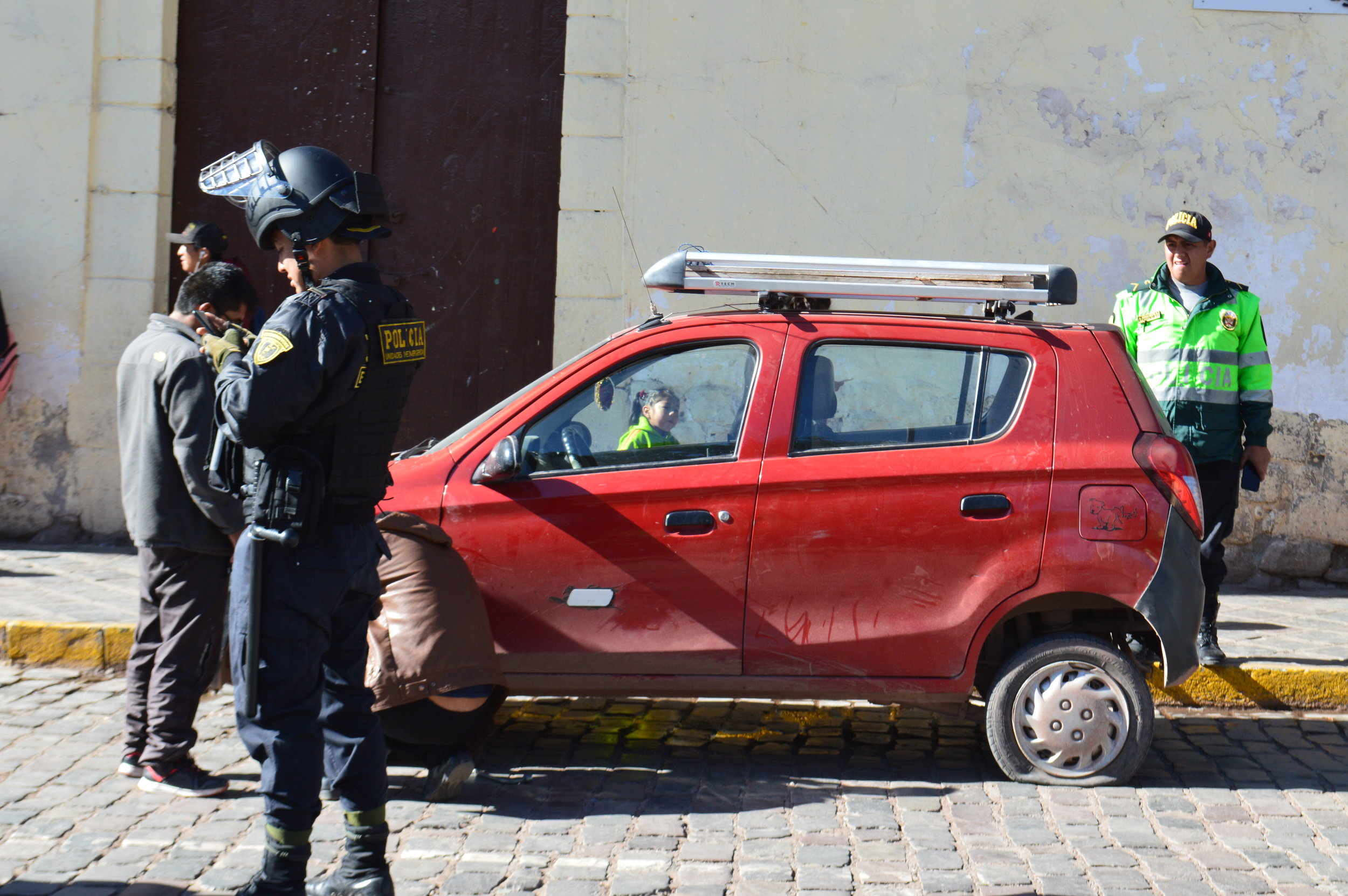
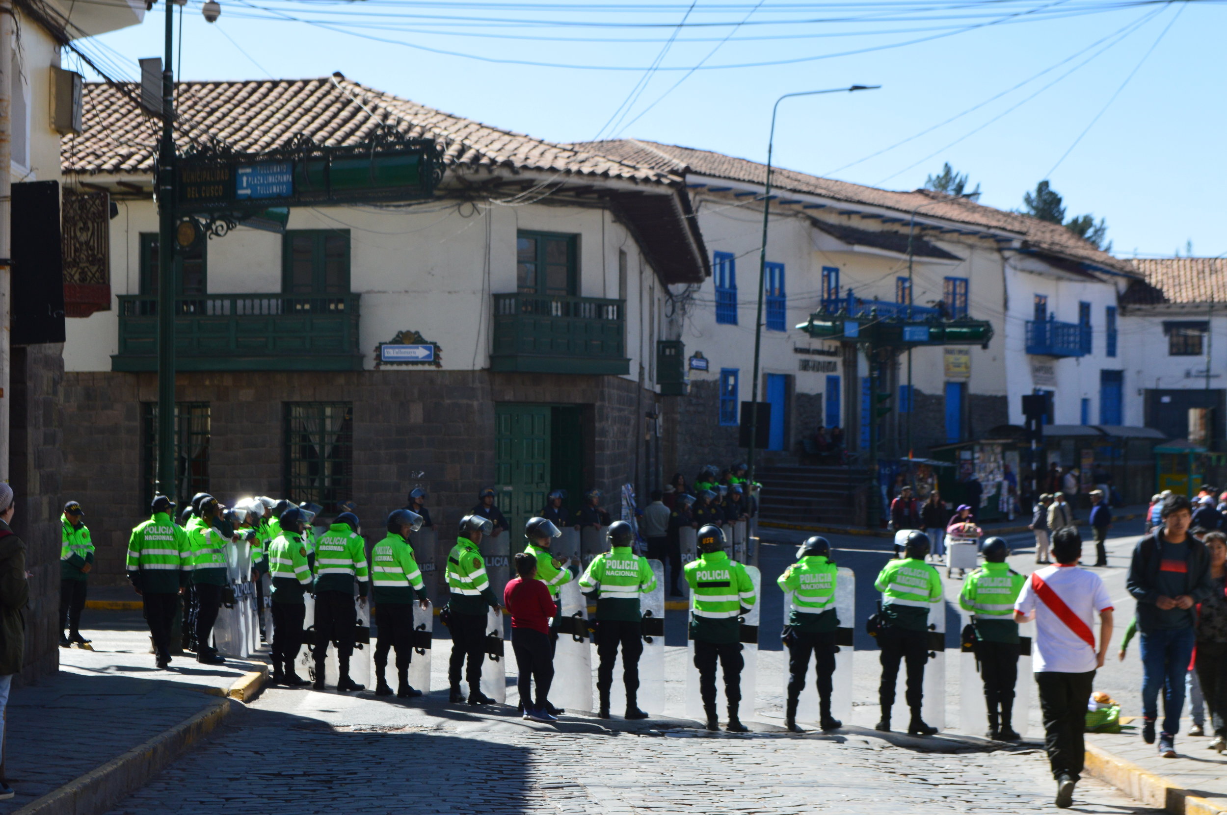
Strikes are apparently pretty common in Peru, and unfortunately, inconvenient for tourists as most of the strikes affect tourism directly.
We spent most of the day wandering around and eating our way through the city. There are many awesome spots for food, drinks, and snacks. If you get the chance, check out Qura Bowl Bar. It’s a trendy, hipster hole-in-the-wall spot perfect for a quick meal or a spot to work. I’m not sure of the quality of their wifi, but I saw many people plugged in and working on their laptops, so I assume it’s pretty decent. They have an assortment of different bowls on their menu from smoothie bowls to poke bowls. Their portions are generous, so I bought one bowl and shared it with my sister. It was just perfect refreshment we were looking for after wandering around the city all day. As with any sanitary establishment, their prices are a tad higher than what you would expect eating out in Cusco, but still reasonable for the area and the quality of food. Additionally, they offer vegan, vegetarian and gluten-free options! A big plus for gluten-free folks like me! It’s very hip—so much so that I felt like I was back in LA for a minute.
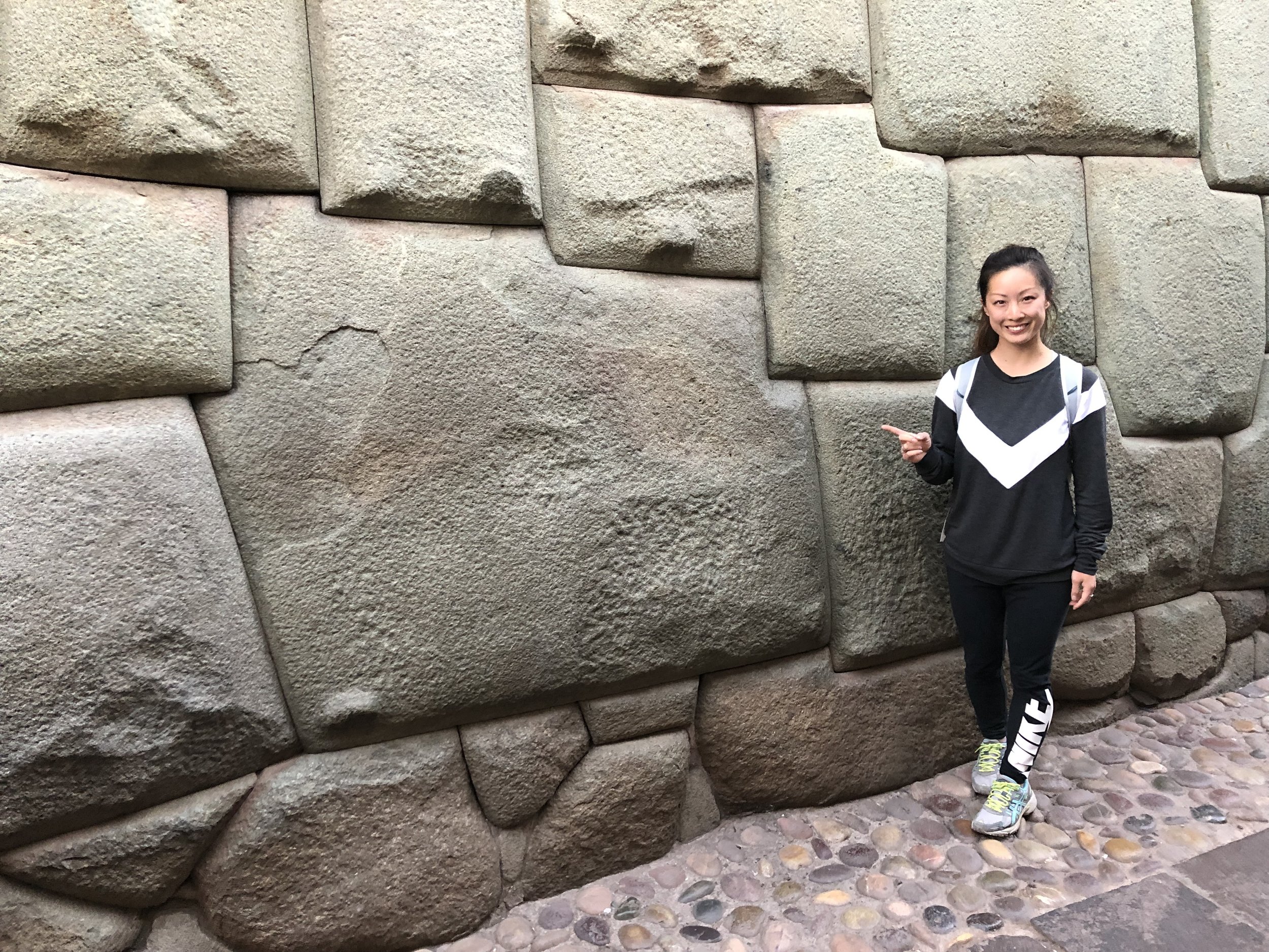
Walking aimlessly around Cusco, we somehow found ourselves walking right past the famous 12-angled stone (Piedra de los doce ángulos), which was a massive stone carved with 12 angles to fit perfectly with every other surrounding block, requiring a painstaking amount of precision and detail. At first glance, it just seems like any ordinary block, but when you examine it closely, you’d be astonished at how tightly all the pieces around it fit that even a single sheet of paper couldn’t slip through it.
Sacred Valley
MOray | Maras Salt Mines | Chinchero
Since we were in a time crunch, we opted to hire a taxi for 180 soles for the entire day (approx. 6 hours). He took us to Moray, Maras Salt Mines, Chinchero, then directly to the airport after that. You could opt for a Sacred Valley tour instead if you’re on a budget or have more time to spare. Moray and Chinchero are included in the Tourist Ticket, but Maras Salt Mines are not. However, the entrance fee to Maras Salt Mines is just 10 soles ($3 USD).
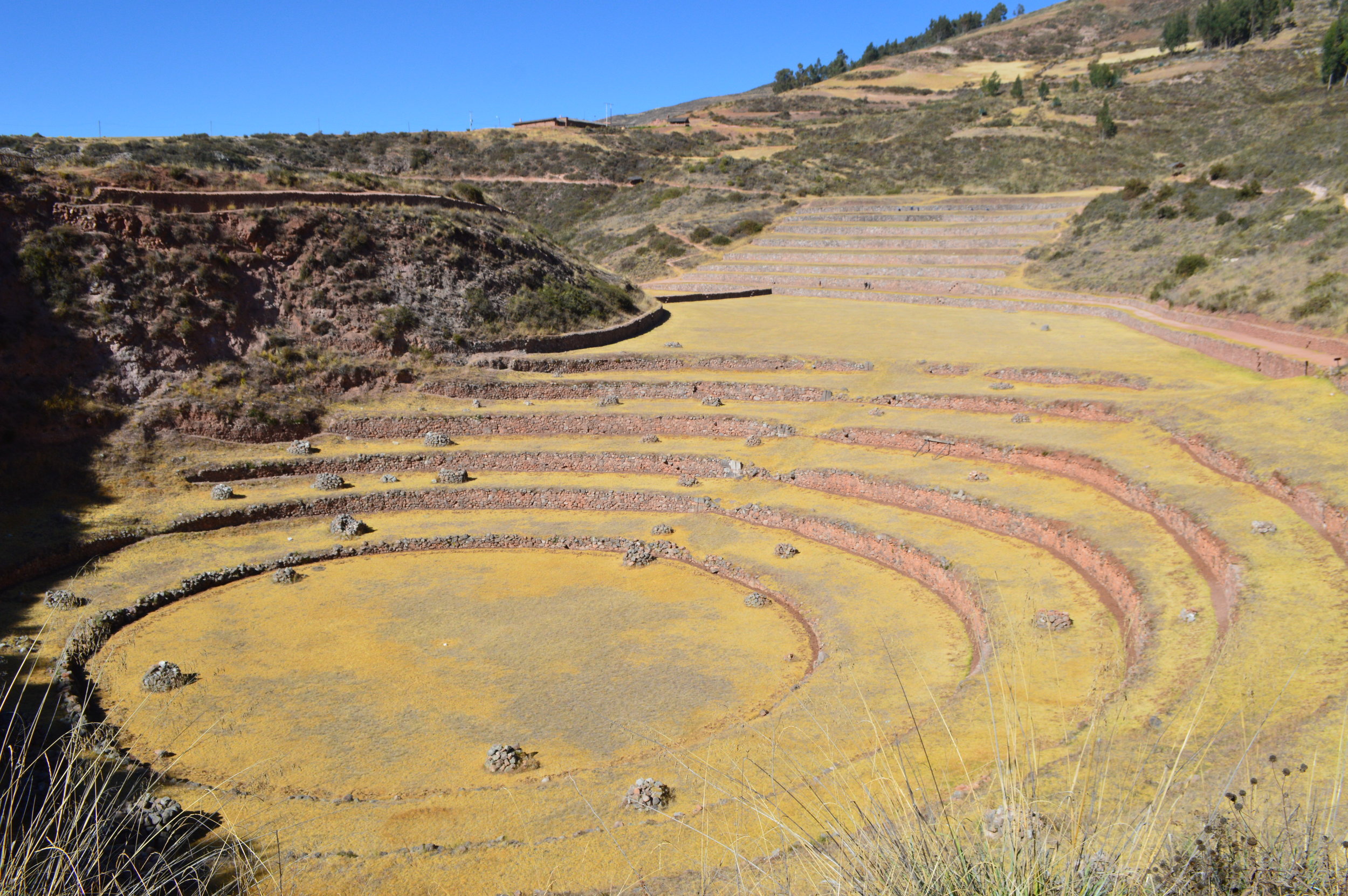
The Incan site of Moray is home to terraces, unusual in that they form complete circles, the largest is roughly 100 feet (30 m) deep. It is believed that this site was used as an agricultural research laboratory, to test and experiment with different microclimates, similar to what is achieved in greenhouses in modern times.
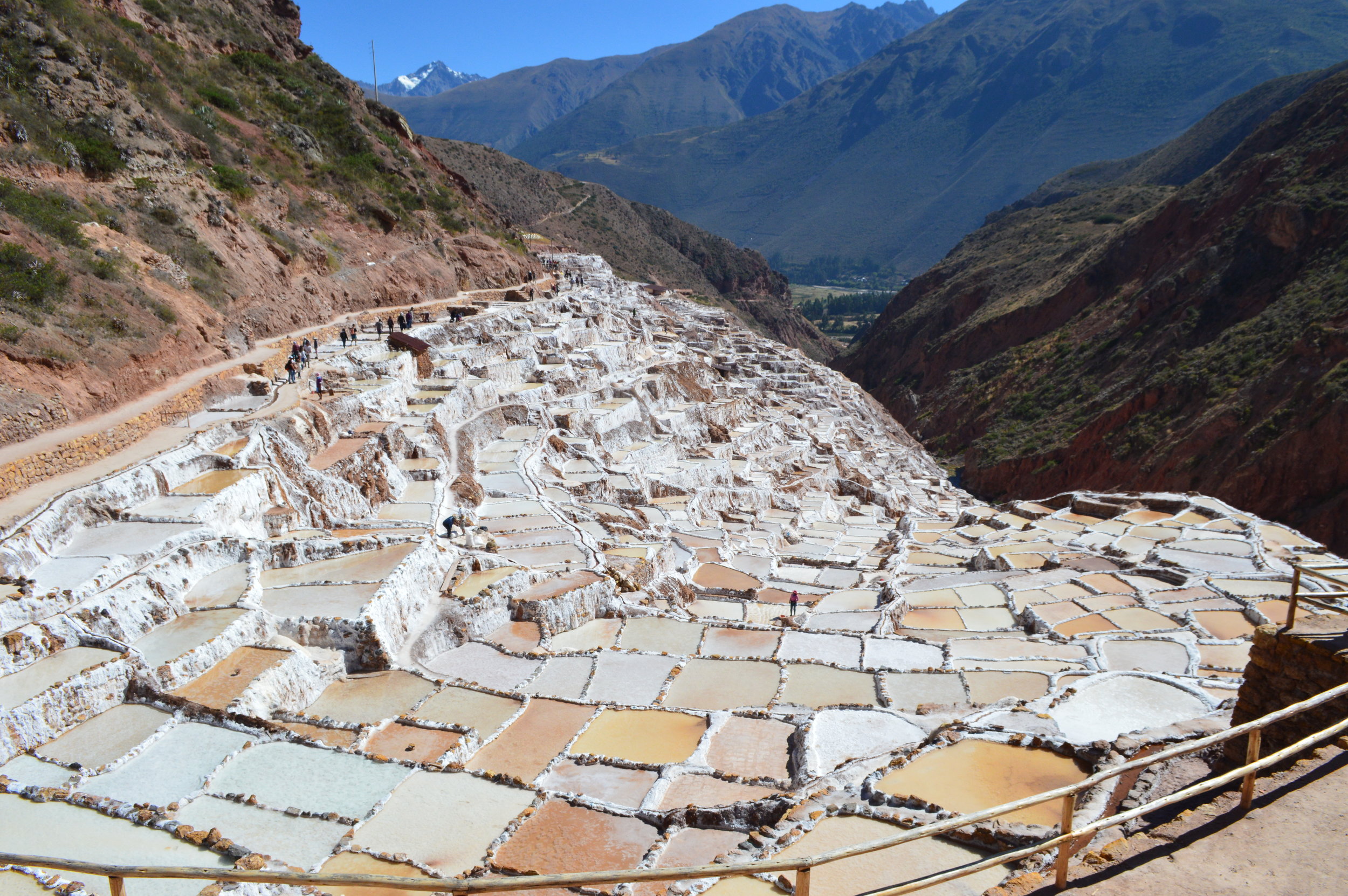
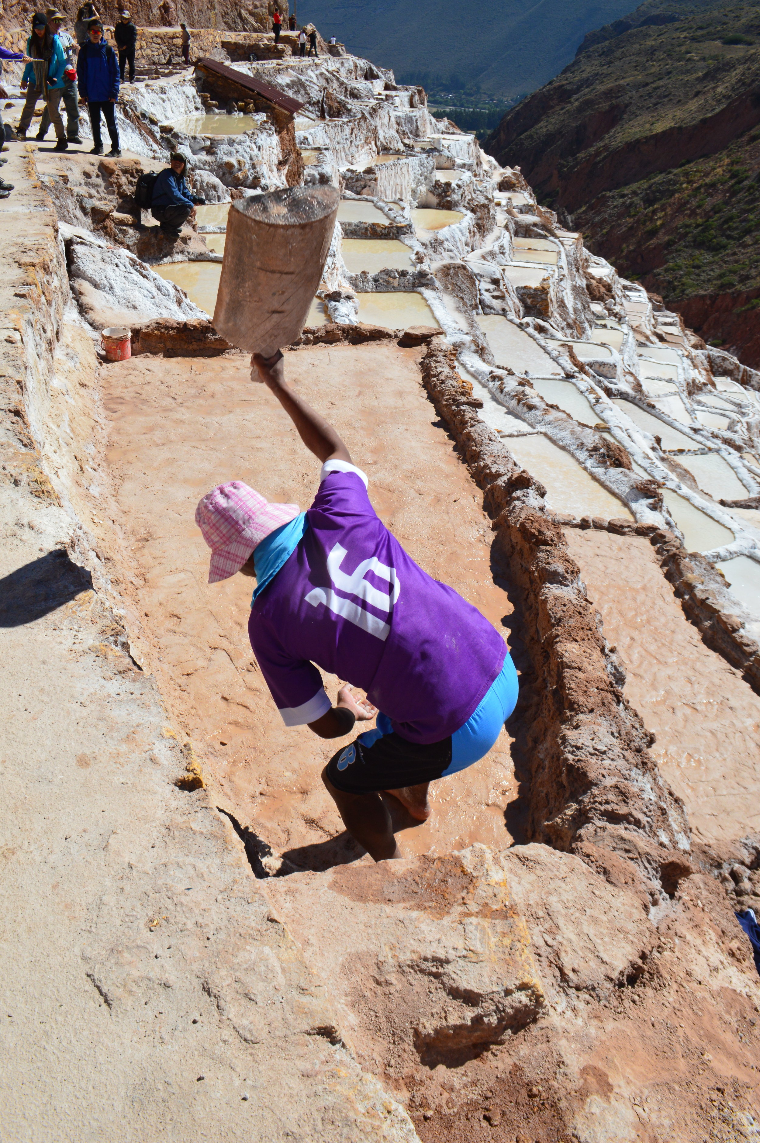
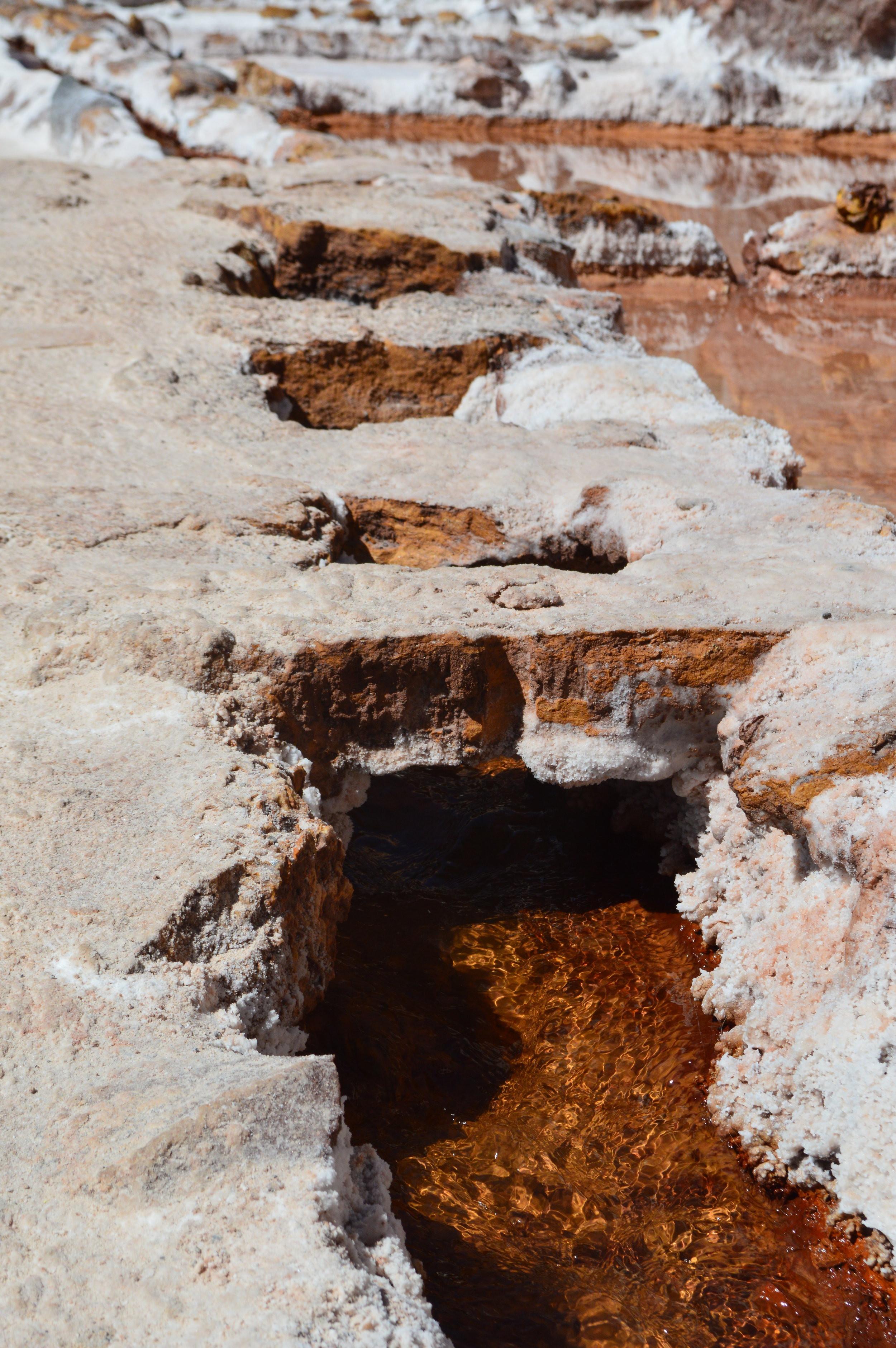
The Maras Salt Mines are not to be missed! From above, there are hundreds of these rectangular salt pools—some dry and others filled with water from a natural spring flowing in. In fact, today there are a total of about 6,000 salt pools; each owned and managed by local family of the Maras community. Even more astounding is the fact that these salt flats have been in use since the times of the Incas and before. I watched as a man patted down the clay foundation with a solid wooden paddle taking 5 minute breaks in between. As wondrous as these pools are, I was saddened to see that some people had carved their names into the drying salt flats. How people could have complete disregard and disrespect for this place is beyond me. As I shook my head at this, I overheard a tour guide say that on June 17, the salt mines were going to be closed to the public, and that it could only be viewed from the observation deck above because of tourists defacing the flats. Go figure.
I recommend arriving in the morning right when it opens at 9:00 a.m. The crowds and tour buses start flooding in around 9:30-10:00 a.m. We arrived around 9:30 a.m. and spent about an hour walking around the salt flats and taking pictures. By the time we left, there were hoards of people entering. Keep in mind, the walking paths aren’t very wide, so if you arrive later, you will probably spend a considerable amount of time waiting on people taking pictures as you attempt to squeeze past them.

Lima
A number of free walking tours are offered in both Lima and Cusco. We chose the Incan Milky Way Free Walking Tour of Lima. They had pretty good reviews on TripAdvisor, boasting reasonable group sizes and basing their business completely off of tips. I found the latter to be a smart business move, however, the group sizes were much larger than I had expected. There were at least 30+ people in the English-speaking group. Halfway through the tour, we lost our guide and ended up exploring the rest of the city on our own. I wasn’t too committed in the first place anyway.
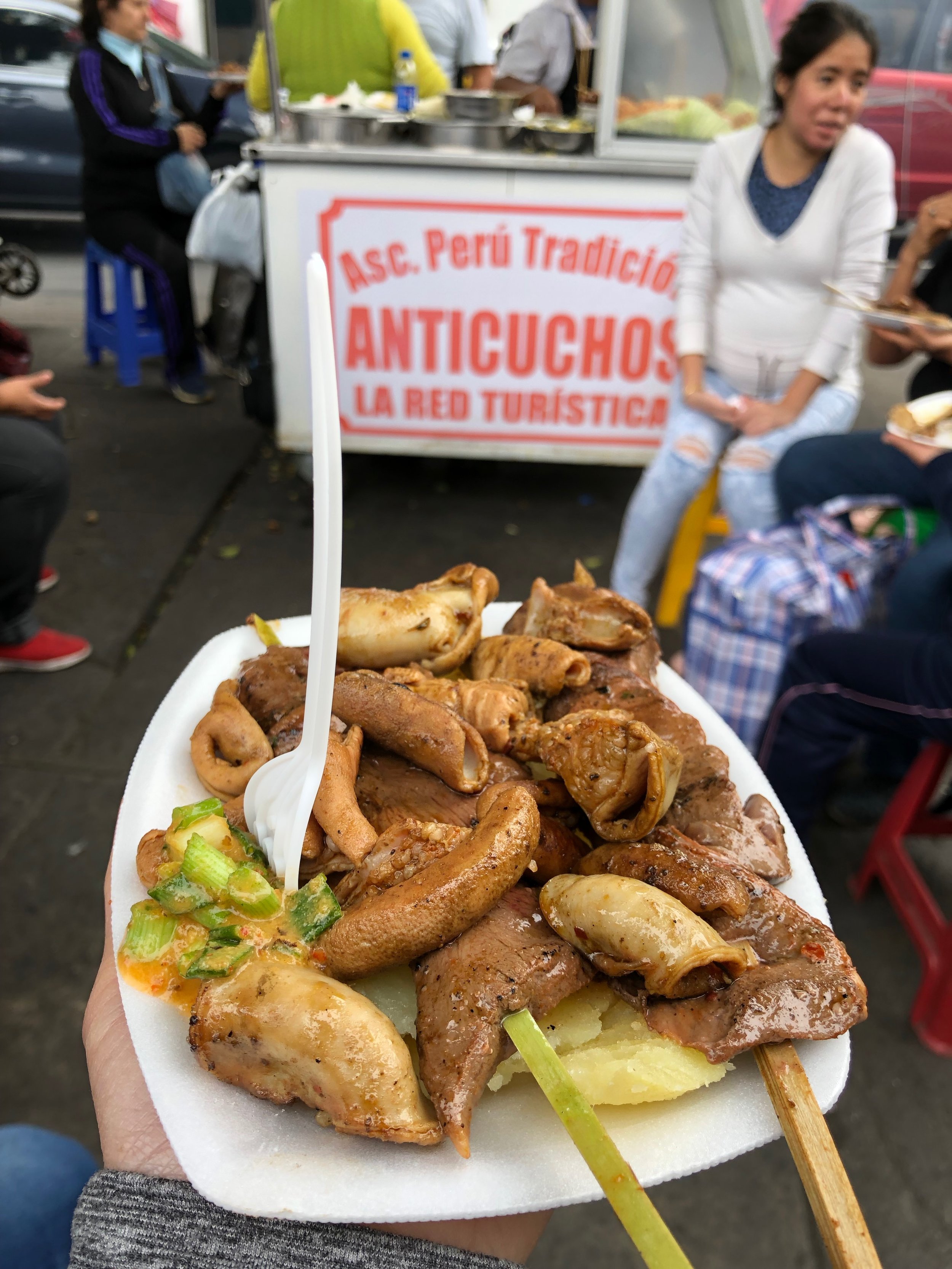
You can’t leave Peru without trying anticuchos! Anticuchos are a popular dish in Peru, traditionally made with beef heart, but can be made with other cuts of beef, chicken, or even alpaca. The meat is marinated, skewered, and grilled, and often accompanied by potatoes and corn. You’ll find them sold nearly everywhere in restaurants and food mobiles.
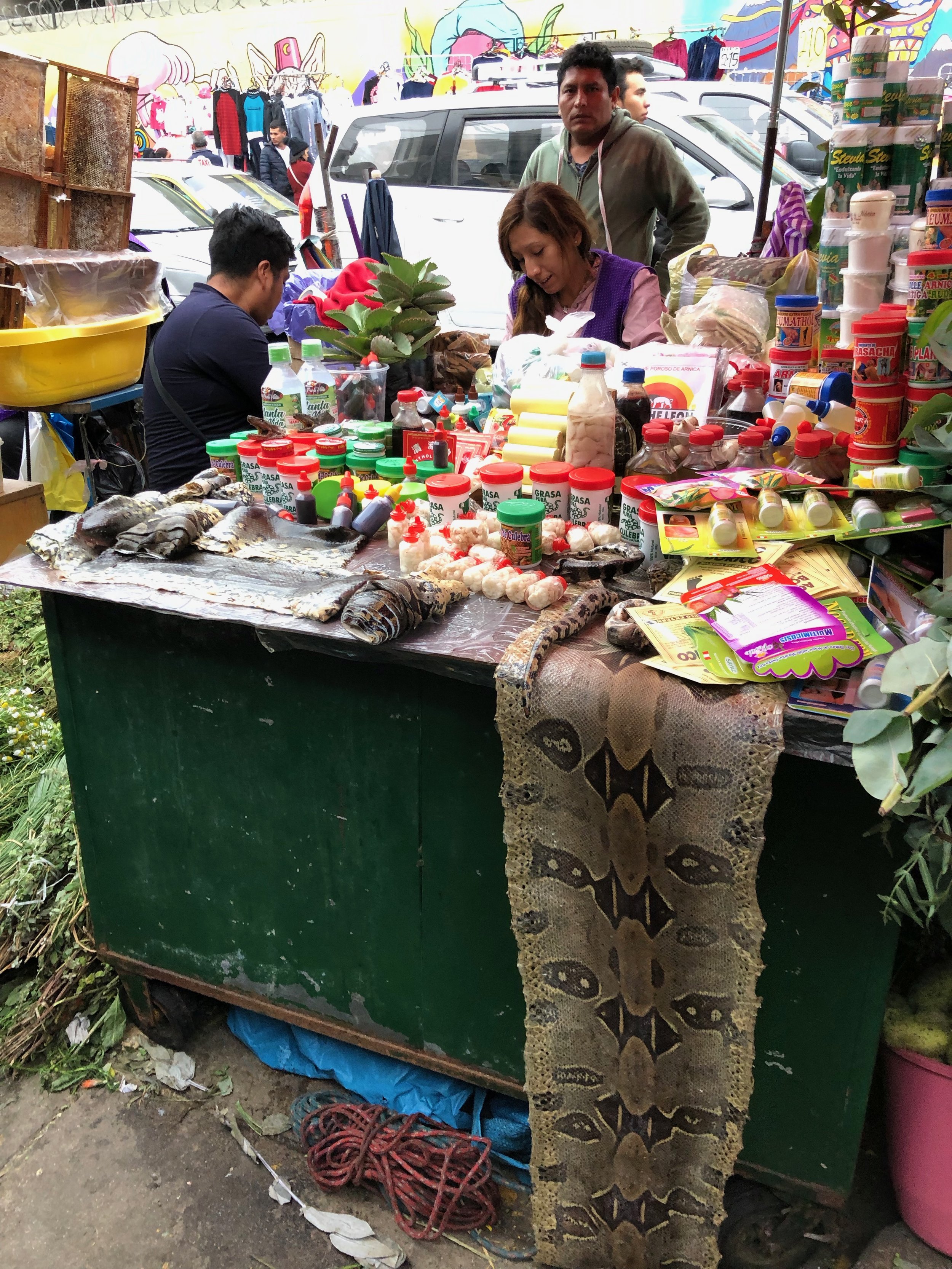
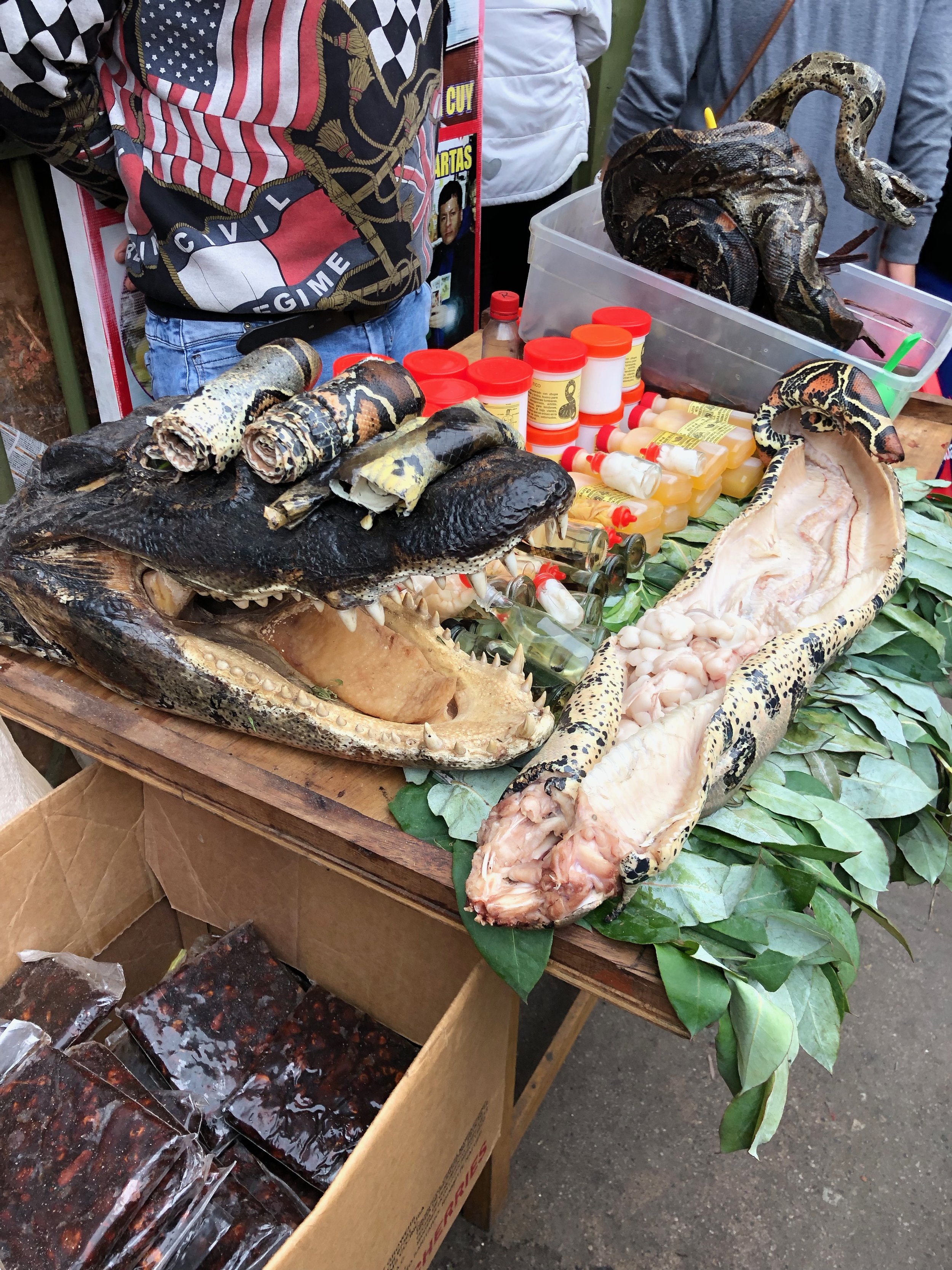
I had previously heard about a place called “Mercado de Brujas”, aka “The Witches’ Market” which showcases a variety of odd products such as snake skin, preserved frogs, and dried llama fetuses, to name a few. It was a bit difficult to find especially since most locals don’t even know of its existence…or rather, don’t refer to that area as Mercado de Brujas. Anyhow, we walked around until we saw several vendors along the street selling python skins. As we walked deeper in, there were vendors selling herbs, supplements, sea shells, cactus leaves, maca root, charms, soaps, perfumes, bee pollen, and so much more.
In La Victoria, Mercado de Brujas is located approximately under the Gamarra Metro bridge. The entire area is a ginormous market selling everything from clothing and textiles to shamanic ritual items, and everything in between. It is extremely crowded; so much that you are constantly bumping shoulders left and right. Be prepared and very mindful of your belongings as that area is notorious for pick pockets. Leave your valuables at home and carry small bills—you won’t need much money anyway. Overall, it was an exciting, however overwhelming, experience. Worth checking out if you have a couple hours to kill.
General Things to Know/Tips:
- Vehicles have right of way. Crosswalks are road decoration—they’re not even for reference. The best way to cross the road is by following a local.
- Queues are almost non-existent in the sense that people will cut in line and shove as they please.
- Short-changing is common. I was short-changed numerous times—a sole here or there, but caught it each time before I walked away. The fact that it was only a sole or two doesn’t really matter to me so much as the principle of honesty, which brings me to another point…
- Carry small bills or change because vendors will often claim that they “don’t have change” if you’re trying to purchase something with a large bill. Funnily enough, if you tell them you won’t purchase the item and start walking away, change somehow magically appears.
- Have a small stash of toilet paper on you always. Most bathrooms don’t supply toilet paper, so you’ll have to provide your own.
